 W
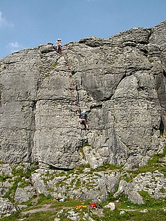
WAill na Cronain is an inland west-facing limestone crag in The Burren in County Clare, Ireland. It is popular with novice rock climbers due to the number of short single-pitch 10–20 metre rock climbing routes in the S to HS rock climbing grades. It is beside the Aillwee Caves.
 W
WAilladie, is an 800-metre-long (2,600 ft) west-facing limestone sea cliff, that varies in height from 8 metres (26 ft) to 35 metres (115 ft), situated on the coast of The Burren in County Clare, Ireland. Ailladie is one of Ireland's most highly regarded rock-climbing locations, particularly for high technical grade climbs and deep-water soloing. It is also a location for shore-angling competitions, and, with its cliffs and view of the Aran Islands, a popular photography stop for tourists.
 W
WBallyryan or Ballyreen is a small inland mostly west-facing limestone crag in The Burren in County Clare, Ireland. It is popular with rock climbers due to its easy access, the range of short easy-to-intermediate rock climbs, and its close proximity to the much larger and highly regarded, Ailladie rock-climbing sea-cliff; Ailladie is also locally known as the Ballyreen Cliffs or Ballyreen Point.
 W
WBencorr at 711 metres (2,333 ft), is the 82nd–highest peak in Ireland on the Arderin scale, and the 102nd–highest peak on the Vandeleur-Lynam scale. Bencorr is situated near the centre of the core massif of the Twelve Bens mountain range in the Connemara National Park in Galway, Ireland. It is the second-tallest mountain of the Twelve Bens range, after Benbaun 729 metres (2,392 ft); it lies close to Benbaun, separated only by the third-highest mountain in the range of Bencollaghduff 696 metres (2,283 ft), and the col of Maumina.
 W
WBinn idir an dá Log at 702 metres (2,303 ft), is the 87th–highest peak in Ireland on the Arderin scale, and the 108th–highest peak on the Vandeleur-Lynam scale. Binn idir an dá Log is situated at the centre of the long north-west to south-east cental spine of the Maumturks mountain range in the Connemara National Park in Galway, Ireland. Binn idir an dá Log is the tallest mountain in the range.
 W
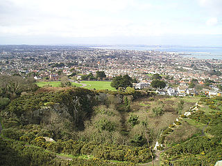
WBray Head is a 241 m (791 ft) hill and headland located in northern County Wicklow, Ireland, between the towns of Bray and Greystones. It forms part of the Wicklow Mountains and is a popular spot with hillwalkers. At the top of the head is a concrete cross which was placed there in 1950 during the holy year. Every Good Friday, hundreds of local people climb to the top of the head in a Good Friday procession marking the stations of the Cross as they go along, with the final station being held at the holy year cross. The headland and adjacent lands were designated under a Special Amenity Area Order in March 2008.
 W
WCamaderry at 699 metres (2,293 ft), is the 90th-highest peak in Ireland on the Arderin scale, and the 112th-highest peak on the Vandeleur-Lynam scale. Camaderry is situated in the southern sector of the Wicklow Mountains range, and forms a broad horseshoe around the valley of Glendalough with the hydroelectric station at Turlough Hill 681 metres (2,234 ft), and the mountains of Conavalla 734 metres (2,408 ft), and Lugduff 652 metres (2,139 ft). Camaderry has a subsidiary summit, Camaderry South East Top 677 metres (2,221 ft), and both lie across the deep Wicklow Gap from Tonelagee 817 metres (2,680 ft), which sits on the "central spine" of the Wicklow range.
 W
WCarrick Mountain is located in the eastern foothills of the Wicklow Mountains in Ireland. Historically it was called Carrigmurrely (1756) and Carrickmacreily (1795).
 W
WCruit Island is a small inhabited island in the Rosses region of County Donegal, Ireland. It is linked to the mainland by bridge.
 W
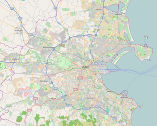
WDalkey Quarry is a long disused 19th century granite quarry located on Dalkey Hill in the Dublin suburb of Dalkey, which has become one of the most popular rock climbing locations in Ireland, with over 350 routes, some of which are amongst the hardest single-pitch rock climbs in Ireland.
 W
WDoolin is a coastal village in County Clare, Ireland, on the Atlantic coast. It is southwest of the spa town of Lisdoonvarna. It is a noted centre of traditional Irish music, which is played nightly in its pubs, making it a popular tourist destination. There are numerous nearby archaeological sites, many dating to the Iron Age and earlier. Doonagore Castle and Ballinalacken Castle are also in the area. The area was officially classified as part of the West Clare Gaeltacht prior to the 1950s, and maintains a connection with Irish-speaking areas - including via its maritime connection with the Aran Islands.
 W
WFair Head or Benmore is a 5 kilometre mountain cliff, close to the sea, at the north-eastern corner of County Antrim, Northern Ireland, whose rock face is formed into distinctive vertical columns like organ pipes. Fair Head is regarded as one of the best outdoor rock-climbing locations in Ireland, and its long cliff, up to 100 metres high in places, is considered one of the biggest expanses of climbable rock in Northwest Europe.
 W
WThe Gap of Dunloe, also recorded as Bearna an Choimín, is a narrow mountain pass running north-south in County Kerry, Ireland, that separates the MacGillycuddy's Reeks mountain range in the west, from the Purple Mountain Group range in the east. It is one of Kerry's most popular tourist destinations due to its scenery.
 W
WGlendalough is a glacial valley in County Wicklow, Ireland, renowned for an Early Medieval monastic settlement founded in the 6th century by St Kevin. From 1825 to 1957, the head of the Glendalough Valley was the site of a galena lead mine. Glendalough is also a recreational area for picnics, for walking along networks of maintained trails of varying difficulty, and also for rock-climbing.
 W
WGola is a small island off the coast of Gweedore, County Donegal, Ireland. The island was unpopulated as recently as 1996 but in recent years people have started to return. A ferry service operates during the holiday season and on request for the remainder of the year.
 W
WIreland's Eye is a small uninhabited island off the coast of County Dublin, Ireland, situated directly north of Howth Harbour. The island is easily reached by regular tourist boats. The island is currently part of the county of Fingal, for administrative purposes, but was at one time part of the city of Dublin. The island was for centuries part of the Howth Estate, but was sold to the Tetrarch investment group in a deal announced in 2018.
 W
WLuggala, also called Fancy Mountain at 595 metres (1,952 ft), is the 230th-highest peak in Ireland on the Arderin scale. Being below 600 metres (2,000 ft), it does not rank on the Vandeleur-Lynam or Hewitt scales. Luggala is in the northeastern section of the Wicklow Mountains in Ireland, and overlooks the Lough Tay, which lies at the base of the steep granite cliffs on Luggala's eastern face. As well as a noted scenic point in County Wicklow, Luggala's eastern cliffs have many graded rock-climbing routes.
 W
WThe Mourne Mountains, also called the Mournes or Mountains of Mourne, are a granite mountain range in County Down in the south-east of Northern Ireland. They include the highest mountains in Northern Ireland, the highest of which is Slieve Donard at 850 m (2,790 ft). The Mournes are designated an Area of Outstanding Natural Beauty and it has been proposed to make the area Northern Ireland's first national park. The area is partly owned by the National Trust and sees many visitors every year. The Mourne Wall crosses fifteen of the summits and was built to enclose the catchment basin of the Silent Valley and Ben Crom reservoirs.
 W
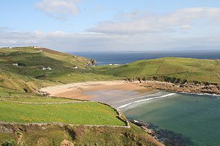
WMuckross Head is a small peninsula in the parish of Kilcar about 10 km west of Killybegs, Co. Donegal, in north-western Ireland. It contains a popular rock-climbing area, noted for its unusual horizontally layered structure.