 W
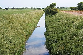
WAdlingfleet is a drained, fertile, former marshland village in the East Riding of Yorkshire, England, that forms part of the civil parish of Twin Rivers. It is 6.5 miles (10.5 km) east-southeast of Goole town centre. Its sea wall along the far north-east is set back from the Ouse estuary leaving the largest single reedbed in England.
 W
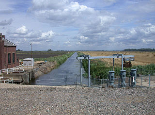
WBarlings Eau is a small river near Barlings, Lincolnshire, England. It is a tributary of the River Witham, joining it near Short Ferry. It acts as the central spine for a number of other small rivers, which drain the low-lying land to either side. Most of its course is within the area managed by the Witham Third District IDB, an Internal Drainage Board responsible for land drainage. One of their pumping stations is on the banks of the river.
 W
WBurnt Fen is an area of low-lying land crossed by the A1101 road between Littleport in Cambridgeshire and Mildenhall in Suffolk, England. It is surrounded on three sides by rivers, and consists of prime agricultural land, with sparse settlement. It is dependent on pumped drainage to prevent it from flooding.
 W
WThe Commissions of Sewers Act 1708 was an Act of the Parliament of Great Britain. It concerned the duties of boards of commissioners with responsibility for the maintenance of sea banks and other defences, which protected low-lying areas from inundation by the sea, and the removal of obstructions in streams and rivers caused by mills, weirs and gates. The word sewer had a much broader meaning than in modern usage, and referred generally to streams and watercourses.
 W
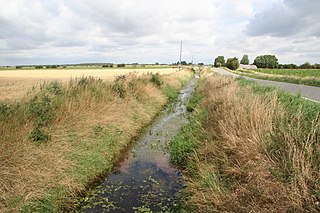
WDeeping Fen is a low-lying area in the South Holland district of Lincolnshire, England, which covers approximately 47 square miles (120 km2). It is bounded by the River Welland and the River Glen, and is extensively drained, but the efficient drainage of the land exercised the minds of several of the great civil engineers of the 17th and 18th centuries.
 W
WHatfield Chase is a low-lying area in South Yorkshire and North Lincolnshire, England, which was often flooded. It was a royal hunting ground until Charles I appointed the Dutch engineer Cornelius Vermuyden to drain it in 1626. The work involved the re-routing of the Rivers Don, Idle and Torne, and the construction of drainage channels. It was not wholly successful, but changed the whole nature of a wide swathe of land including the Isle of Axholme and caused legal disputes for the rest of the century. The civil engineer John Smeaton looked at the problem of wintertime flooding in the 1760s, and some remedial work was carried out.
 W
WAn internal drainage board (IDB) is a type of operating authority which is established in areas of special drainage need in England and Wales with permissive powers to undertake work to secure clean water drainage and water level management within drainage districts. The area of an IDB is not determined by county or metropolitan council boundaries, but by water catchment areas within a given region. IDBs are geographically concentrated in the Broads, Fens in East Anglia and Lincolnshire, Somerset Levels and Yorkshire.
 W
WThe Land Drainage Act 1930 was an Act of Parliament passed by the United Kingdom Government which provided a new set of administrative structures to ensure that drainage of low-lying land could be managed effectively. It followed the proposals of a royal commission which sat during 1927.
 W
WThe Land Drainage Act 1961 was an Act of Parliament passed by the United Kingdom Government which provided mechanisms for river boards to raise additional finance to fund their obligations. It built upon the provisions of the Land Drainage Act 1930 and the River Boards Act 1948.
 W
WLaneham is a small Nottinghamshire village and civil parish on the banks of the River Trent. The population of the civil parish at the 2011 census was 312. It is 13 miles (21 km) due west of the city of Lincoln and 8 miles (13 km) east of the market town of Retford.
 W
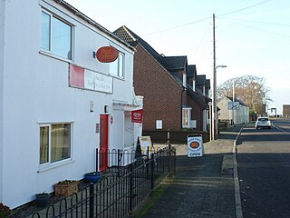
WThe Lewes and Laughton Levels are an area of low-lying land bordering the River Ouse near Lewes and the Glynde Reach near Laughton in East Sussex, England. The area was probably a tidal inlet in Norman times, but by the early 14th century, some meadows had been created by building embankments. Conditions deteriorated later that century, and by 1537, most of the meadows were permanently flooded. Part of the problem was the buildup of shingle across the mouth of the Ouse, but in 1537 a scot tax was raised, and a new channel cut through the shingle. By the mid 17th century, shingle was again preventing the region from draining properly, until the new channel was reinstated around 1731. In 1758 John Smeaton surveyed the area with a view to improving it for agriculture. He suggested straightening and widening the river channel, raising the banks around meadows, and building a large sluice near Piddinghoe, to keep the tides out. Some dredging and widening were carried out, but the straightending and sluice were discarded.
 W
WPode Hole is a small village 2 miles (3.2 km) to the west of the centre of Spalding, Lincolnshire, England. The village lies at the confluence of several drainage channels, where two pumping stations discharge water into Vernatt's Drain from land in Deeping Fen to the South and West. Water from Pinchbeck South Fen to the North is also lifted into Vernatt's Drain. The village arose to service the pumping stations.
 W
WThe River Boards Act 1948 was an Act of Parliament passed by the United Kingdom Government which provided constitutional, financial and general administrative structures for River Boards, which were responsible for the management of river board areas, and superseded the catchment boards that had been set up under the Land Drainage Act 1930.
 W
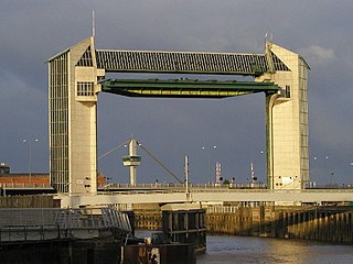
WThe River Hull is a navigable river in the East Riding of Yorkshire in Northern England. It rises from a series of springs to the west of Driffield, and enters the Humber Estuary at Kingston upon Hull. Following a period when the Archbishops of York charged tolls for its use, it became a free navigation. The upper reaches became part of the Driffield Navigation from 1770, after which they were again subject to tolls, and the section within the city of Hull came under the jurisdiction of the Port of Hull, with the same result.
 W
WThe River Rother flows for 35 miles (56 km) through the English counties of East Sussex and Kent. Its source is near Rotherfield in East Sussex, and its mouth is on Rye Bay, part of the English Channel. Prior to 1287, its mouth was further to the east at New Romney, but it changed its course after a great storm blocked its exit to the sea. It was known as the Limen until the sixteenth century. For the final 14 miles (23 km), the river bed is below the high tide level, and Scots Float sluice is used to control levels. It prevents salt water entering the river system at high tides, and retains water in the river during the summer months to ensure the health of the surrounding marsh habitat. Below the sluice, the river is tidal for 3.7 miles (6.0 km).
 W
WSouth Holland IDB is an English internal drainage board set up under the terms of the Land Drainage Act 1930. It has responsibility for the land drainage of 148.43 square miles (384.4 km2) of low-lying land in South Lincolnshire. It is unusual as its catchment area is the same as the area of the drainage district, and so it does not have to deal with water flowing into the area from surrounding higher ground. No major rivers flow through the area, although the district is bounded by the River Welland to the west and the River Nene to the east.
 W
WThe Upper Witham IDB is an English Internal Drainage Board responsible for land drainage and the management of flood risk for an area to the west of the Lincolnshire city of Lincoln, broadly following the valleys of the upper River Witham, the River Till and the course of the Fossdyke Navigation.
 W
WWitham First District IDB is an English internal drainage board which was set up under the terms of the Land Drainage Act 1930. The Board inherited the responsibilities of the Witham General Drainage Commissioners, who were first constituted by an Act of Parliament of 1762. They manage the land drainage of an area to the west of the River Witham, between Lincoln and Dogdyke, which includes the valley of the River Slea to above Sleaford.
 W
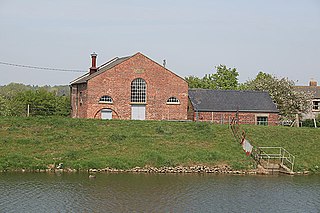
WWitham Third District IDB is an English internal drainage board set up under the terms of the Land Drainage Act 1930. The Board inherited the responsibilities of the Witham General Drainage Commissioners, who were first constituted by an Act of Parliament of 1762. They manage the land drainage of an area to the north and east of the River Witham, between Lincoln and Dogdyke, which includes the valley of the River Bain to above Hemingby, and the valleys of Barlings Eau and most of its tributaries, to the north east of Lincoln.