 W
WAridoamerica denotes an ecological region spanning Mexico and the Southwestern United States, defined by the presence of the culturally significant staple foodstuff Phaseolus acutifolius, a drought-resistant bean. Its dry, arid climate and geography stand in contrast to the verdant Mesoamerica of present-day central Mexico into Central America to the south and east, and the higher, milder "island" of Oasisamerica to the north. Aridoamerica overlaps with both.
 W
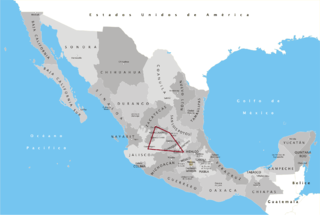
WThe Bajío (lowlands) is a region of Central Mexico that includes parts of the states of Aguascalientes, Jalisco, Guanajuato, and Querétaro.
 W
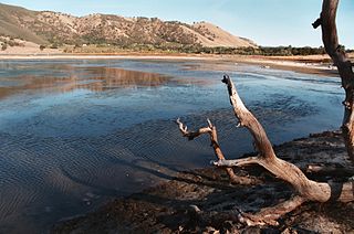
WThe Borax Lake Site, also known as the Borax Lake—Hodges Archaeological Site and designated by the Smithsonian trinomial CA-LAK-36, is a prehistoric archaeological site near Clearlake, California. The site, a deeply stratified former lakeshore, contains evidence of the earliest known period of human habitation in what is now California, dating back 12,000 years. A portion of the site, designated a National Historic Landmark in 2006, is owned and preserved by the Archaeological Conservancy.
 W
WCliff Palace is the largest cliff dwelling in North America. The structure built by the Ancestral Puebloans is located in Mesa Verde National Park in their former homeland region. The cliff dwelling and park are in Montezuma County, in the southwestern corner of Colorado, in the Southwestern United States.
 W
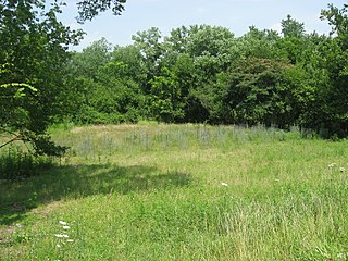
WThe Clough Creek and Sand Ridge Archaeological District is a historic district composed of two archaeological sites in the southwestern part of the U.S. state of Ohio. Its name is derived from those of the two sites included in the district: one that lies along Clough Creek, and one that occupies part of the Sand Ridge near the creek.
 W
WDark Canyon Wilderness is a designated Wilderness Area in the heart of southeast Utah's canyon country, part of the Bears Ears National Monument. The wilderness is named for its high steep walls that narrow in the lower section so that they block the light in the morning and late afternoon. The roughly horseshoe-shaped wilderness is made up of the upper part of 40-mile-long (64 km) Dark Canyon and two major tributaries, Woodenshoe Canyon and Peavine Canyon in the Manti-La Sal National Forest. These canyons all descend from pine-covered Elk Ridge northeast of Natural Bridges National Monument. Dark Canyon continues west within a U.S. Bureau of Land Management primitive area that is recommended for wilderness designation. The last four miles (6.4 km) of the main canyon drop steeply through Glen Canyon National Recreation Area into Lake Powell.
 W
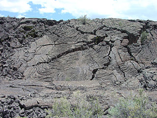
WEl Malpais National Monument is a National Monument located in western New Mexico, in the Southwestern United States. The name El Malpais is from the Spanish term Malpaís, meaning badlands, due to the extremely barren and dramatic volcanic field that covers much of the park's area.
 W
WHahn Field Archeological District is a registered historic district near Newtown, Ohio, listed in the National Register of Historic Places on October 29, 1974.
 W
WThe indigenous peoples of the North American Southwest are those in the current states of Colorado, Arizona, New Mexico, Utah, and Nevada in the western United States, and the states of Sonora and Chihuahua in northern Mexico. An often quoted statement from Erik Reed (1964) defined the Greater Southwest culture area as extending north to south from Durango, Mexico to Durango, Colorado and east to west from Las Vegas, Nevada to Las Vegas, New Mexico. Other names sometimes used to define the region include "American Southwest", "North Mexico", "Chichimeca", and "Oasisamerica/Aridoamerica". This region has long been occupied by hunter-gatherers and agricultural people.
 W
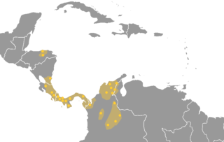
WThe Intermediate Area is an archaeological geographical area of the Americas that was defined in its clearest form by Gordon R. Willey in his 1971 book An Introduction to American Archaeology, Vol. 2: South America. It comprises the geographical region between Mesoamerica to the north and the Central Andes to the south, including portions of Honduras and most of the territory of the republics of Nicaragua, Costa Rica, Panama, Colombia, Venezuela, and Ecuador. As an archaeological concept, the Intermediate Area has always been somewhat poorly defined.
 W
WThe archaeology of Iowa is the study of the buried remains of human culture within the U.S. state of Iowa from the earliest prehistoric through the late historic periods. When the American Indians first arrived in what is now Iowa more than 13,000 years ago, they were hunters and gatherers living in a Pleistocene glacial landscape. By the time European explorers visited Iowa, American Indians were largely settled farmers with complex economic, social, and political systems. This transformation happened gradually. During the Archaic period American Indians adapted to local environments and ecosystems, slowly becoming more sedentary as populations increased. More than 3,000 years ago, during the Late Archaic period, American Indians in Iowa began utilizing domesticated plants. The subsequent Woodland period saw an increase on the reliance on agriculture and social complexity, with increased use of mounds, ceramics, and specialized subsistence. During the Late Prehistoric period increased use of maize and social changes led to social flourishing and nucleated settlements. The arrival of European trade goods and diseases in the Protohistoric period led to dramatic population shifts and economic and social upheaval, with the arrival of new tribes and early European explorers and traders. During the Historical period European traders and American Indians in Iowa gave way to American settlers and Iowa was transformed into an agricultural state.
 W
WThe Isthmo-Colombian Area is defined as a cultural area encompassing those territories occupied predominantly by speakers of the Chibchan languages at the time of European contact. It includes portions of the Central American isthmus like eastern El Salvador, eastern Honduras, Caribbean Nicaragua, Costa Rica, Panama, and northern Colombia.
 W
WMesoamerica is a historical region and cultural area in North America. It extends from approximately central Mexico through Belize, Guatemala, El Salvador, Honduras, Nicaragua, and northern Costa Rica. Within this region pre-Columbian societies flourished for more than 1000 years before the Spanish colonization of the Americas. Mesoamerica was the site of two of the most profound historical transformations in world history: primary urban generation, and the formation of New World cultures out of the long encounters among Indigenous, European, African and Asian cultures.
 W
WThe Mimbres is a 91-mile-long (146 km) river in southwestern New Mexico. It forms from snow pack and runoff on the south-western slopes of the Black Range at 33°06′58″N 107°51′04″W in Grant County. It flows southward into a small endorheic basin east of Deming, New Mexico in Luna County. The uplands watershed are administered by the US Forest Service, while the land in the Mimbres Valley is mostly privately owned. The upper reaches of the river are perennial. The river flows south from the Black Range and the surface flow of the river dissipates in the desert north of Deming, but the river bed and storm drainage continue eastward, any permanent flow remaining underground. The Mimbres River Basin has an area of about 13,000 km² (5,140 mi²) and extends slightly into northern Chihuahua.
 W
WNavajo National Monument is a National Monument located within the northwest portion of the Navajo Nation territory in northern Arizona, which was established to preserve three well-preserved cliff dwellings of the Ancestral Puebloan people: Keet Seel, Betatakin, and Inscription House. The monument is high on the Shonto plateau, overlooking the Tsegi Canyon system, west of Kayenta, Arizona. It features a visitor center with a museum, three short self-guided trails, two small campgrounds, and a picnic area.
 W
WOasisamerica is a term that was coined by Paul Kirchhoff and published in a 1954 article, and is used by some scholars, primarily Mexican anthropologists, for the broad cultural area defining pre-Columbian southwestern North America. It extends from modern-day Utah down to southern Chihuahua, and from the coast on the Gulf of California eastward to the Río Bravo river valley. Its name comes from its position in relationship with the similar regions of Mesoamerica and mostly nomadic Aridoamerica. The term Greater Southwest is often used to describe this region by American anthropologists.
 W
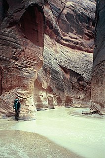
WThe Paria River is a tributary of the Colorado River, approximately 95 miles (153 km) long, in southern Utah and northern Arizona in the United States. It drains a rugged and arid region northwest of the Colorado, flowing through roadless slot canyons along part of its course.
 W
WSalado culture, or Salado Horizon, was a human culture in the upper Salt River of the Tonto Basin in southeastern Arizona from approximately 1150 CE through the 15th century.
 W
WThe Southern Maya Area (SMA) is a part of Mesoamerica, long believed important to the rise of Maya civilization, the period that is also known as Preclassic Maya. It lies within a broad arc or cantilevered rectangle from Chiapa de Corzo, in the Isthmus of Tehuantepec, in the northwest due south to Izapa and Paso de la Amada, from Chiapa de Corzo southeast to Copán, Honduras, and from Copán south to Chalchuapa, El Salvador.
 W
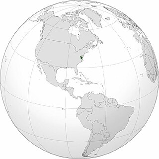
WTsenacommacah is the name given by the Powhatan people to their native homeland, the area encompassing all of Tidewater Virginia and parts of the Eastern Shore. More precisely, its boundaries spanned 100 miles (160 km) by 100 miles (160 km) from near the south side of the mouth of the James River all the way north to the south end of the Potomac River and from the Eastern Shore west to about the Fall Line of the rivers.