 W
WSediment is a naturally occurring material that is broken down by processes of weathering and erosion, and is subsequently transported by the action of wind, water, or ice or by the force of gravity acting on the particles. For example, sand and silt can be carried in suspension in river water and on reaching the sea bed deposited by sedimentation; if buried, they may eventually become sandstone and siltstone through lithification.
 W
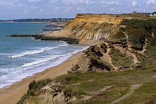
WIn hydrology and geography, armor is the association of surface pebbles, rocks or boulders with stream beds or beaches. Most commonly hydrological armor occurs naturally; however, a man-made form is usually called riprap, when shorelines or stream banks are fortified for erosion protection with large boulders or sizable manufactured concrete objects. When armor is associated with beaches in the form of pebbles to medium-sized stones grading from two to 200 millimeters across, the resulting landform is often termed a shingle beach. Hydrological modeling indicates that stream armor typically persists in a flood stage environment.
 W
WBarton Beds is the name given to a series of grey and brown clays, with layers of sand, of Upper Eocene age, which are found in the Hampshire Basin of southern England. They are particularly well exposed in the cliffs at Barton-on-Sea, which is the type locality for the Barton Beds, and lends its name to the Bartonian age of the Eocene epoch. The clay is abundant in fossils, especially molluscs.
 W
WBay mud consists of thick deposits of soft, unconsolidated silty clay, which is saturated with water; these soil layers are situated at the bottom of certain estuaries, which are normally in temperate regions that have experienced cyclical glacial cycles. Example locations are Cape Cod Bay, Chongming Dongtan Reserve in Shanghai, China, Banc d'Arguinpreserve in Mauritania, The Bristol Channel in the United Kingdom, Mandø Island in the Wadden Sea in Denmark, Florida Bay, San Francisco Bay, Bay of Fundy, Casco Bay, Penobscot Bay, and Morro Bay. Bay mud manifests low shear strength, high compressibility and low permeability, making it hazardous to build upon in seismically active regions like the San Francisco Bay Area.
 W
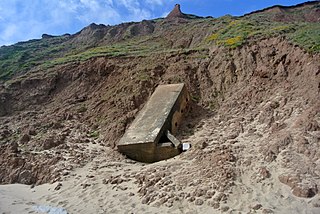
WBlack sand is sand that is black in color. One type of black sand is a heavy, glossy, partly magnetic mixture of usually fine sands containing minerals such as magnetite, found as part of a placer deposit. Another type of black sand, found on beaches near a volcano, consists of tiny fragments of basalt.
 W
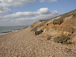
WBoulder clay is a geological deposit of clay, often full of boulders, which is formed out of the ground moraine material of glaciers and ice-sheets. It was the typical deposit of the Glacial Period in northern Europe and North America.
 W
WBrickearth is a term originally used to describe superficial windblown deposits found in southern England. The term has been employed in English-speaking regions to describe similar deposits.
 W
WClay is a type of fine-grained natural soil material containing clay minerals. Clays develop plasticity when wet, due to a molecular film of water surrounding the clay particles, but become hard, brittle and non–plastic upon drying or firing. Most pure clay minerals are white or light-coloured, but natural clays show a variety of colours from impurities, such as a reddish or brownish colour from small amounts of iron oxide.
 W
WA desert pavement, also called reg, serir, gibber, or saï is a desert surface covered with closely packed, interlocking angular or rounded rock fragments of pebble and cobble size. They typically top alluvial fans. Desert varnish collects on the exposed surface rocks over time.
 W
WDetrital zircon geochronology is the science of analyzing the age of zircons deposited within a specific sedimentary unit by examining their inherent radioisotopes, most commonly the uranium–lead ratio. The chemical name of zircon is zirconium silicate and its corresponding chemical formula is Zr SiO4. Zircon is a common accessory or trace mineral constituent of most granite and felsic igneous rocks. Due to its hardness, durability and chemical inertness, zircon persists in sedimentary deposits and is a common constituent of most sands. Zircons contain trace amounts of uranium and thorium and can be dated using several modern analytical techniques. It has become increasingly popular in geological studies from the 2000s mainly due to the advancement in radiometric dating techniques. Detrital zircon age data can be used to constrain the maximum depositional age, determine provenance, and reconstruct the tectonic setting on a regional scale.
 W
WDropstones are isolated fragments of rock found within finer-grained water-deposited sedimentary rocks. They range in size from small pebbles to boulders. The critical distinguishing feature is that there is evidence that they were not transported by normal water currents, but rather dropped in vertically through the water column.
 W
WLightweight expanded clay aggregate (LECA) or expanded clay (exclay) is a lightweight aggregate made by heating clay to around 1,200 °C (2,190 °F) in a rotary kiln. The yielding gases expand the clay by thousands of small bubbles forming during heating producing a honeycomb structure. LECA has an approximately round or potato shape due to circular movement in the kiln and is available in different sizes and densities. LECA is used to make lightweight concrete products and other uses.
 W
WLoess is a clastic, predominantly silt-sized sediment that is formed by the accumulation of wind-blown dust. Ten percent of the Earth's land area covered by loess or similar deposits.
 W
WA moraine is any accumulation of unconsolidated debris, sometimes referred to as glacial till, that occurs in both currently and formerly glaciated regions, and that has been previously carried along by a glacier or ice sheet. It may consist of partly rounded particles ranging in size from boulders down to gravel and sand, in a groundmass of finely-divided clayey material sometimes called glacial flour. Lateral moraines are those formed at the side of the ice flow, and terminal moraines were formed at the foot, marking the maximum advance of the glacier. Other types of moraine include ground moraines and medial moraines.
 W
WA mud volcano or mud dome is a landform created by the eruption of mud or slurries, water and gases. Several geological processes may cause the formation of mud volcanoes. Mud volcanoes are not true igneous volcanoes as they do not produce lava and are not necessarily driven by magmatic activity. The Earth continuously exudes a mud-like substance, which may sometimes be referred to as a "mud volcano". Mud volcanoes may range in size from merely 1 or 2 meters high and 1 or 2 meters wide, to 700 meters high and 10 kilometers wide. Smaller mud exudations are sometimes referred to as mud-pots.
 W
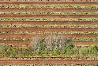
WPeat, sometimes known as turf, is an accumulation of partially decayed vegetation or organic matter. It is unique to natural areas called peatlands, bogs, mires, moors, or muskegs. The peatland ecosystem covers 3.7 million square kilometres (1.4 million square miles) and is the most efficient carbon sink on the planet, because peatland plants capture CO2 naturally released from the peat, maintaining an equilibrium. In natural peatlands, the "annual rate of biomass production is greater than the rate of decomposition", but it takes "thousands of years for peatlands to develop the deposits of 1.5 to 2.3 m [4.9 to 7.5 ft], which is the average depth of the boreal [northern] peatlands", which store around 415 gigatonnes (457 billion short tons; 408 billion long tons) of carbon (about 46 times 2019 global CO2 emissions). Globally, it even stores up to 550 gigatonnes (610 billion short tons; 540 billion long tons) of carbon, representing 42% of all soil carbon and exceeds the carbon stored in all other vegetation types, including the world's forests. Across the world, peat covers just 3% of the land’s surface, but stores one-third of the Earth’s soil carbon. Sphagnum moss, also called peat moss, is one of the most common components in peat, although many other plants can contribute. The biological features of sphagnum mosses act to create a habitat aiding peat formation, a phenomenon termed 'habitat manipulation'. Soils consisting primarily of peat are known as histosols. Peat forms in wetland conditions, where flooding or stagnant water obstructs the flow of oxygen from the atmosphere, slowing the rate of decomposition.
 W
WQuicksand is a colloid consisting of fine granular material and water.
 W
WA salt glacier is a rare flow of salt that is created when a rising diapir in a salt dome breaches the surface of the Earth. The name ‘salt glacier’ was given to this phenomenon due to the similarity of movement when compared with ice glaciers. The causes of these formations is primarily due to salt's unique properties and its surrounding geologic environment. A rising body of salt is referred to as a diapir; which rises to the surface and feeds the salt glacier. Salt structures are usually composed of halite, anhydrite, gypsum and clay minerals. Clays may be brought up with the salt, turning it dark. These salt flows are rare on earth. In a more recent discovery, scientists have found that they also occur on Mars, but are composed of sulfates.
 W
WSilt is granular material of a size between sand and clay, whose mineral origin is quartz and feldspar. Silt may occur as a soil or as sediment mixed in suspension with water and soil in a body of water such as a river. It may also exist as soil deposited at the bottom of a water body, like mudflows from landslides. Silt has a moderate specific area with a typically non-sticky, plastic feel. Silt usually has a floury feel when dry, and a slippery feel when wet. Silt can be visually observed with a hand lens, exhibiting a sparkly appearance. It also can be felt by the tongue as granular when placed on the front teeth.
 W
WSiltation, or siltification, is water pollution caused by particulate terrestrial clastic material, with a particle size dominated by silt or clay. It refers both to the increased concentration of suspended sediments and to the increased accumulation of fine sediments on bottoms where they are undesirable. Siltation is most often caused by soil erosion or sediment spill.
 W
WTill or glacial till is unsorted glacial sediment.