 W
WThe radio frequency 2182 kHz is one of the international calling and distress frequencies for maritime radiocommunication in a frequency band allocated to the mobile service on primary basis, exclusively for distress and calling operations.
 W
WThe AIS-SART is a self-contained radio device used to locate a survival craft or distressed vessel by sending updated position reports using a standard Automatic Identification System (AIS) class-A position report. The position and time synchronization of the AIS-SART are derived from a built in GNSS receiver . Shipboard Global Maritime Distress Safety System (GMDSS) installations include one or more search and rescue locating devices. These devices may be either an AIS-SART, or a radar-SART.
 W
WThe automatic identification system (AIS) is an automatic tracking system that uses transceivers on ships and is used by vessel traffic services (VTS). When satellites are used to detect AIS signatures, the term Satellite-AIS (S-AIS) is used. AIS information supplements marine radar, which continues to be the primary method of collision avoidance for water transport. Although technically and operationally distinct, the ADS-B system is analogous to AIS and performs a similar function for aircraft.
 W
WMaritime call signs are call signs assigned as unique identifiers to ships and boats. All radio transmissions must be individually identified by the call sign. Merchant and naval vessels are assigned call signs by their national licensing authorities.
 W
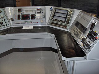
WA coast radio station is an on-shore maritime radio station which may monitor radio distress frequencies and relays ship-to-ship and ship-to-land communications.
 W
WDigital selective calling or DSC is a standard for transmitting pre-defined digital messages via the medium-frequency (MF), high-frequency (HF) and very-high-frequency (VHF) maritime radio systems. It is a core part of the Global Maritime Distress Safety System (GMDSS).
 W
WDiver communications are the methods used by divers to communicate with each other or with surface members of the dive team. In professional diving, communication is usually between a single working diver and the diving supervisor at the surface control point. This is considered important both for managing the diving work, and as a safety measure for monitoring the condition of the diver. The traditional method of communication was by line signals, but this has been superseded by voice communication, and line signals are now used in emergencies when voice communications have failed. Surface supplied divers often carry a closed circuit video camera on the helmet which allows the surface team to see what the diver is doing and to be involved in inspection tasks. This can also be used to transmit hand signals to the surface if voice communications fails. Underwater slates may be used to write text messages which can be shown to other divers, and there are some dive computers which allow a limited number of pre-programmed text messages to be sent through-water to other divers or surface personnel with compatible equipment.
 W
WAn Electronic Chart Display and Information System (ECDIS) is a geographic information system used for nautical navigation that complies with International Maritime Organization (IMO) regulations as an alternative to paper nautical charts. IMO refers to similar systems not meeting the regulations as Electronic Chart Systems (ECSs).
 W
WInmarsat-C is a two-way, packet data service operated by the telecommunications company Inmarsat which operates between mobile earth stations (MES) and land earth stations (LES). It became fully operational after a period of pre-operational trials in January 1991. The advantages of Inmarsat-C compared to Inmarsat-A are low cost, smaller and uses a smaller omni-directional antenna. The disadvantage is that voice communication is not possible with Inmarsat-C. The service is approved for use under the Global Maritime Distress and Safety System (GMDSS), meets the requirements for Ship Security Alert Systems (SSAS) defined by the International Maritime Organization (IMO) and is the most widely used service in fishing Vessel Monitoring Systems (VMS).
 W
WThe International Code of Signals (ICS) is an international system of signals and codes for use by vessels to communicate important messages regarding safety of navigation and related matters. Signals can be sent by flaghoist, signal lamp ("blinker"), flag semaphore, radiotelegraphy, and radiotelephony. The International Code is the most recent evolution of a wide variety of maritime flag signalling systems.
 W
WThe International Cospas-Sarsat Programme is a satellite-aided search and rescue initiative. It is organized as a treaty-based, nonprofit, intergovernmental, humanitarian cooperative of 45 nations and agencies. It is dedicated to detecting and locating radio beacons activated by persons, aircraft or vessels in distress, and forwarding this alert information to authorities that can take action for rescue.
 W
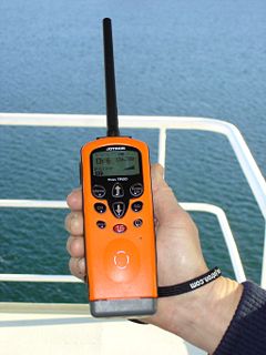
WMarine VHF radio is a worldwide system of two way radio transceivers on ships and watercraft used for bidirectional voice communication from ship-to-ship, ship-to-shore, and in certain circumstances ship-to-aircraft. It uses FM channels in the very high frequency (VHF) radio band in the frequency range between 156 and 174 MHz, inclusive. In the official language of the International Telecommunication Union the band is called the VHF maritime mobile band. In some countries additional channels are used, such as the L and F channels for leisure and fishing vessels in the Nordic countries. Transmitter power is limited to 25 watts, giving them a range of about 100 kilometres.
 W
WMaritime mobile-satellite service is – according to Article 1.29 of the International Telecommunication Union's Radio Regulations (RR) – "A mobile-satellite service in which mobile earth stations are located on board ships; survival craft stations and emergency position-indicating radiobeacon stations may also participate in this service".
 W
WA message in a bottle is a form of communication in which a message is sealed in a container and released into a conveyance medium.
 W
WMobile-satellite service is – according to Article 1.25 of the International Telecommunication Union's Radio Regulations – "A radiocommunication servicebetween mobile earth stations and one or more space stations, or between space stations used by this service; or between mobile earth stations by means of one or more space stations.
 W
WNAVTEX, sometimes styled Navtex or NavTex, is an international automated medium frequency direct-printing service for delivery of navigational and meteorological warnings and forecasts, as well as urgent maritime safety information (MSI) to ships.
 W
WPort operations service is – according to Article 1.30 of the International Telecommunication Union's (ITU) Radio Regulations (RR) – defined as «A maritime mobile service in or near a port, between coast stations and ship stations, or between ship stations, in which messages are restricted to those relating to the operational handling, the movement and the safety of ships and, in emergency, to the safety of persons. Messages which are of a public correspondence nature shall be excluded from this service.»See also
 W
WPort station is – according to Article 1.80 of the International Telecommunication Union´s (ITU) RR – defined as «A coast station in the port operations service.»
 W
WA radiotelephone is a radio communication system for transmission of speech over radio. Radiotelephony means transmission of sound (audio) by radio, in contrast to radiotelegraphy, which is transmission of telegraph signals, or television, transmission of moving pictures and sound. The term may include radio broadcasting systems, which transmit audio one way to listeners, but usually refers to two-way radio systems for bidirectional person-to-person voice communication between separated users, such as CB radio or marine radio. In spite of the name, radiotelephony systems are not necessarily connected to or have anything to do with the telephone network, and in some radio services, including GMRS, interconnection is prohibited.
 W
WSatellite emergency position-indicating radiobeacon station is – according to article 1.94 of the International Telecommunication Union´s (ITU) ITU Radio Regulations (RR) – defined as «An earth station in the mobile-satellite service the emissions of which are intended to facilitate search and rescue (SAR) operations.»
 W
WA satellite navigation or satnav system is a system that uses satellites to provide autonomous geo-spatial positioning. It allows small electronic receivers to determine their location to high precision using time signals transmitted along a line of sight by radio from satellites. The system can be used for providing position, navigation or for tracking the position of something fitted with a receiver. The signals also allow the electronic receiver to calculate the current local time to high precision, which allows time synchronisation. These uses are collectively known as Positioning, Navigation and Timing (PNT). Satnav systems operate independently of any telephonic or internet reception, though these technologies can enhance the usefulness of the positioning information generated.
 W
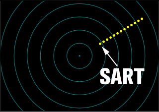
WA search and rescue transponder (SART) is a self-contained, waterproof transponder intended for emergency use at sea. These devices may be either a radar-SART, or a GPS-based AIS-SART.
 W
WSES Broadband for Maritime is a two-way satellite broadband Internet service for use on private boats and commercial ships throughout European waters.
 W
WShip earth station is – according to Article 1.78 of the International Telecommunication Union's (ITU) ITU Radio Regulations (RR) – defined as «A mobile earth station in the maritime mobile-satellite service located on board ship.»
 W
WShip movement service is – according to Article 1.31 of the International Telecommunication Union's (ITU) Radio Regulations (RR) – defined as «A safety service in the maritime mobile service other than a port operations service, between coast stations and ship stations, or between ship stations, in which messages are restricted to those relating to the movement of ships. Messages which are of a public correspondence nature shall be excluded from this service.»See also
 W
WA ship station is a radio station located on board a sea vessel. The ITU Radio Regulations define it as "A mobile station in the maritime mobile service located on board a vessel which is not permanently moored, other than a survival craft station."
 W
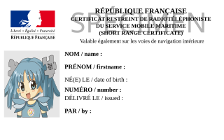
WThe Short Range Certificate is an internationally valid certificate issued to marine radio station operators. It entitles the holder to participate in marine communications on leisure crafts using Marine VHF radio and DSC, while in the GMDSS A1 sea areas.
 W
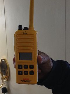
WVery high frequency (VHF) survival craft transceivers (SCTs) are lightweight, portable, two-way, handheld VHF transceivers capable of radiotelephone on-scene communication between rescue units and the survival craft. Essentially these are hand-held VHF radios that are used in any survival craft, such as a life boat or life raft. SCTs with re-chargeable type batteries may be used for on-board communications as well.
 W
WA vessel traffic service (VTS) is a marine traffic monitoring system established by harbour or port authorities, similar to air traffic control for aircraft. The International Maritime Organization defines VTS as "a service implemented by a competent authority designed to improve the safety and efficiency of vessel traffic and protect the environment. The service shall have the capability to interact with the traffic and respond to traffic situations developing in the VTS area". Typical VTS systems use radar, closed-circuit television (CCTV), VHF radiotelephony and automatic identification system to keep track of vessel movements and provide navigational safety in a limited geographical area.