 W
WAn alluvial fan is an accumulation of sediments shaped like a section of a shallow cone, with its apex at a point source of sediments, such as a narrow canyon emerging from an escarpment. They are characteristic of mountainous terrain in arid to semiarid climates, but are also found in more humid environments subject to intense rainfall and in areas of modern glaciation. They range in area from less than 1 square kilometre (0.39 sq mi) to almost 20,000 square kilometres (7,700 sq mi).
 W
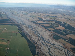
WAn alluvial plain is a largely flat landform created by the deposition of sediment over a long period of time by one or more rivers coming from highland regions, from which alluvial soil forms. A floodplain is part of the process, being the smaller area over which the rivers flood at a particular period of time, whereas the alluvial plain is the larger area representing the region over which the floodplains have shifted over geological time.
 W
WThe Americas, also known as America, are lands of the Western Hemisphere, composed of numerous entities and regions variably defined by geography, politics, and culture.
 W
WIn geography and ecology, anthropization is the conversion of open spaces, landscapes, and natural environments by human action.
 W
WThe terms barrier ridge, a term of art in the Earth Sciences, especially Geology and sometimes barrier range describing the existence of gross landforms describing long ridgelines which are particularly difficult to pass, especially in the context of being on foot or dependent upon other forms of animal powered transportation systems, in mountainous and sometimes hilly terrains.
 W
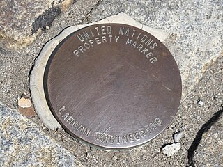
WA unit of real estate or immovable property is limited by a legal boundary. The boundary may appear as a discontinuation in the terrain: a ditch, a bank, a hedge, a wall, or similar, but essentially, a legal boundary is a conceptual entity, a social construct, adjunct to the likewise abstract entity of property rights.
 W
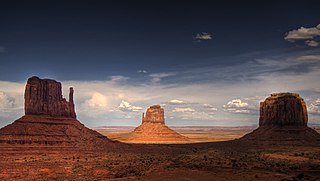
WIn geomorphology, a butte is an isolated hill with steep, often vertical sides and a small, relatively flat top; buttes are smaller landforms than mesas, plateaus, and tablelands. The word butte comes from a French word meaning knoll ; its use is prevalent in the Western United States, including the southwest where mesa is used for the larger landform. Due to their distinctive shapes, buttes are frequently landmarks in plains and mountainous areas. To differentiate the two landforms, geographers use the rule of thumb that a mesa has a top that is wider than its height, while a butte has a top that is narrower than its height.
 W
WIn physical geography, a dell is a small secluded hollow, grassy, park-like, usually partially-wooded valley. The word "dell" comes from the Old English word dell, which is related to the Old English word dæl, modern 'dale'. Dells in literature are often portrayed as pleasant safe havens. The term is sometimes used interchangeably with dingle, although this specifically refers to deep ravines or hollows that are embowered with trees. The terms have also been combined to form examples of tautological placenames in Dingle Dell, Kent, and Dingle Dell Reserve, Auckland.
 W
WIn geography, a dry point is an area of firm or flood-free ground in an area of wetland, marsh or flood plains. The term typically applies to settlements, and dry point settlements were common in history.
 W
WAn endorheic lake is a collection of water within an endorheic basin, or sink, with no evident outlet. Endorheic lakes are generally saline as a result of being unable to get rid of solutes left in the lake by evaporation. These lakes can be used as indicators of anthropogenic change, such as irrigation or climate change, in the areas surrounding them. Lakes with subsurface drainage are considered cryptorheic.
 W
WThis is a list of common atlas and gazetteer abbreviations. These abbreviations are not always used consistently between publications; some terms have fallen out of use over time. Older gazetteers and atlases often neglect to define abbreviations and underlying terms. Gazetteer and map abbreviations can show up in several forms: upper or lower case, with or without periods, sometimes with hyphens.
 W
WIn classical Roman religion, a genius loci was the protective spirit of a place. It was often depicted in religious iconography as a figure holding attributes such as a cornucopia, patera or snake. Many Roman altars found throughout the Western Roman Empire were dedicated to a particular genius loci. The Roman imperial cults of the Emperor and the imperial house developed in part in connections with the sacrifices made by neighborhood associations (vici) to the local genius. These 265 local districts had their cult organised around the Lares Compitales, which the emperor Augustus transformed into Lares Augusti along with the Genius Augusti. The emperor's genius is then regarded as the genius loci of the Roman Empire as a whole.
 W
WThe head of the valley or, less commonly, the valley head, refers to the uppermost part of a valley.
 W
WIn general, an imaginary line is usually any sort of geometric line that has only an abstract definition and does not physically exist. In fact, they used to properly identify places on a map.
 W
WAn interfluve is a narrow, elongated and plateau-like or ridge-like landform between two valleys. More generally, an interfluve is defined as an area of higher ground between two rivers in the same drainage system.
 W
WThe Intertropical Convergence Zone (ITCZ), known by sailors as the doldrums or the calms because of its monotonous windless weather, is the area where the northeast and the southeast trade winds converge. It encircles Earth near the thermal equator though its specific position varies seasonally. When it lies near the geographic Equator, it is called the near-equatorial trough. Where the ITCZ is drawn into and merges with a monsoonial circulation, it is sometimes referred to as a monsoon trough, a usage that is more common in Australia and parts of Asia.
 W
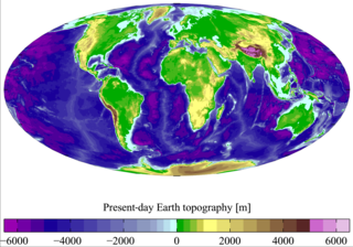
WLand is the solid surface of the Earth that is not permanently covered by water. The vast majority of human activity throughout history has occurred in land areas that support agriculture, habitat, and various natural resources. Some life forms, including terrestrial plants and terrestrial animals, have developed from predecessor species that originated in bodies of water.
 W
WA land claim is defined as "the pursuit of recognized territorial ownership by a group or individual". The phrase is usually only used with respect to disputed or unresolved land claims. Some types of land claims include aboriginal land claims, Antarctic land claims, and post-colonial land claims.
 W
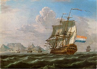
WA landmark is a recognizable natural or artificial feature used for navigation, a feature that stands out from its near environment and is often visible from long distances.
 W
WA landmass, or land mass, is a large region or area of land. The term is often used to refer to lands surrounded by an ocean or sea, such as a continent or a large island.
 W
WThis is a list of financial districts in cities around the world.
 W
WThe name Macedonia is used in a number of competing or overlapping meanings to describe geographical, political and historical areas, languages and peoples in a part of south-eastern Europe. It has been a major source of political controversy since the early 20th century. The situation is complicated because different ethnic groups use different terminology for the same entity, or the same terminology for different entities, with different political connotations.
 W
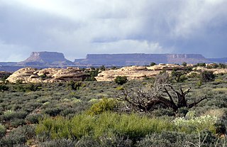
WA mesa is an isolated, flat-topped elevation, ridge or hill, which is bounded from all sides by steep escarpments and stands distinctly above a surrounding plain. Mesas characteristically consist of flat-lying soft sedimentary rocks capped by a more resistant layer or layers of harder rock, e.g. shales overlain by sandstones. The resistant layer acts as a caprock that forms the flat summit of a mesa. The caprock can consist of either sedimentary rocks such as sandstone and limestone; dissected lava flows; or a deeply eroded duricrust. Unlike plateau, whose usage does not imply horizontal layers of bedrock, e.g. Tibetan Plateau, the term mesa applies exclusively to the landforms built of flat-lying strata. Instead, flat-topped plateaus are specifically known as tablelands.
 W
WA mountain is an elevated portion of the Earth's crust, generally with steep sides that show significant exposed bedrock. A mountain differs from a plateau in having a limited summit area, and is larger than a hill, typically rising at least 300 metres above the surrounding land. A few mountains are isolated summits, but most occur in mountain ranges.
 W
WThe Orient is a term for the East, traditionally comprising anything that belongs to the Eastern world, in relation to Europe. It is the antonym of Occident, the Western World. In English, it is largely a metonym for, and coterminous with, the continent of Asia, loosely classified into the Near East, Middle East and Far East: the geographical and ethno-cultural regions now known as West Asia, South Asia, East Asia, and Southeast Asia. Originally, the term Orient was used to designate the Near East, and later its meaning evolved and expanded, designating also the Middle East or the Far East.
 W
WPlacer is a term used by Spanish and Portuguese navigators and cartographers to refer to a certain kind of submerged bank or reef. Commonly the bottom of such a reef is sandy, but there are some where the bottom is muddy or stoney. Although most reefs designated as placer are flat and shallow, exceptionally there are some that do not share those characteristics and are known as placer acantilado. A placer usually provides an anchorage for seagoing vessels.
 W
WA polynya is an area of open water surrounded by sea ice. It is now used as a geographical term for an area of unfrozen seawater within otherwise contiguous pack ice or fast ice. It is a loanword from the Russian полынья, which refers to a natural ice hole and was adopted in the 19th century by polar explorers to describe navigable portions of the sea.
 W
WThe sector model, also known as the Hoyt model, is a model of urban land use proposed in 1939 by land economist Homer Hoyt. It is a modification of the concentric zone model of city development. The benefits of the application of this model include the fact it allows for an outward progression of growth. As with all simple models of such complex phenomena, its validity is limited.
 W
WSpatial scale is a specific application of the term scale for describing or categorizing the size of a space, or the extent of it at which a phenomenon or process occurs.
 W
WA table or tableland is a butte, flank of a mountain, or mountain, that has a flat top.
 W
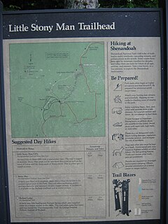
WA trailhead is the point at which a trail begins, where the trail is often intended for hiking, biking, horseback riding, or off-road vehicles. Modern trailheads often contain rest rooms, maps, sign posts and distribution centers for informational brochures about the trail and its features, and parking areas for vehicles and trailers. The United States access board states "A trailhead is defined as an outdoor space that is designated by an entity responsible for administering or maintaining a trail to serve as an access point to the trail."
 W
WA tunnel valley is a U-shaped valley originally cut under the glacial ice near the margin of continental ice sheets such as that now covering Antarctica and formerly covering portions of all continents during past glacial ages. They can be as long as 100 km (62 mi), 4 km (2.5 mi) wide, and 400 m (1,300 ft) deep.