 W
WAtlantean figures are carved stone support columns or pillars in the shape of fierce men in Pre-Columbian Mesoamerica. These figures are considered to be "massive statues of Toltec warriors". They take their name from the European tradition of similar Atlas or Atalante figures in classical architecture, which was then revived in the Renaissance and especially popular in Baroque architecture. Atlantean here refers to the figures' supporting posture, alluding to the load-bearing Titan Atlas, not Atlantis.
 W
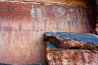
WBarrier Canyon Style (BCS) describes a distinctive style of rock art which appears mostly in Utah, with the largest concentration of sites in and around the San Rafael Swell and Canyonlands National Park, but the full range extends into much of the state and western Colorado. The term was first applied by Polly Schaafsma to describe a handful of similar sites known at the time, including several along Barrier Creek in Horseshoe Canyon. Barrier Canyon Style rock art panels are mostly pictographs (painted) but there are also several petroglyphs (pecked) in the style. These panels are believed to have been created during the archaic period and are estimated to be somewhere in the range of 1500 to 4000 years old, possibly older -- clay figurines of a similar style found in Cowboy Cave have been dated to over 7000 years old.
 W
WBirch Point, also known as Clark's Point, is a peninsula in Machiasport, Maine. It separates Sanborn Cove to the north from Larrabee Cove to the south on the west side of Machias Bay, a short way south of the mouth of the Machias River. The point is of prehistoric and historic importance to the local Passamaquoddy people, as it is the site of large panels of rock art which have been listed on the National Register of Historic Places.
 W
WThe Blythe Intaglios or Blythe Geoglyphs are a group of gigantic figures incised on the ground near Blythe, California, in the Colorado Desert. The ground drawings or geoglyphs were created by humans for an, as yet, unknown reason.
 W
WBon Echo Provincial Park is a provincial park in southeastern Ontario north of Kaladar, approximately 6 kilometres (3.7 mi) north of Cloyne.
 W
WThe Buckhorn Draw Pictograph Panel is an example of rock art, located in Buckhorn Draw in the San Rafael Swell in central Utah, approximately four miles north of the San Rafael campground and bridge.
 W
WThe Caguana Ceremonial Ball Courts Site in Caguana barrio, Utuado, Puerto Rico, is considered, by archeologists, one of the most important archeological sites in the West Indies.
 W
WCañon Pintado, meaning painted canyon, is an archaeological site of Native American rock art located in the East Four Mile Draw, 10.5 miles (16.9 km) south of Rangely in Rio Blanco County, Colorado. Led by Ute guides, the Domínguez–Escalante expedition, Spanish missionaries in search of a route to California in 1776, passed through this region as they moved north and then west into Utah. The first Europeans to the area, they named it Cañon Pintado, meaning "painted canyon".
 W
WCeremonial Stone Landscapes is the term used by USET, United Southern and Eastern Tribes, Inc., a non-profit, intertribal organization of American Indians, for certain stone work sites in eastern North America. Elements often found at these sites include dry stone walls, rock piles, stone chambers, unusually-shaped boulders, split boulders with stones inserted in the split, and boulders propped up off the ground with smaller rocks. While neither the age of these sites nor the idea of their creation by indigenous peoples has been accepted generally, interest in the sites is increasing. This interest is generated in part by USET's Resolution #2007:037, entitled Sacred Ceremonial Stone Landscapes Found in the Ancestral Territories of United Southern and Eastern Tribes, Inc. Member Tribes.
 W
WChumash rock art is a genre of paintings on caves, mountains, cliffs, or other living rock surfaces, created by the Chumash people of southern California. Pictographs and petroglyphs are common through interior California, the rock painting tradition thrived until the 19th century. Chumash rock art is considered to be some of the most elaborate rock art tradition in the region.
 W
WThe Crow Mountain Petroglyph is a small petroglyph rock art panel in Pope County, Arkansas. The panel includes a sun motif and an arrow, both of which have been pecked into the rock. Although its provenance and age are unknown, it is similar in style to other examples of rock art in the United States. The arrow was observed on December 21, 1978 to point at the location of that day's sunset, so its use as a prehistoric solstice marker cannot be ruled out.
 W
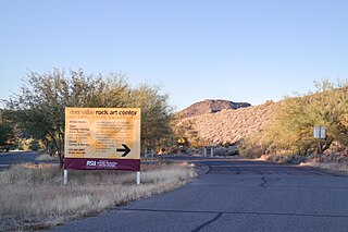
WThe Deer Valley Petroglyph Preserve, formerly known as the Deer Valley Rock Art Center, is a 47-acre nature preserve featuring over 1500 Hohokam, Patayan, and Archaic petroglyphs visible on 500 basalt boulders in the Deer Valley area of Phoenix, Arizona. In 1980, the US Army Corps of Engineers contracted Simon J. Bruder to conduct an archaeological investigation prior to the construction of the Adobe Dam at the Hedgpeth Hills. The petroglyphs are between 500 and 5,000 years old. The site was listed on the National Register of Historic Places in 1984, and it was also listed with the Phoenix Points of Pride. The preserve and museum are operated by the Arizona State University's School of Human Evolution and Social Change.
 W
WThe Esperanza Stone was a large inscribed stone found in the valley of the Yaqui, Mexico. It was discovered and excavated in 1909 by Major F. R. Burnham and Charles Frederick Holder.
 W
WGreat Mural Rock Art consists of prehistoric paintings of humans and other animals, often larger than life-size, on the walls and ceilings of natural rock shelters in the mountains of northern Baja California Sur and southern Baja California, Mexico. This group of monuments comprises the site Rock Paintings of Sierra de San Francisco, which is included on the UNESCO World Heritage List.
 W
WThe Hegman Lake Pictographs are a well-preserved example of a Native American pictograph, located on North Hegman Lake in the Boundary Waters Canoe Area Wilderness in Minnesota, USA. The rock art is considered "Perhaps the most visited and photogenic pictograph within the State of Minnesota." The rock wall overlooking the lake has a panel of images as described below.
 W
WHueco Tanks is an area of low mountains and historic site in El Paso County, Texas, in the United States. It is located in a high-altitude desert basin between the Franklin Mountains to the west and the Hueco Mountains to the east. Hueco is a Spanish word meaning hollows and refers to the many water-holding depressions in the boulders and rock faces throughout the region. Due to the unique concentration of historic artifacts, plants and wildlife, the site is under protection of Texas law; it is a crime to remove, alter, or destroy them.
 W
WIndian Cave State Park is a public recreation and historic preservation area covering nearly 3,400 acres (1,400 ha) along the Missouri River in southeast Nebraska. The state park preserves a cave with prehistoric petroglyphs as well as the partially reconstructed village of St. Deroin established in 1853 as part of the former Nemaha Half-Breed Reservation. The state park lies ten miles (16 km) south of Brownville and eight miles (13 km) east of Shubert, straddling the county line between Nemaha and Richardson counties.
 W
WThe use of jade in Mesoamerica for symbolic and ideological ritual was highly influenced by its rarity and value among pre-Columbian Mesoamerican cultures, such as the Olmec, the Maya, and the various groups in the Valley of Mexico. Although jade artifacts have been created and prized by many Mesoamerican peoples, the Motagua River valley in Guatemala was previously thought to be the sole source of jadeite in the region.
 W
WKaminaljuyu is a Pre-Columbian site of the Maya civilization that was primarily occupied from 1500 BC to AD 1200. Kaminaljuyu has been described as one of the greatest of all archaeological sites in the New World by Michael Coe, although its remains today – a few mounds only – are far less impressive than other Maya sites more frequented by tourists. When first mapped scientifically, it comprised some 200 platforms and pyramidal mounds, at least half of which were created before the end of the Preclassic period. Debate continues about the size, scale, and degree by which, as an economic and political entity, it integrated both the immediate Valley of Guatemala and the Southern Maya area.
 W
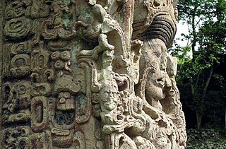
WMaya stelae are monuments that were fashioned by the Maya civilization of ancient Mesoamerica. They consist of tall, sculpted stone shafts and are often associated with low circular stones referred to as altars, although their actual function is uncertain. Many stelae were sculpted in low relief, although plain monuments are found throughout the Maya region. The sculpting of these monuments spread throughout the Maya area during the Classic Period, and these pairings of sculpted stelae and circular altars are considered a hallmark of Classic Maya civilization. The earliest dated stela to have been found in situ in the Maya lowlands was recovered from the great city of Tikal in Guatemala. During the Classic Period almost every Maya kingdom in the southern lowlands raised stelae in its ceremonial centre.
 W
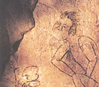
WNaj Tunich is a series of pre-Columbian era natural caves outside the village of La Compuerta, roughly 35 km east of Poptún in Guatemala. The site was used by the Maya as a ritual pilgrimage site during the Classic period. Artifacts show that the cave was accessed primarily during the Early Classic period with deposits becoming rarer during the Late Classic period. The fame of the cave, however, rests on its long Late Classic hieroglyphic texts as well as on a considerable number painted scenes and figures.
 W
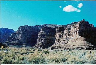
WNinemile Canyon is a canyon, approximately 40 miles (64 km) long, located in Carbon and Duchesne counties in eastern Utah, United States. Promoted as "the world’s longest art gallery", the canyon is known for its extensive rock art, most of it created by the Fremont culture and the Ute people. The rock art, shelters, and granaries left behind by the Fremont make Ninemile Canyon a destination for archaeologists and tourists alike.
 W
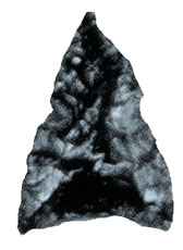
WObsidian is a naturally formed volcanic glass that was an important part of the material culture of Pre-Columbian Mesoamerica. Obsidian was a highly integrated part of daily and ritual life, and its widespread and varied use may be a significant contributor to Mesoamerica's lack of metallurgy. Lithic and contextual analysis of obsidian, including source studies, are important components of archaeological studies of past Mesoamerican cultures and inform scholars on economy, technological organization, long-distance trade, ritual organization, and socio-cultural structure.
 W
WPetroglyph Provincial Park is a provincial park located at the south end of the city of Nanaimo in British Columbia, Canada. The park was established on August 24, 1948 to protect a collection of petroglyphs found near the estuary of the Nanaimo River.
 W
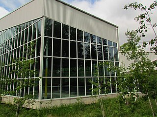
WPetroglyphs Provincial Park is a historical-class provincial park situated in Woodview, Ontario, Canada, northeast of Peterborough. It has the largest collection of ancient First Nations petroglyphs in Ontario. The carvings were created in the pre-Columbian era and represents aspects of First Nations spirituality, including images of shamans, animals, reptiles, and, possibly, the Great Spirit itself.
 W
WThe Piasa or Piasa Bird is a Native American dragon depicted in one of two murals painted by Native Americans on bluffs (cliffsides) above the Mississippi River. Its original location was at the end of a chain of limestone bluffs in Madison County, Illinois at present-day Alton, Illinois. The original Piasa illustration no longer exists; a newer 20th-century version, based partly on 19th-century sketches and lithographs, has been placed on a bluff in Alton, Illinois, several hundred yards upstream from its origin. The location of the present-day mural is at 38.898055, -90.19915. The limestone rock quality on the new site is unsuited for holding an image, and the painting must be regularly restored. The original site of the painting was a high-quality layer of lithographic limestone, which was predominantly quarried away in the late 1870s by the Mississippi Lime Company.
 W
WPictograph Cave is an area of three caves located 5 miles (8.0 km) south of Billings, Montana, United States, preserved and protected in the 23-acre (9.3 ha) Pictograph Cave State Park.
 W
WThe Pomier Caves are a series of 55 caves located north of San Cristobal in the south of the Dominican Republic. They contain the largest collection of rock art in the Caribbean created since 2,000 years ago primarily by the Taíno people but also the Carib people and the Igneri, the pre-Columbian indigenous inhabitants of the Bahamas, Greater Antilles, and some of the Lesser Antilles. These caves have been damaged by the uncontrolled mining of limestone nearby.
 W
WThe Quail rock art panel is a panel of Native American rock art located at the intersect of Grand Gulch and Step Canyon in Cedar Mesa, San Juan County, Utah. Grand Gulch contains a large number of relatively well-preserved rock art and ledge dwellings. The Quail Panel is a grouping of pictographs that were probably created by people of the Basketmaker II or Fremont culture. Cedar Mesa is located at a point where the two cultures overlapped.
 W
WQuiriguá is an ancient Maya archaeological site in the department of Izabal in south-eastern Guatemala. It is a medium-sized site covering approximately 3 square kilometres (1.2 sq mi) along the lower Motagua River, with the ceremonial center about 1 km (0.6 mi) from the north bank. During the Maya Classic Period (AD 200–900), Quiriguá was situated at the juncture of several important trade routes. The site was occupied by 200, construction on the acropolis had begun by about 550, and an explosion of grander construction started in the 8th century. All construction had halted by about 850, except for a brief period of reoccupation in the Early Postclassic. Quiriguá shares its architectural and sculptural styles with the nearby Classic Period city of Copán, with whose history it is closely entwined.
 W
WThe Rio Grande Gorge is a geological feature in northern New Mexico where the watercourse of the Rio Grande follows a tectonic chasm. Beginning near the Colorado border, the approximately 50-mile (80 km) gorge runs from northwest to southeast of Taos, New Mexico, through the basalt flows of the Taos Plateau volcanic field. The gorge depth is 800 feet (240 m) just south of the Rio Grande Gorge Bridge, which spans the gorge 10 miles (16 km) northwest of Taos.
 W
WRoche-a-Cri State Park is a state park north of Adams and Friendship in central Wisconsin. The park, 605 acres (245 ha) in area, was established in 1948.
 W
WThe Rock Paintings of Sierra de San Francisco are prehistoric rock art pictographs found in the Sierra de San Francisco mountain range in Mulegé Municipality of the northern region of Baja California Sur state, in Mexico.
 W
WThe Sierra de Guadalupe cave paintings are a series of prehistoric rock art pictographs near Rancho La Trinidad, Mulegé in Baja California Sur, Mexico. The Sierra de Guadalupe, mountains west of Mulegé, contains the largest number of known prehistoric rock art sites in Baja California.
 W
WThe Sierra de San Borja, also known as Sierra La Libertad is a mountain range on the Baja California Peninsula of Mexico. It is one of the Peninsular Ranges which form the backbone of Baja California. The Sierra de San Borja is located between 28° North latitude and 29° North latitude. The highest point of the Sierra is Cerro La Sandia, 1,775 metres (5,823 ft) in elevation located at 28°24′25″N 113°26′18″W.
 W
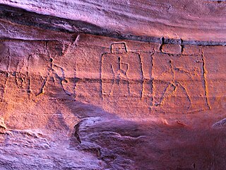
WThe South Carolina Petroglyph Site is a county-owned museum at Hagood Mill Historic Site in Pickens County, South Carolina, managed by the non-profit Hagood Mill Foundation. The museum exhibits and protects in situ at least 32 rock art carvings, most believed to be prehistoric.
 W
WThe stone spheres of Costa Rica are an assortment of over 300 petrospheres in Costa Rica, on the Diquís Delta and on Isla del Caño. Locally, they are also known as bolas de piedra. The spheres are commonly attributed to the extinct Diquís culture, and they are sometimes referred to as the Diquís Spheres. They are the best-known stone sculptures of the Isthmo-Colombian area.
 W
WWhite Canyon is a canyon in San Juan County, Utah, United States.
 W
WWoodland Caribou Provincial Park is a provincial park in Northwestern Ontario, Canada, west of the municipality of Red Lake. It borders Atikaki Provincial Park and Nopiming Provincial Park in eastern Manitoba, and is made up of Canadian Shield and boreal forest. Woodland Caribou Provincial Park is a wilderness park of 450,000 hectares, and it became part of the Pimachiowin Aki UNESCO World Heritage site in 2018.
 W
WWriting-on-Stone Provincial Park is located about 100 kilometres (60 mi) southeast of Lethbridge, Alberta, Canada, or 44 kilometres (30 mi) east of the community of Milk River, and straddles the Milk River itself. It is one of the largest areas of protected prairie in the Alberta park system, and serves as both a nature preserve and protection for many First Nations (indigenous) rock carvings and paintings. The park is sacred to the Blackfoot and many other aboriginal tribes.
 W
WIndian Painted Rocks is a tiny state park right outside Yakima, Washington at the intersection of Powerhouse and Ackely Roads. The Indian rock paintings, also known as pictographs are on a cliff of basaltic rocks parallel to the current Powerhouse road which was once an Indian trail and later a main pioneer road that connected the Ahtanum valley to the Wenas mountains.