 W
WAchala Fort / अचला किल्ला is a westernmost fort in the Satmala hill range. It is located 55km from Nashik, in Nashik district, of Maharashtra. This fort is adjoining the Ahivant Fort. The three forts Achala, Ahivant, and Mohandar are very close by. The Achala and Mohandar forts were constructed to guard the Ahivant fort. Captain Briggs has described it as a large hill, whose ascent is very easy till it reaches the top where it is very steep.
 W
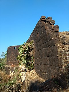
WAhivant Fort / अहिवंत किल्ला is a fort located 55km from Nashik, in Nashik district, of Maharashtra. This fort is an important fort in Nashik district. The three forts Achala, Ahivant, and Mohandar are very close by. The other two forts were constructed to guard the Ahivant fort. Captain Briggs has described it as a large and shapeless hill, remarkably bleak and unhealthy
 W
WGopalgad Fort / Anjanvel Fort is a fort located 51 km (32 mi) from Chiplun, in Ratnagiri district, of Maharashtra. This fort is an important fort in Ratnagiri district. The Fort is located on a prominent and commanding point for guarding the trade route along the Vashishti River, which runs till Gavilgad near Chiplun and the Dabhol port which was a busy route in medieval times. It is a fort located on a hill near the sea.
 W
WAnkai Fort ( Marathi: अंकाई / अणकाई किल्ला ) is a historic site found in the Satmala Range hills in western India. It is located in Yeola Taluka of Nashik district in the state of Maharashtra. Geographically, it is near Manmad. The Ankai fort and Tankai fort are two different forts on adjacent hills. A common fortification is constructed to secure both. The Ankai fort is located on a hill with perpendicular scarps on all the sides, except for a narrow nose on the eastern side.
 W
WAsheri Fort / Asheri is a fort located 102 km from Mumbai and 88 km from Thane. It is in Palghar district, of Maharashtra. This fort is an important fort in Palghar district. The fort is located on the hills near Mendhavan Khind on Mumbai-Ahmedabad highway. The base village Khodkona is a very small tribal village. The Fort restoration is done by the local villagers.
 W
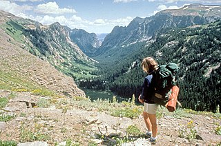
WBackpacking is the outdoor recreation of carrying gear on one's back, while hiking for more than a day. It is often but not always an extended journey, and may or may not involve camping outdoors. In North America tenting is common, where simple shelters and mountain huts, widely found in Europe, are rare. In New Zealand, tramping is the term applied though overnight huts are frequently used. Hill walking is an equivalent in Britain, though backpackers make use of a variety of accommodation, in addition to camping. Backpackers use simple huts in South Africa. Trekking and bushwalking are other word used to describe such multi-day trips.
 W
WBackpacking is a form of low-cost, independent travel, which often includes staying in inexpensive lodgings and carrying all necessary possessions in a backpack. Once seen as a marginal form of travel undertaken only through necessity, it has since become a mainstream form of tourism.
 W
WBackpacking with animals is the use of pack animals, such as a horse, llama, goat, dog, or donkey to help carry the weight of a backpackers gear during an excursion. These animals need special considerations when accompanying backpackers on a trip. Some areas restrict the use of horses and other pack animals. For example, Great Basin National Park does not allow domestic animals at all in backcountry areas.
 W
WBankot Fort / Himmatgad Fort/ Fort Victoria बाणकोट चा किल्ला / हिम्मतगड is a fort located 47 km from Dapoli, in Ratnagiri district, of Maharashtra. This fort is an important fort in Ratnagiri district. The Fort is located on a prominent and commanding point for guarding the trade route along the Savitri River, which runs till, Mahad which was a busy route in medieval times. It is a fort located on a hill near the sea.
 W
WBhavangad Fort is a fort located 3 km from village Kelve, in Palghar district, of Maharashtra. This fort is in very dilapidated condition. The outer walls, steps, parapets, bastions etc. were built without using limestone at many places. This fort was built to capture the Fort Bassein by Maratha Army.
 W
WBirwadi fort is hill fortress located in the village of Birwadi in Roha taluka, Raigad district, Maharashtra, India. Birwadi village is about 3 km away from Chanera village, which is on the Roha–Salav road. The fort looks like a small hillock from a distance.
 W
WChandragad Fort / Dhavalgad Fort is a fort located 89km from Mumbai, in Raigad district, of Maharashtra. This fort was an important fort in Kolhapur district as a watch over for the Varandha Ghattrade routes from Bhor to coastal ports. The fort is surrounded by forest and hill slopes.
 W
WDativare Fort / Hira Dongar/ दातिवरे चा किल्ला / हिरा डोंगर is a fort located 72 km from Vasai, in Palghar district, of Maharashtra. The Fort is located on a small hillock and at commanding point for guarding the trade route along the Vaitarna River, which runs till, Arnala Fort.This was a busy route in medieval times.
 W
WGhargad Fort / Gadgada Fort is a fort located 145 km from Mumbai, in Nashik district, of Maharashtra. This fort is less visited fort in Nashik district. This fort is quiet difficult to climb.
 W
WHanumantgad is a fort located 24 km from Sawantwadi, Sindhudurg district, of Maharashtra. The fort is situated on plateau at the top of the hill.
 W
WHargad fort is located in the Baglan area of Nashik district. There are two main hill ranges in Baglan area, the Selbari range is south of the Dolbari hill range. These two ranges run parallel to each other in east-west direction. Hargad is located on Selbari hill range. All these forts were maintained to keep watch on the Burhanpur-Surat ancient commercial road. The road passes between the two hill ranges. Hargad fort is a small fort, close to Mulher fort. These are key forts situated between fertile lands of Khandesh and port city of Surat.
 W
WHatgad Fort is a fort located 71 km (44 mi)from Nashik, Nashik district, of Maharashtra. The base village is Hatgad on the Nashik-Saputara Road. The nearest town is Saputara, which is 6 km from Hatgad village. It is a historic monument located in Maharashtra, India, south of the hill station of Saputara and near the border with Gujarat. It was built by the Maratha king Shivaji and is located at an elevation of about 3,600 feet. The only way to reach the fort is through a trekking route via a narrow rocky path. A statue of Lord Ganesha is placed on the top of the fort.
 W
WKoldher Fort (Marathi: कोळधेर किल्ला) is a fort located 11.26 km (7.00 mi) from chandwad, Nashik district, of Maharashtra. This fort is close to the Rajdher fort and lies westwards. It requires about 1-2 hours to reach the fort from Rajdher.
 W
WKonkandiva Fort (Marathi: कोंकणदिवा किल्ला, Hindi: कोंकणदिवा क़िला, is a fort located 70 km from Pune in Maharashtra. This fort is on the boundary of Raigad and Pune district. The fort was important as a surveillance fort to keep watch on the possible attack on the Raigad fort through Ghol Village side along the Mutha river.
 W
WKothaligad (Marathi: कोथळीगड/पेठ चा किल्ला) is a small fort (3100 ft) situated to the east of Karjat near Karjat-Murbad Road in the Indian state of Maharashtra. It is a famous trek in the Karjat area, because of its small height and easy climbing. It is also known as the Fort of Peth because of its vicinity to Peth village at its base.
 W
WKurdugad Fort is a fort located 143 km (89 mi) from Mumbai and 113km from Pune in Raigad district, of Maharashtra. This fort was an important fort in Raigad district as a watch over for the trade route from Pune to coastal ports. The fort is surrounded by thick forest and hill slopes.
 W
WMahipalgad Fort is a fort located 20 km (12 mi)from Belgaum. It is in the Chandgad taluka of Kolhapur district, of Maharashtra. This fort is an important fort in Kolhapur district. The fort is situated on the mountain ridge close to the line dividing Maharashtra and Karnataka state. The fort is admist of dense evergreen forest area.
 W
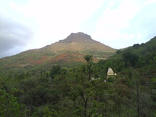
WMakrandgad Fort / Madhumakrandgad मकरंदगड is a fort near Pratapgad Fort. It is located 156km from Pune, in Satara district, of Maharashtra. The fort is located in the midst of the famous Javli forest. The trek to this fort is an easy one day trek for visitors at Mahabaleshwar. The fort consists of two flattened humps with a ridge between them.
 W
WMangalgad, also known as Kangori, is a fort in Maharashtra near the village of Dudhanewadi. Kangori, or Mangalgad Fort, is in the Mahad sub-division about eleven miles (18 km) east by south from Mahad town.
 W
WManohargad-Mansantoshgad Fort are two adjacent forts located on the same hill but separated by a saddle. This fort is situated at Shivapur, Tal - Kudal. The forts are 33 km from Sawantwadi and the same distance from Kudal Sindhudurg district of Maharashtra. The forts are situated on the hill north of the base village Shivapur.The fort is located in the proximity of the Amboli hill station.
 W
WMarkandya Fort/Markinda Fort/ Markanda fort is a fort located 52 km (32 mi)from Nashik, Nashik district, of Maharashtra. The base village is Mulane on the Wani-Kalwan Link Road. The nearest town is Wani, which is 5.5 km from Mulane village. This fort is opposite the holy Saptashringi hill..
 W
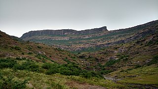
WMohandar Fort / Shidaka fort / मोहनदर /शिडका किल्ला ा is a fort located 55 km from Nashik, in Nashik district, of Maharashtra, India. This fort is an important fort in Nashik district. The three forts Achala, Ahivant, and Mohandar are very close by. This fort was constructed to guard the Ahivant fort. This fort can be seen from a long distance due to the presence of needle hole in the cliff below this fort.
 W
WRajdeher Fort (Marathi: राजधेर किल्ला) is a fort located 10 km (6.2 mi) from chandwad, Nashik district, of Maharashtra. This fort is an important fort in Nashik district.
 W
WRamsej or Ramshej Fort (Marathi: रामशेज किल्ला) is a small fort located 10 kilometres (6.2 mi) north-west of Nashik, in the Indian state of Maharashtra.There is a story that Lord Rama stayed for a while on this fort while going to Sri Lanka. This fort can be visited in a day from Nashik. This fort is located on the busy Nashik-Vapi Route.
 W
W W
WSankshi Fort सांक्शी किल्ला This fort is located in Pen Taluka of Raigad district of Maharashtra. It is 9 kilometres (5.6 mi) from Pen.
 W
WShivgad Fort is a fort located 89km from Kolhapur, in Kolhapur district, of Maharashtra. This fort was an important fort in Kolhapur district as a watch over for the Phonda ghat trade route from Kolhapur to coastal ports. The fort is surrounded by thick forest and hill slopes.
 W
WShrivardhan Fort is one of the two hill forts that constitute the Rajmachi fortification, the other being Manaranjan Fort. It is located in Rajmachi village which 8.5 km from Lonavala in the Sahyadris mountain range. At 900 m(3000 feet) above sea level it was the taller of the two peaks and was named after Shrivardhan Ganpatrao Patwardhan. Other than a rampart there is no visible construction. It was probably used at a watchtower for the Sahyadri region. There are two water tanks at the top of the hill but one of them has an iron pillar in it.
 W
WTandulwadi Fort तांदुळवाडी किल्ला is located near Saphale, 104 km north of Mumbai. Tandulwadi is not a fully built up fort, but a series of structures spread over the top of the mountain. The fort dates back 800 years and was primarily used as a watch tower over the surrounding plains. At a height of 1524 feet, it has views of the surrounding towns of Saphale, the Zanzorli lake, and the confluence of the Surya and Vaitarna rivers. There's a best place on highway to stay with family and friends Hotel Parivar just 500 mtr from Varaifata
 W
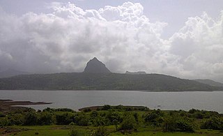
WTikona also known as Vitandgad) is the dominant hill fort in Maval in western India. It is located near Kamshet around 60 km from Pune. The village nearest to the fort is called Tikona-Peth. The 3500 ft high hill is pyramidal in shape and the name Tikona means "triangular".
 W
WTung Fort (or Kathingad; difficult fort in Marathi) is a hill fort in Pune District, India.
 W
WPeb Fort / Vikatgad Fort(Marathi: पेब किल्ला / विकटगड) is a fort located 19km from Karjat, in Raigad district, of Maharashtra. This fort is in continuation with the Malang gad, Tauli Hill and Chanderi fort of the Matheran Hill Range. Vikatgad is a favourite destination for one-day trekkers. The trek path to Vikatgad is along deep ravines and cliffs. Its closeness to Matheran and Neral attracts many trekkers on weekends. The forest department and local villagers are doing plantation and some restoration works on the fort.
 W
WPhilmont Scout Ranch camps are a group of backpacking camps located in Philmont Scout Ranch, a large property in Colfax County near Cimarron, New Mexico, owned by the Boy Scouts of America and used as a backpacking reservation. Philmont operates from one large Base Camp which includes camping headquarters, the Philmont Training Center and Villa Philmonte, the Seton Museum, fire response facilities, cattle headquarters, and an administration area. As of 2014, there were 76 trail camps and 36 staffed camps. Philmont's camps are generally set no more than a couple of miles apart. Old camps are closed or relocated and new camps are opened every few years. Some camp sites are closed due to changing safety protocols. For example, camps were once located on top of Urraca Mesa and in the Baldy Saddle but these are unlikely to reopen because the locations are at risk for lightning strikes.
 W
W"Banana Pancake Trail" or "Banana Pancake Circuit" is the name given to growing routes around Southeast Asia, and to some extent South Asia, travelled by backpackers and other tourists. The Trail has no clear geographical definition, but is used as a metaphor for places that are popular among Western tourists.
 W
WBothies are remote, rural cottages that have outlived their original purposes but now are kept unlocked for people to take shelter or stay overnight without charge. They are located mostly in Scotland, with a small number in England and Wales, and have extremely basic facilities - with no electricity, gas, or piped water. The Mountain Bothies Association, established in 1965, is a charity that maintains bothies.
 W
WA bunkhouse is a barracks-like building that historically was used to house working cowboys on ranches, or loggers in a logging camp in North America. As most cowboys were young single men, the standard bunkhouse was a large open room with narrow beds or cots for each individual and little privacy. The bunkhouse of the late 19th century was usually heated by a wood stove and personal needs were attended to in a cookhouse and an outhouse.
 W
WA campsite or camping pitch is a place used for overnight stay in an outdoor area. In UK English, a campsite is an area, usually divided into a number of pitches, where people can camp overnight using tents, camper vans or caravans; this UK English use of the word is synonymous with the US English expression campground. In American English, the term campsite generally means an area where an individual, family, group, or military unit can pitch a tent or park a camper; a campground may contain many campsites.
 W
WThe Complete Walker is an in-depth guide to backpacking, written by Colin Fletcher with illustrations by political aide/women's rights advocate Nick Bauer. It was very influential and "could be credited with starting the backpacking industry." Since its first publishing in 1968, there have been three revised editions. The most recent edition, The Complete Walker IV, was co-authored by Chip Rawlins, with illustrations by Vanna Prince and Hannah Hinchman.
 W
WFastpacking is a marriage of trail running and ultralight backpacking: "hiking the ups, jogging the flats, and running the downs," depending on the gradient, because of the weight carried. Participants carry a light pack with essential supplies, including a sleeping bag and tent, or similar form of shelter, if mountain huts or other accommodation is not available. The weight carried will vary but fastpackers aim at no more than 15 pounds (6.8 kg) and some achieve less than 10 pounds (4.5 kg). This activity may be undertaken either unsupported, self-supported, or supported. "Unsupported fastpackers make no use of outside assistance along the route", while self-supported fastpackers will leave caches of supplies along the intended route.
 W
WEmma Rowena Gatewood, known as Grandma Gatewood,, was a U.S. based extreme hiker and ultra-light hiking pioneer who was the first woman to hike the 2,168-mile (3,489 km) Appalachian Trail solo and in one season, in 1955. After this feat, she continued to forge new fronts in the hiking world and became the first person to hike the Appalachian National Trail three times, with her last venture completed in 1963 at age 75.
 W
WThe German Youth Hostel Association or DJH is a not-for-profit, registered association. It was founded in 1919 to create an organized network of affordable and safe accommodation away from home for travelling school and youth groups and individuals all over the country. Today, the 442 youth hostels in the association still cater to school and youth groups but are also open to anyone else looking for an alternative to hotels - families, backpackers, business travellers, etc. Through the state (Bundesland) associations it is the representative of the 442 youth hostels in Germany and thus the largest member of the international youth association, Hostelling International (HI). The headquarters has its seat in Detmold and is divided into 14 state associations and 178 local and county volunteer associations. It has more than 2,46 million members.
 W
WHomestay is a popular form of hospitality and lodging whereby visitors share a residence with a local of the city to which they are traveling. The length of stay can vary from one night to over a year and can be provided gratis, in exchange for monetary compensation, in exchange for a stay at the guest's property either simultaneously or at another time, or in exchange for housekeeping or work on the host's property. Homestays are examples of collaborative consumption and the sharing economy.
 W
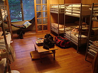
WA hostel is a form of low-cost, short-term shared sociable lodging where guests can rent a bed, usually a bunk bed in a dormitory, with shared use of a lounge and sometimes a kitchen. Rooms can be mixed or single-sex and have private or shared bathrooms. Private rooms may also be available, but the property must offer dormitories to be considered a hostel. Hostels are popular forms of lodging for backpackers, cycle tourists, and gap year travelers. They are part of the sharing economy. Benefits of hostels include lower costs and opportunities to meet people from all over the world, find travel partners, and share travel ideas. such as Zostel in India or Hostelling International, caters to a niche market of travelers. For example, one hostel might feature in-house social gatherings such as movie nights or communal dinners, another might feature local tours, one might be known for its parties, and another might have a quieter place to relax in serenity, or be located on the beach. Newer hostels focus on a more trendy design interior, some of which are on par with boutique hotels. Some may cater to older digital nomads, global nomads, and perpetual travelers that prefer slightly more upmarket private rooms or a quieter atmosphere.
 W
WHostelling International (HI), formerly known as International Youth Hostel Federation (IYHF), is a federation of more than 70 National Youth Hostel Associations in more than 80 countries. HI has over 4,000 affiliated hostels around the world. Hostelling International is a non-governmental, not-for-profit organisation working with United Nations Educational, Scientific and Cultural Organisation UNESCO and the World Tourism Organisation UNWTO.
 W
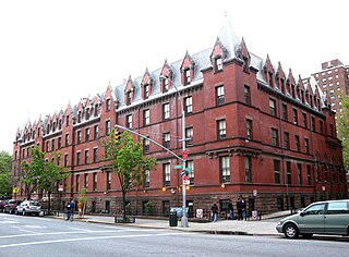
WHostelling International USA, also known as American Youth Hostels, Inc. (AYH), is a nonprofit organization that operates youth hostels and runs programs around those hostels. It is the official United States affiliate of Hostelling International (HI), also known as the International Youth Hostel Federation. It is incorporated as a not-for-profit organization, with its headquarters in Silver Spring, Maryland.
 W
WThe Ice Age Trail is a National Scenic Trail stretching 1,200 miles (1,900 km) in the state of Wisconsin in the United States. The trail is administered by the National Park Service, and is constructed and maintained by private and public agencies including the Ice Age Trail Alliance, a non-profit and member-volunteer based organization with local chapters.
 W
WOrienteering is a group of sports that require navigational skills using a map and compass to navigate from point to point in diverse and usually unfamiliar terrain whilst moving at speed. Participants are given a topographical map, usually a specially prepared orienteering map, which they use to find control points. Originally a training exercise in land navigation for military officers, orienteering has developed many variations. Among these, the oldest and the most popular is foot orienteering. For the purposes of this article, foot orienteering serves as a point of departure for discussion of all other variations, but almost any sport that involves racing against a clock and requires navigation with a map is a type of orienteering.
 W
WPhilmont Scout Ranch camps are a group of backpacking camps located in Philmont Scout Ranch, a large property in Colfax County near Cimarron, New Mexico, owned by the Boy Scouts of America and used as a backpacking reservation. Philmont operates from one large Base Camp which includes camping headquarters, the Philmont Training Center and Villa Philmonte, the Seton Museum, fire response facilities, cattle headquarters, and an administration area. As of 2014, there were 76 trail camps and 36 staffed camps. Philmont's camps are generally set no more than a couple of miles apart. Old camps are closed or relocated and new camps are opened every few years. Some camp sites are closed due to changing safety protocols. For example, camps were once located on top of Urraca Mesa and in the Baldy Saddle but these are unlikely to reopen because the locations are at risk for lightning strikes.
 W
WA Turbaza is a holiday accommodation, a type of tourist camp or tourist base that arose in the Soviet era and is still common in the post-Soviet countries. Turbazas are commonly leased-out to groups or firms renting the entire facility to provide holiday accommodation for their members or employees. They are generally rustic, located in rural areas that offer outdoor recreation. Dining, and often sleeping, is accommodated in a large, open, common area.
 W
WUltralight backpacking is a style of backpacking that emphasizes carrying the lightest and simplest gear safely possible for a given trip. Base weight is reduced as much as safely possible, though reduction of the weight of consumables is also applied.
 W
WUrban exploration is the exploration of manmade structures, usually abandoned ruins or hidden components of the manmade environment. Photography and historical interest/documentation are heavily featured in the hobby and it sometimes involves trespassing onto private property. Urban exploration is also called draining, urban spelunking, urban rock climbing, urban caving, building hacking, or mousing.
 W
WA wilderness hut, bothy, backcountry hut, or backcountry shelter is a free, primitive mountain hut for temporary accommodation, usually located in wilderness areas, national parks and along backpacking and hiking routes. They are found in many parts of the world, such as Finland, Sweden, Norway, northern Russia, the Alps, the Pyrenees, Scotland, Australia, New Zealand, Canada, and the United States. Huts are basic and unmanned, without running water.
 W
WYamnuska Mountain Adventures is a mountaineering school and mountain adventure company located in Canmore, Alberta, Canada. The company was founded in 1975.