 W
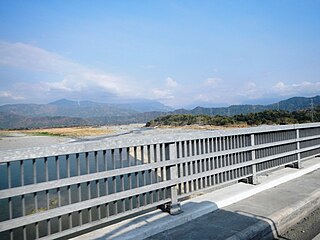
WAgno River or Pangasinan River is a river on the island of Luzon in the Philippines. Traversing the provinces of Benguet and Pangasinan, it is one of the largest river systems in the country with a drainage area of 5,952 square kilometres (2,298 sq mi).
 W
WAmburayan River is a river in the northeastern portion of island of Luzon in the Philippines. It originates from the Cordillera mountains and traverses the provinces of Benguet, La Union, and Ilocos Sur. With a total length of 96 km (60 mi) where it empties into the South China Sea.
 W
WBalili River also called Naguilian River is a river in the province of Benguet in the island of Luzon Philippines. With a total length of 62.7 km (39.0 mi) it traverses the city of Baguio, and the municipalities of La Trinidad and Sablan before entering the province of La Union, where it is named the Naguilian River.
 W
WBued River is a river in the island of Luzon in the Philippines with a total length of 77.3 km (48.0 mi). It covers primarily the provinces of Benguet and Pangasinan, and a few parts of La Union. The river originates from the city of Baguio and joins with the Angalacan River in the municipality of Mangaldan, Pangasinan to form the Cayanga River.
 W
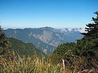
WThe Cordillera Central or Cordillera Range is a massive 320 km long north-south, 118 km width east-west. Cordillera mountain range situated in the northern central part of the island of Luzon, in the Philippines. The mountain range encompasses all provinces of the Cordillera Administrative Region, as well as portions of eastern Ilocos Norte, eastern Ilocos Sur, eastern La Union, northeastern Pangasinan, western Nueva Vizcaya, and western Cagayan.
 W
WMount Cabuyao is a mountain in the Philippines located in the municipality of Tuba in the province of Benguet. Its summit, rising to more than 2,000 metres (6,600 ft) above sea level, overlooks the city of Baguio. It is commonly mistaken as Mount Santo Tomas, a taller mountain just beside it.
 W
WMount Data is a mountain located in the Cordillera Central mountain range rising to a height of 2,310 metres (7,580 ft) in the north of Luzon Island, Philippines. It is about 100 kilometres (62 mi) north of Baguio on the borders of the provinces of Benguet and Mountain Province along the Halsema Highway. The mountain and surrounding area has been declared a National Park since 1936. In 1940 the park was expanded to 5,513 hectares. The slopes of the mountain are covered with pine forests and mossy oak forests.
WMount Mirador is a mountain situated in the city of Baguio in the Cordillera Central mountain range, Luzon Island in the Philippines.
 W
WMount Pulag is Luzon’s highest peak at 2,928 metres (9,606 ft) above sea level. It is also a dormant volcano. The borders between the provinces of Benguet, Ifugao, and Nueva Vizcaya meet at the mountain's peak.
 W
WMount Santo Tomas is a potentially active stratovolcano in the Philippines located in the municipality of Tuba in the province of Benguet.