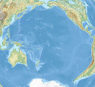
 W
WThe Benham Rise, also known as the Philippine Rise, is an extinct volcanic ridge located in the Philippine Sea approximately 250 km (160 mi) east of the northern coastline of Dinapigue, Isabela. The Rise has been known to the people of Catanduanes as Kalipung-awan since pre-colonial times, which literally means 'loneliness from an isolated place'.
 W
WThe Campbell Plateau is a large oceanic plateau south of New Zealand and the Chatham Rise. It originated in the Gondwanan breakup and is part of Zealandia, a largely submerged continent. The above sea level parts of the plateau — the Bounty Islands, Antipodes Islands, Auckland Islands and Campbell Island — form part of the New Zealand Subantarctic Islands which were declared a World Heritage Site in 1998. Large parts of the Campbell Plateau lie less than 1000 m below sea level. It rises to 500 m at the Pukaki Rise and emerges above sea level at the Auckland and Campbell Islands.
 W
WThe Challenger Plateau is a large submarine plateau west of New Zealand and south of the Lord Howe Rise. It has an approximate diameter of 500 km (310 mi) and an area of about 280,000 km2 (110,000 sq mi). The water depth over the plateau varies between 500 m (1,600 ft) to 1,500 m (4,900 ft) and is covered by up to 3,500 m (11,500 ft) of sedimentary rocks of Upper Cretaceous to recent in age. The plateau originated in the Gondwanan breakup and is one of the five major submerged parts of Zealandia, a largely submerged continent.
 W
WThe Hikurangi Plateau is an oceanic plateau in the South Pacific Ocean east of the North Island of New Zealand. It is part of a large igneous province (LIP) together with Manihiki and Ontong Java, now located 3,000 km (1,900 mi) and 3,500 km (2,200 mi) north of Hikurangi respectively. Mount Hikurangi, in Māori mythology the first part of the North Island to emerge from the ocean, gave its name to the plateau.
 W
WMount Malaueg was known to be the most historic mountain of Malaueg. The mountain was also known the Gigantic Plateau of Malaueg since its only location was a plateau and the place was said to be the treasure keeping of the Spaniards dating four centuries ago. The name of the mountain was derived from their dialect which means "Bad Brook" and the peak of the mountain was said to be the bridge between Poblacion and Capacuan, Rizal, Cagayan.
 W
WThe Manihiki Plateau is an oceanic plateau in the south-west Pacific Ocean. The Manihiki Plateau was formed by volcanic activity 125 to 120 million years ago during the mid-Cretaceous period at a triple junction plate boundary called the Tongareva triple junction. 125 million years ago the Manihiki Plateau formed part of the giant Ontong Java-Manihiki-Hikurangi plateau.
 W
WThe Mid-Pacific Mountains (MPM) is a large oceanic plateau located in the central North Pacific Ocean or south of the Hawaiian–Emperor seamount chain. Of volcanic origin and Mesozoic in age, it is located on the oldest part of the Pacific Plate and rises up to 2 km (1.2 mi) above the surrounding ocean floor and is covered with several layers of thick sedimentary sequences that differ from those of other plateaux in the North Pacific. About 50 seamounts are distributed over the MPM. Some of the highest points in the range are above sea level which include Wake Island and Marcus Island.
 W
WThe Ontong Java Plateau (OJP) is a huge oceanic plateau located in the southwestern Pacific Ocean, north of the Solomon Islands. The OJP was emplaced around 120 million years ago (Ma) with a much smaller volcanic event around 90 Ma. Two other southwestern Pacific plateaus, Manihiki and Hikurangi, now separated from the OJP by Cretaceous oceanic basins, are of similar age and composition and probably formed as a single plateau and a contiguous large igneous province together with the OJP. When emplaced this Ontong Java–Manihiki–Hikurangi plateau covered 1% of Earth's surface and represented a volume of 80 million km3 (19 million cu mi) of basaltic magma. This "Ontong Java event", first proposed in 1991, represents the largest volcanic event of the past 200 million years, with a magma emplacement rate estimated at up to 22 km3 (5.3 cu mi) per year over 3 million years, several times larger than the Deccan Traps. The smooth surface of the OJP is punctuated by seamounts such as the Ontong Java Atoll, one of the largest atolls in the world.
 W
WThe Shatsky Rise is Earth's third largest oceanic plateau, located in the north-west Pacific Ocean 1,500 km (930 mi) east of Japan. It is one of a series of Pacific Cretaceous large igneous provinces (LIPs) together with Hess Rise, Magellan Rise, and Ontong Java-Manihiki-Hikurangi. It was named for Nikolay Shatsky (1895-1960), a Soviet geologist, expert in tectonics of ancient platforms.
 W
WThe Wrangellia Terrane is a terrane extending from the south-central part of Alaska through southwestern Yukon and along the Coast of British Columbia in Canada. Some geologists contend that Wrangellia extends southward to Oregon, although this is not generally accepted.