 W
WThe Algodones Dunes is a large erg located in the southeastern portion of the U.S. state of California, near the border with Arizona and the Mexican state of Baja California. The field is approximately 45 miles (72 km) long by 6 miles (9.7 km) wide and extends along a northwest-southeast line that correlates to the prevailing northerly and westerly wind directions. The name "Algodones Dunes" refers to the entire geographic feature, while the administrative designation for that portion managed by the Bureau of Land Management is the Imperial Sand Dunes Recreation Area. In 1966, Imperial Sand Hills was designated as a National Natural Landmark by the National Park Service. The Algodones Dunes are split into many different sections. These sections include Glamis, Gordon's Well, Buttercup, Midway, and Patton's Valley. Although the Arabic-derived Spanish word algodones translates to "cotton plants", the origin of the toponym is unknown.
 W
WDeath Valley National Park is an American national park that straddles the California–Nevada border, east of the Sierra Nevada. The park boundaries include Death Valley, the northern section of Panamint Valley, the southern section of Eureka Valley, and most of Saline Valley. The park occupies an interface zone between the arid Great Basin and Mojave deserts, protecting the northwest corner of the Mojave Desert and its diverse environment of salt-flats, sand dunes, badlands, valleys, canyons, and mountains. Death Valley is the largest national park in the contiguous United States, and the hottest, driest and lowest of all the national parks in the United States. The second-lowest point in the Western Hemisphere is in Badwater Basin, which is 282 feet (86 m) below sea level. Approximately 91% of the park is a designated wilderness area. The park is home to many species of plants and animals that have adapted to this harsh desert environment. Some examples include creosote bush, bighorn sheep, coyote, and the Death Valley pupfish, a survivor from much wetter times. UNESCO included Death Valley as the principal feature of its Mojave and Colorado Deserts Biosphere Reserve in 1984.
 W
WGreat Sand Dunes National Park and Preserve is an American national park that conserves an area of large sand dunes up to 750 feet (229 m) tall on the eastern edge of the San Luis Valley, and an adjacent national preserve in the Sangre de Cristo Range, in south-central Colorado, United States. The park was originally designated Great Sand Dunes National Monument on March 17, 1932, by President Herbert Hoover. The original boundaries protected an area of 35,528 acres. A boundary change and redesignation as a national park and preserve was authorized on November 22, 2000, and then established by an act of Congress on September 24, 2004. The park encompasses 107,342 acres while the preserve protects an additional 41,686 acres for a total of 149,028 acres. The recreational visitor total was 527,546 in 2019.
 W
WLittle Sahara is a dune system in the Australian state of South Australia located on Kangaroo Island in the gazetted locality of Vivonne Bay. It is a naturally occurring sand dune system roughly covering two square kilometres. The dunes vary in size with plenty of small dunes and the highest dune is approximately 70 metres above sea level.
 W
WLucky Bay is a bay located at 33°59′40″S 122°13′57″E on the south coast of Western Australia, in the Cape Le Grand National Park. Located south-east of Esperance, the bay is a tourist spot known for its bright white sands and turquoise-coloured waters.
 W
WMerthyr Mawr Sand Dunes are sand dunes and a Site of Special Scientific Interest in Bridgend, south Wales. The village of Merthyr Mawr is nearby.
 W
WMonte Kaolino is a sand dune in Hirschau, Bavaria, Germany. It consists of 35,000,000 tonnes of sand, a by-product of kaolinite production over the years. The sand dune is now used as a ski resort for sand skiing and sandboarding, in addition to other activities.
 W
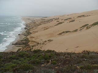
WGuadalupe-Nipomo Dunes is the largest remaining dune system south of San Francisco and the second largest in the U.S. state of California. It encompasses an 18-mile (29 km) stretch of coastline on the Central Coast of California and extends from southern San Luis Obispo County to northern Santa Barbara County.
 W
WThe Oregon Dunes National Recreation Area is located on the Oregon Coast, stretching approximately 40 miles (64 km) north of the Coos River in North Bend to the Siuslaw River in Florence, and adjoining Honeyman State Park on the west. It is part of Siuslaw National Forest and is administered by the United States Forest Service.
 W
WPalm Springs is a desert resort city in Riverside County, California, United States, within the Colorado Desert's Coachella Valley. The city covers approximately 94 square miles (240 km2), making it the largest city in Riverside County by land area. With multiple plots in checkerboard pattern, more than 10% of the city is part of the Agua Caliente Band of Cahuilla Indians reservation land. Traditionally the Cahuilla refer to the Palm Springs area as Sec-he or Se-Khi.