 W
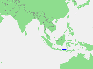
WBadung Strait is a strait on the south east side of Bali in Indonesia. It lies between the islands of Bali and Nusa Penida. It is about 60 km long and 20 km wide.
 W
WThe Bali Sea is the body of water north of the island of Bali and south of Kangean Island in Indonesia. The sea forms the south-west part of the Flores Sea, and the Madura Strait opens into it from the west.
 W
WBali Strait is a stretch of water separating Java and Bali while connecting the Indian Ocean and the Bali Sea. At its narrowest it is 2.4 kilometers (1.5 mi) wide.
 W
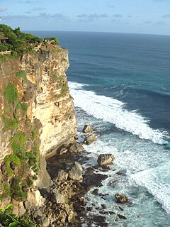
WThe Bukit Peninsula is at the southern end of the island of Bali, Indonesia. It is traditionally considered to be the entire area south of Jimbaran beach. Unlike the bulk of Bali, it features a dry, arid and stony landscape. It is administered under Kuta South District. Bukit means 'hill' in Indonesian.
 W
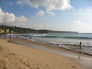
WDreamland Beach is a beach located on the Bukit peninsula, on the island of Bali, Indonesia. The beach provides basic accommodation and cafes for surfers and day-trippers. It is also renowned for its dangerous shorebreak.
 W
WGitgit Waterfall is a waterfall on Bali, Indonesia. It is located on the north of the Southeast Asian island between the old island capital of Singaraja and the inland village of Munduk. The waterfall is a popular tourist destination in Bali, known for its height and the surrounding attractive foliage and natural swimming pools, accessible by a rocky walking trail. The falls are located in Gitgit Village in the Sukasada District, around 10 kilometres (6.2 mi) from Singaraja, 26 kilometres (16 mi) from Munduk and 83 kilometres (52 mi) from Denpasar's Ngurah Rai International Airport.
 W
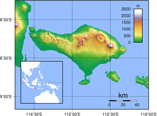
WLake Batur is a volcanic crater lake in Kintamani, Bali, Bangli Regency of Bali, located about 30 km (19 mi) northeast of Ubud in Bali. The lake is inside of the caldera of an active volcano, Mount Batur, located along the Ring of Fire of volcanic activity.
 W
WLake Tamblingan is a caldera lake located in Buleleng Regency, Bali. The lake is located at the foot of Mount Lesung in Munduk administrative village, Banjar subdistrict, Buleleng Regency, Bali, Indonesia. The lake is one of the three lakes that formed inside an ancient caldera, the other lakes to the east of Lake Tamblingan are Lake Buyan and Lake Bratan. Tamblingan lake is a pristine lake surrounded with dense rainforest and archaeological remnants of the 10th-century Tamblingan civilization. The lake and the surrounding settlements is designated as a spiritual tourism area protected from modern development by the government.
 W
WThis is a list of significant lakes and rivers on the island of Bali, Indonesia.
 W
WLovina Beach is a coastal area on the northwestern side of the island of Bali, Indonesia. The coastal strip stretches from 5 km west of the city of Singaraja to 15 km west. Singaraja is the seat of Buleleng Regency. The Lovina area contains the small villages of Pemaron, Tukad Mungga, Anturan, Banyualit, Kalibukbuk, Kaliasem and Temukus. It is becoming more popular with tourists but remains far quieter than the tourist hotspots of the island's south side.
WPecatu is a region located in the southwestern peninsula of Bali, adjacent to the popular resort area of Nusa Dua that is located in the south-eastern end of the island. Pecatu is composed of hilly landscapes with limestone cliffs isolating small, short beaches. It also houses the renowned Uluwatu Temple that offers a spectacular performance of Kecak Dance with the Indian Ocean and magnificent sunset as its background. The area is popular for surfers and also nudists due to its location behind the cliffs with limited access.