 W
WThe Pannonian island mountains is a term for isolated mountains scattered across the Pannonian Plain, chiefly its western and southern parts, in Hungary, Serbia and Croatia. In prehistoric times, these mountains were islands of the ancient Pannonian Sea that disappeared about 600,000 years ago.
 W
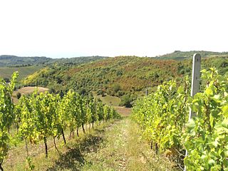
WDilj is a low mountain in south-central Slavonia, located in eastern Croatia. Of all the mountains in Slavonia, Dilj is the lowest-lying, at 471 meters. It is located north of Slavonski Brod and south of Krndija. Dilj mountain contains a forest that spreads in an East-West direction of approximately 50km, and a North-South direction of approximately 30km. Forestation of the area includes a variety of plants, including Pannonian-Balkan forest oak. Areas not covered in forestation are mainly cultivated with Orchards, Vineyards and Dehesas.
 W
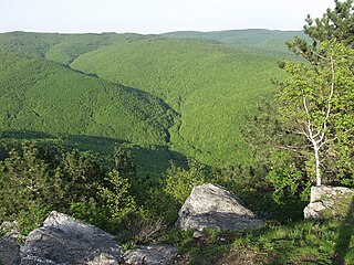
WFruška gora is a mountain in northern Serbia. Most of the area is administratively part of Serbia, but a small part on its western side extends into eastern Croatia. The area under Serbian administration forms the country's oldest national park. Sometimes it's also referred to as the Jewel of Serbia due to its largely pristine landscape and protection effort, as well as Serbian Mount Athos, due to a big number of Orthodox monasteries.
 W
WThe Kőszeg Mountains [ˈkøːsɛɡ], sometimes called the Guns or Güns Mountains, are a mountain range in the Alpokalja area, the easternmost region of the Alps. The territory of the range is shared between Austria and Hungary. Its highest point is the Írott-kő with a height of 884 metres.
 W
WKrndija is a mountain in Slavonia, Croatia, extending eastwards from Papuk. It is located south of Orahovica and Našice and north of Požega.
 W
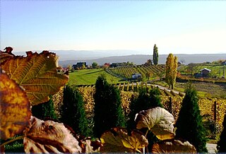
WMecsek is a mountain range in southern Hungary. It is situated in the Baranya region, in the north of the city of Pécs.
WMedvednica is a mountain in central Croatia, just north of Zagreb, and marking the southern border of the historic region of Zagorje. The highest peak, at 1,035 m (3,396 ft) is Sljeme. Most of the area of Medvednica is a nature park, a type of preservation lesser than a national park. The area of the park is 228.26 km2 (88.1 sq mi) and about 63% is covered with forest. During Miocene and Pliocene, the mountain was an island within the Pannonian Sea.
 W
WPapuk is the largest mountain in the Slavonia region in eastern Croatia, near the city of Požega. It extends between Bilogora to the northwest, Krndija to the east, and Ravna gora and Psunj to the southwest.
 W
WPožeška gora,, is a mountain located south of Požega, Croatia in the region of central Slavonia. The mountain is a part of Slavonian mountains enveloping the Požega Valley, located adjacent to Psunj to the east of Požeška gora, and to the west of Dilj. Požeška gora and Dilj are separated by a gap through which Orljava River flows south out of the Požega Valley. The highest peak of the mountain is Kapavac, 618 metres above sea level.
WPsunj is a mountain in the southwestern Slavonia region in eastern Croatia. It is the highest mountain of Slavonia, with the highest peak of Brezovo polje at 984 m.a.s.l. In the north it extends to Ravna gora and Papuk, while otherwise it is surrounded by lowlands. It is located north of Nova Gradiška and southeast of Pakrac.
 W
WThe Vršac Mountains, also known as Vršac Hill, are located in the Banat region near the city of Vršac, Serbia and partially also in Romania. They represent an independent and distinct massif, 19 kilometers long and spreading on an area of 170 square kilometers, of which 122 belong to Serbia and 48 to Romania.