 W
WThe Danakil Desert is a desert in northeast Ethiopia, southern Eritrea, and northwestern Djibouti. Situated in the Afar Triangle, it stretches across 136,956 square kilometres (52,879 sq mi) of arid terrain. It is inhabited by a few Afar, who engage in salt mining. The area is known for its volcanoes and extreme heat, with daytime temperatures surpassing 50 °C (122 °F). Less than an inch of rainfall occurs each year. The Danakil Desert is one of the lowest and hottest places on Earth.
 W
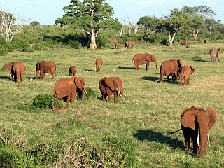
WThe East Sudanian Savanna is a hot, dry, tropical savanna ecoregion of Central and East Africa.
 W
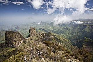
WThe Ethiopian Highlands is a rugged mass of mountains in Ethiopia, situated in northeast part of Africa. It forms the largest continuous area of its elevation in the continent, with little of its surface falling below 1,500 m (4,900 ft), while the summits reach heights of up to 4,550 m (14,930 ft). It is sometimes called the Roof of Africa due to its height and large area. Most of the Ethiopian Highlands are part of central and northern Ethiopia, and its northernmost portion reaches into Eritrea.
 W
WThe Ethiopian xeric grasslands and shrublands ecoregion is a semi-desert strip on or near the Red Sea and the Gulf of Aden coasts in Eritrea, Ethiopia, Djibouti and Somalia. This ecoregion lies mainly between sea level and 800 meters (m) elevation. There are, however, many hills and massifs, which range up to 1300 m as well as outstanding fault-induced depressions, such as the Danakil, lying as low as 155 m below sea level. This region is extremely active tectonically, experiencing many earthquakes and intermittently active volcanoes. Rainfall is very low and yearly averages range from 100 to 200 millimeters (mm), with less rain falling closer to the coast. There are many species of interest, including the endemic Archer's lark, a species of dragon tree, and a large suite of desert ungulates, including the last viable population of African wild ass.
 W
WThe Masai xeric grasslands and shrublands is a Desert and xeric shrubland ecoregion in Kenya and Ethiopia. It includes the lowlands around Lake Turkana and the Chalbi Desert east of the lake.
 W
WThe Northern Acacia-Commiphora bushlands and thickets are a tropical grasslands, savannas, and shrublands ecoregion in eastern Africa. The ecoregion is mostly located in Kenya, extending north into southeastern South Sudan, northeastern Uganda, and southwestern Ethiopia, and south into Tanzania along the Kenya-Tanzania border.
 W
WThe Somali Acacia-Commiphora bushlands and thickets is a semi-arid tropical grasslands, savannas, and shrublands ecoregion in the Horn of Africa. It is home to diverse communities of plants and animals, including several endemic species.
 W
WThe Sudanian savanna is a broad belt of tropical savanna that runs east and west across the African continent, from the Atlantic Ocean in the west to the Ethiopian Highlands in the east. The Sahel, a belt of drier grasslands and acacia savannas, lies to the north, between the Sudanian savanna and the Sahara Desert. To the south the forest-savanna mosaic forms a transition zone between the Sudanian savanna and the Guineo-Congolian forests that lie nearer the equator.
 W
WThe Victoria Basin forest-grassland mosaic is an ecoregion that lies mostly in Uganda and extends into neighboring countries. The ecoregion is centered north and west of Lake Victoria, with an outlier on the border of Ethiopia and South Sudan.