 W
WThe Venezuelan Andes also simply known as the Andes in Venezuela, are a mountain system that form the northernmost extension of the Andes. They are fully identified, both by their geological origin as by the components of the relief, the constituent rocks and the geological structure.
 W
WCaripe is a town in Caripe Municipality in the mountainous north of the state of Monagas in eastern Venezuela. The official name of the town is Caripe del Guácharo 'Caripe of the Oilbird'. The name makes reference to a colony of nocturnal birds which lives in a nearby cave, the Cueva del Guácharo, where Alexander von Humboldt studied them in 1799 during his Latin American Expedition.
 W
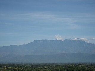
WThe Cordillera de la Costa Central is a range of the Venezuelan Coastal Ranges System, in northern Venezuela.
 W
WThe Eastern Tepuis, also known as the Roraima–Ilú range, is a mountain chain stretching for some 60 kilometres (37 mi) along the border between the disputed territory of Guayana Esequiba in Guyana, Venezuela and, to a small extent, Brazil. It runs in a northwesterly direction from the tripoint of these countries, closely following the Guyana–Venezuela border, with a single major peak (Uei-tepui) to the south, on the Brazil–Venezuela border. Moving northwest from Uei-tepui (2,150 m), the main summits of this chain are Roraima-tepui (2,810 m), Kukenán-tepui (2,650 m), Yuruaní-tepui (2,400 m), Wadakapiapué-tepui (2,000 m), Karaurín-tepui (2,500 ), Ilú-tepui (2,700 m), and Tramen-tepui. The minor peak of Wei-Assipu-tepui lies entirely outside Venezuela, on the border between Brazil and Guyana. Additionally, there are a number of minor plateaus which form a chain between Uei-tepui and Roraima-tepui. Ilú- and Tramen-tepuis are often treated together since they are joined by a common base.
 W
WThe Cordillera de Mérida is a series of mountain ranges, or massif, in northwestern Venezuela. The Cordillera de Mérida is a northeastern extension of the Andes Mountains and the most important branch of the Venezuelan Andes. The ranges run southwest-northeast between the Venezuelan-Colombian border and the Venezuelan Coastal Ranges. The Táchira depression separates the Cordillera de Mérida from the Cordillera Oriental, which forms the Colombia-Venezuela border.
 W
WThe Serranía de Los Motilones is a mountain range in the Cordillera Oriental of Colombia and Venezuela. A forest reserve zone exists within the range and spans 998,581 hectares.
 W
WThe Serranía del Perijá, Cordillera de Perijá or Sierra de Perijá is a mountain range, an extension of the eastern Andean branch, in northern South America, between Colombia and Venezuela, ending further north in the Guajira Desert, a total distance of about 310 kilometres (190 mi). It separates the Maracaibo Basin from the Cesar-Ranchería Basin. Some of the area has been considered as a Flora and Fauna Sanctuary.
 W
WThe Sierra de La Culata is a mountain range in the largest massif in Venezuela, the Cordillera de Mérida, which in turn is part of the northern extent of the Cordillera de los Andes. The Sierra la Culata includes some of the highest peaks in Venezuela, such as Pico Piedras Blancas, Pico Pan de Azúcar, and Collado del Cóndor.
 W
WThe Sierra de Lema is an upland mountain range area with tepuis, located in Bolívar state of southeastern Venezuela.
 W
WThe Sierra Nevada de Mérida is the highest mountain range in the largest massif in Venezuela, the Cordillera de Mérida, which in turn is part of the northern extent of the Cordillera de los Andes. The Sierra Nevada de Mérida includes the highest peaks in Venezuela, Pico Bolívar, which has an elevation of 4,981 metres (16,342 ft), Pico Humboldt, Pico Bonpland and others.
 W
WThe Tamá Massif is a group of mountains on the border between Colombia and Venezuela to the south of Lake Maracaibo. It contains evergreen rainforest and cloud forest at the lower levels, and páramos at the highest levels.
 W
WThe Venezuelan Coastal Range, also known as Venezuelan Caribbean Mountain System is a mountain range system and one of the eight natural regions of Venezuela, that runs along the central and eastern portions of Venezuela's northern coast. The range is a northeastern extension of the Andes, and is also known as the Maritime Andes. It covers around 48,866 km2, being the 4th largest natural region in Venezuela.