 W
WMount Aspiring National Park is in the Southern Alps of the South Island of New Zealand, north of Fiordland National Park, situated in Otago and Westland regions. The park forms part of the Te Wahipounamu World Heritage site.
 W
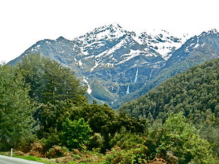
WThe Bridal Veil Falls is a waterfall near Queenstown, Otago, in New Zealand. It is one of numerous streams and waterfalls in this region. This fall is only notable because it has been given a common name, is clearly visible from the road and the stream from this fall runs under the third bridge of the Routeburn Track. This fall is over Torlesse Terrane metamorphic rock.
 W
WThe Haast Pass / Tioripatea is a mountain pass in the Southern Alps of the South Island of New Zealand. Māori used the pass in pre-European times.
 W
WThe Haast-Hollyford road or Haast-Hollyford Highway is a long-standing proposal to link Haast via the Hollyford Valley to Milford Sound and Te Anau in the South Island of New Zealand. Proposals for this road have been mooted since the 1880s.
 W
WThe Humboldt Mountains or Humboldt Range are one of the many ranges which make up the Southern Alps in the South Island of New Zealand. They lie to the northwest of Lake Wakatipu in the Otago Region. Parts of the range lie within Fiordland National Park, and they form the southern extremity of Mount Aspiring National Park. The range was named by early explorer James McKerrow, and like many geographic features worldwide, it was named in honour of notable scientist Alexander von Humboldt.
 W
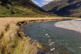
WThe Landsborough River is located in New Zealand's South Island. A major tributary of the Haast River, it flows southwest, parallel with the Southern Alps, for 50 kilometres from its source five kilometres north of Mount Hopkins to meet the Haast 12 kilometres below the Haast Pass.
 W
WThe Makarora River is in the Otago region of the South Island of New Zealand.
 W
WThe Mātukituki River is found in the Southern Alps of New Zealand's South Island. Both the West Branch and the East Branch originate from the Main Divide mountain ranges near Mount Aspiring and their largely glacier-fed waters flow for approximately 20 kilometres (12 mi) each before joining near Camerons Flat. After this confluence, the Mātukituki River leaves the boundaries of Mount Aspiring National Park and continues for another 30 kilometres (19 mi) until it drains into Lake Wānaka at the lake's southwestern edge.
 W
WThe Olivine Ice Plateau is a glacier in the Olivine Wilderness Area and Aspiring National Park in New Zealand's South Island. The Plateau is named after the mineral olivine, which is common within the Dun Mountain Ophiolite that underlies the area. The Plateau extents to the west over the Forgotten River Col. into the Forgotten River and to the North it merges with the Andy Glacier, which feeds a tributary of the Arawhata River. The Olivine Ice Plateau is one of many glaciers in the region of the Arawhata, Dart, Hollyford and Matukituki rivers' headwaters.
 W
WThe Rob Roy Glacier is a small hanging glacier in the Southern Alps of New Zealand's South Island. It is located within the Mount Aspiring National Park, 9 kilometres (6 mi) south of Mount Aspiring / Tititea.
 W
WThe Routeburn Classic mountain run is a mountain running event in New Zealand and is 32 km (20 mi) in distance, following the entire Routeburn Track. It is an annual event which was first held in 2001, and draws many local competitors as well as many international runners. Numbers are limited to about 350 for each event to reduce impact on the area, which is one of the great walks in New Zealand and is looked after by the Department of Conservation.
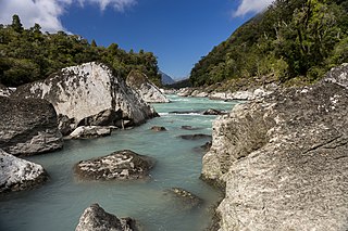
WThe Routeburn River, also known as the Route Burn, is a river in New Zealand. It is a short stony river that flows for some 15 kilometres into the Dart River in the South Island. The Routeburn River flows alongside a section of the Routeburn Track. The upper reaches of the river are found in the Routeburn North Branch and leave the Routeburn Track around the Routeburn Flat Hut area.
 W
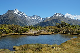
WThe Routeburn Track is a world-renowned, 32 km tramping (hiking) track found in the South Island of New Zealand. The track can be done in either direction, starting on the Queenstown side of the Southern Alps, at the northern end of Lake Wakatipu or on the Te Anau side, at the Divide, several kilometres from the Homer Tunnel to Milford Sound.
 W
WThe Waiatoto River is a river of the West Coast of New Zealand's South Island. Formed from several small rivers which are fed by glaciers surrounding Mount Aspiring, it flows north along a valley flanked in the west by the Haast Range before turning northwest to reach the Tasman Sea 20 kilometres (12 mi) southwest of Haast. Much of the river's length is within Mount Aspiring National Park.
 W
WYoung River is in the Otago region of the South Island of New Zealand.