 W
WThe Lower Rhine flows from Bonn, Germany, to the North Sea at Hoek van Holland, Netherlands ; alternatively, Lower Rhine may refer to the part upstream of Pannerdens Kop, excluding the Nederrijn.
WBetween Bingen and Bonn, Germany, the river Rhine flows as the Middle Rhine through the Rhine Gorge, a formation created by erosion, which happened at about the same rate as an uplift in the region, leaving the river at about its original level, and the surrounding lands raised. This gorge is quite deep, about 130 metres (430 ft) from the top of the rocks down to the average water-line.
 W
WThe Rhine is one of the major European rivers, which has its sources in Switzerland and flows in a mostly northerly direction through Germany and the Netherlands, emptying into the North Sea. The river begins in the Swiss canton of Graubünden in the southeastern Swiss Alps, forms part of the Swiss-Liechtenstein, Swiss-Austrian, Swiss-German and then the Franco-German border, then flows through the German Rhineland and the Netherlands and eventually empties into the North Sea.
 W
WThe Upper Rhine is the section of the Rhine in the Upper Rhine Plain between Basel in Switzerland and Bingen in Germany. The river is marked by Rhine-kilometres 170 to 529.
 W
WThis list of old waterbodies of the Rhine contains a selection of ox-bow lakes and meanders of the River Rhine which go under various names that mean Old Rhine or Old Arm [of the Rhine]: Alter Rhein, Altrhein, Altrheinarm, Altrheinzug, Altarm, Rheinaltarm or Restrhein. Artificially created waterbodies, such as quarry ponds; e. g. the Altrheinsee, which may be confused with old branches of the Rhine are mentioned in the section Waterbodies linked to the Rhine.
 W
WMarscholsee is a lake at San Bernardino Pass in the Grisons, Switzerland. The lake is located at an elevation of 2053 m.
 W
WThe Obersee, also known as Upper Lake Constance, is the much larger of the two parts of Lake Constance, the other part being the Untersee.
 W
WSufnersee is a reservoir between Splügen and Sufers on the Hinterrhein river in the Grisons, Switzerland. The dam Sufers was built 1962. The reservoir has a volume of 17.5 million m³ and its surface area is 0.90 km².
 W
WThe Wehra Dam is a dam which impounds the River Wehra near Wehr in the county of Waldshut in the German state of Baden-Württemberg. Its reservoir forms the lower basin of the Hornberg stage and it is thus part of the Schluchseewerk network. The upper basin of the pumped-storage power station is the Hornberg Basin; the cavern with its power station lies inside the mountain about half way between the two basins.
WThe Wölferlinger Weiher is a pond in the municipality of Wölferlingen between the village of Wölferlingen itself and Langenhahn in the German county of Westerwaldkreis. In 1979, the Wölferlinger Weiher was designated an official nature reserve. It is on the Seven Weiher Way (7-Weiher-Weg) in the Westerwald region. Laid out along with six other ponds by Count Frederick III of Wied in the 17th century, the Wölferlinger Weiher is part of the protected landscape known as the Westerwald Lake District.
 W
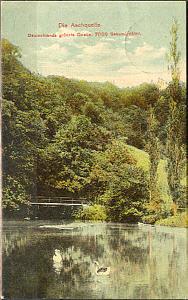
WThe Aachtopf (help·info) is Germany's biggest karst spring, located south of the western end of the Swabian Jura, near the town Aach. It produces an average of 8,500 litres per second. Most of the water stems from the River Danube where it disappears underground at the Danube Sinkhole, 12 km North near Immendingen and about 14 km North near Fridingen. The cave system has been explored since 1960´s, but as of 2020 only a small part has been discovered due to a large blockage after a few hundred meters.
 W
WThe Schwanentorbrücke is a vertical-lift bridge in Duisburg, North Rhine-Westphalia, Germany, that crosses the Duisburg Inner Harbour. The bridge can be vertically raised to allow cargo ships to access the inner city, and lowered to allow cars, trains and pedestrians to cross. The bridge is named after the Schwanenturm that protected the city walls in the 13th and 14th centuries.
 W
WThe All Saints Waterfalls are located in the Black Forest on the territory of the town of Oppenau in the German state of Baden-Württemberg at an elevation of about 500 m above NN. The Lierbach stream, also called the Grindenbach, cascades, as a natural waterfall, down seven steps, a total drop of 83 metres. Due to the scouring of the rocks under the cataract which have formed basin-like holes known as Gumpen or kolks), the falls are also called the Büttensteiner Waterfalls or Sieben Bütten.
 W
WThe Gertelbach Falls or Gertelbach Waterfalls (Gertelbach-Wasserfälle), formerly also the Gertelbach Gorge (Gertelbachschlucht), are on the Gertelbach stream in the Bühlertal valley in the Northern Black Forest in Germany.
 W
WThe Rhine Falls is a waterfall located in Switzerland and the most powerful waterfall in Europe. The falls are located on the High Rhine on the border between the cantons of Schaffhausen (SH) and Zürich (ZH), between the municipalities of Neuhausen am Rheinfall (SH) and Laufen-Uhwiesen/Dachsen (ZH), next to the town of Schaffhausen in northern Switzerland.