 W
WCommewijne River is a river in northern Suriname.
 W
WThe Coppename is a river in Suriname in the district of Sipaliwini, forming part of the boundary between the districts of Coronie and Saramacca.
 W
WCottica River is a river in Suriname, located at around 5.866667°N 54.866667°W.
 W
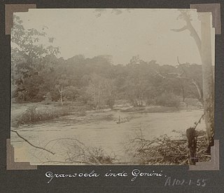
WGonini River is a river of Suriname which flows into the Lawa River near Mofina in French Guiana. The river is formed from a confluence between the Wilhelmina River and the Emma River. Both rivers are sourced from the Oranjegebergte which in turn is a subdivision of the Tumuk Humak Mountains. The area was first explored by A. Franssen Herderschee in 1903. The river is home to the Koloegado, Lenabari, Makoe-makoe, and Kotilolo waterfalls.
 W
WGran Rio is a river of Suriname. The Gran Rio confluences with the Pikin Rio to form Suriname River.. The river runs from the northern hills of the Eilerts de Haan Mountains. It has a stony bottom, forms many tiny islands and has many rapids. At Awarradam, there are many rapids and waterfalls. The river was first explored in 1908 by Eilerts de Haan to find the source of the Suriname River.
 W
WKabalebo River is a river in Suriname. It joins with the Courantyne River near Apoera. A plan for a dam in the river serving a hydroelectric power plant is part of the West Suriname Plan of the 1960s. As of 2020, nothing has happened. The river is home to major waterfalls like the Wonotobo, Stanley, and Frederik Willem IV falls. Petrogylphs had been discovered on a rock by Ten Kate in 1886.
 W
WThe Lawa is a river of South America. It forms part of the international boundary between Suriname and French Guiana. It is formed by the confluence of the Litani and Malani. Downstream from its confluence with the Tapanahony, it is called Maroni. The total length of Litani, Lawa and Maroni is 612 km (380 mi).
 W
WThe Litani or Itany is a river which forms part of the boundary between Suriname and French Guiana. It is a tributary, or the upper course, of the Maroni. The boundary is disputed, with Suriname also claiming land to the east of the river.
 W
WThe Maroni or Marowijne is a river in South America that forms the border between French Guiana and Suriname.
 W
WThe Nickerie is a river in the northwestern part of Suriname.
WOelemari River is a river of Suriname. The Oelemari River flows into the Litani which is a tributary to the Marowijne. The river is sourced from the Oranjegebergte which in turn is a subdivision of the Tumuk Humak Mountains. Gold has been discovered in the area and is being exploited by Guardian Exploration from Texas.
 W
WSaramacca River is a river in Suriname. Arawaks named this river "Surama", and today's name "Saramacca" is probably derived from it. It originates in the Wilhelmina Mountains and flows northwards and enters the Atlantic Ocean together with Coppename River. It has a river basin of 9.400 km² and length of 255 km. Saramacca River is used for water transport. Scientific exploration of the river began in the 1770s.
 W
WSipaliwini River is a river of Suriname, the main source of the Courantyne River. It gives its name to the village of Sipaliwini and to the Sipaliwini District. It flows through the village of Kwamalasamutu. The name translates to thornback ray (sipari) river in the local Maroon dialect.
 W
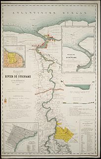
WThe Suriname River is 480 km long and flows through the country Suriname. Its sources are located in the Guiana Highlands on the border between the Wilhelmina Mountains and the Eilerts de Haan Mountains. The river flows below the reservoir along Brokopondo, Berg en Dal, the migrant communities Klaaskreek and Nieuw-Lombé, Jodensavanne, Carolina, Ornamibo and Domburg, before reaching the capital Paramaribo on the left bank and Meerzorg on the right bank. At Nieuw-Amsterdam it is joined by the Commewijne and immediately thereafter at the sandspit Braamspunt it flows into the Atlantic Ocean.
 W
WThe Tapanahony River is a major river in the south eastern part of Suriname, South America. The river originates in the Southern part of the Eilerts de Haan Mountains, near the border with Brazil. It joins the Marowijne River at a place called Stoelmanseiland. Upstream, there are many villages inhabited by Indian Tiriyó people, while further downstream villages are inhabited by the Amerindian Wayana and Maroon Ndyuka people.