 W
WCaracol Falls, or Cascata do Caracol, is a 426-foot waterfall about 4.35 miles (7.00 km) from Canela, Brazil in Caracol State Park. It is formed by the Caracol River and cuts out of basalt cliffs in the Serra Geral mountain range, falling into the Vale da Lageana. The falls are situated between the pinheiral zone of the Brazilian Highlands and the southern coastal Atlantic Forest. The base of the waterfall can be reached by a steep 927-step trail maintained by the Projeto Lobo-Guará.
 W
WCerro do Jarau crater is a 13.5 kilometres (8.4 mi) diameter circular feature in the Paraná Basin, Rio Grande do Sul in southern Brazil, close to the border with Uruguay. The Russian Academy of Sciences lists the structure as a probable impact crater.
 W
WFortaleza Canyon is a canyon located in Serra Geral National Park in Cambará do Sul, Rio Grande do Sul, Brazil.
 W
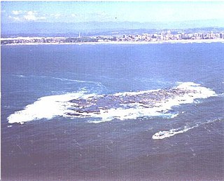
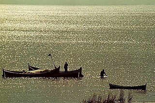
WIlha dos Lobos is a small island and wildlife refuge on the Atlantic coast of Torres, Rio Grande do Sul, Brazil.
 W
WIlha dos Marinheiros is an island located in the south part of a lagoon named Lagoa dos Patos, located in the municipality of Rio Grande, in the state of Rio Grande do Sul, Brazil. It is situated on the west bank of that lagoon. This island has an area 39.28 km² and is situated 1.5 km (0.93 mi) off the continent at its nearest point.
 W
WLagoa dos Patos is the largest lagoon in Brazil and the largest barrier-lagoon in South America. It is located in the state of Rio Grande do Sul, southern Brazil. It covers an area of 10,100 km2 (3,900 sq mi), is 180 miles (290 km) long and has a maximum width of 44 miles (71 km).
 W
WLagoon Mirim or Merín is a large estuarine lagoon which extends from southern Rio Grande do Sul state in Brazil into eastern Uruguay. Lagoa Mirim is separated from the Atlantic Ocean by a sandy, partially barren isthmus.
 W
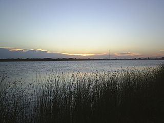
WLake Guaíba is a waterway in Rio Grande do Sul, the southernmost state of Brazil. It is famous for its beautiful reflection at sunset. The Guaíba is an extension of the Lagoa dos Patos, the largest lagoon in Brazil. It is commonly referred to as a "river" besides "lake". The Jacuí River, the Sinos River, the Gravataí River and the Caí River empties into the Guaíba from the north.
 W
WMorro do Diabo, literally "Devil's Hill", is a distinctive hill formation in Rio Grande do Sul, Brazil.
 W
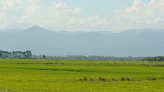
WThe Pampas are fertile South American lowlands that cover more than 1,200,000 square kilometres (460,000 sq mi) and include the Argentine provinces of Buenos Aires, La Pampa, Santa Fe, Entre Ríos, and Córdoba; all of Uruguay; and Brazil's southernmost state, Rio Grande do Sul. The vast plains are a natural region, interrupted only by the low Ventana and Tandil hills, near Bahía Blanca and Tandil (Argentina), with a height of 1,300 m (4,265 ft) and 500 m (1,640 ft), respectively.
WThe Pelotas Basin is a mostly offshore sedimentary basin of approximately 346,000 square kilometres (134,000 sq mi) in the South Atlantic, administratively part of the southern states Santa Catarina and Rio Grande do Sul of Brazil and the departments Cerro Largo, Rocha and Treinta y Tres of Uruguay.
 W
WPraia do Cassino is the southernmost beach of the Brazilian coast, on the South Atlantic Ocean, in the state of Rio Grande do Sul. It is thought to be the longest uninterrupted sandy seashore in the world, with various sources measuring it from 212 kilometres (132 mi) to 254 kilometres (158 mi), stretching from the Molhes (breakwaters) at the entrance of the Rio Grande seaport in the north to the mouth of the Chuí Stream, on the border with Uruguay, in the south.
 W
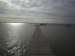
WThe São Gonçalo Channel is a navigable channel connecting two large coastal lagoons, Lagoa Mirim and Lagoa dos Patos, in the state of Rio Grande do Sul in southern Brazil. At its eastern end, it separates the municipalities of Rio Grande to the south from Pelotas to the north.
 W
WThe Serra Gaúcha is a cultural region comprising the mountainous in the northeastern portion of Rio Grande do Sul state in southern Brazil. Most of its inhabitants are of German and Italian ancestry. Consequently, the cities in the Serra Gaúcha reflect German and Italian influences through their architecture, gastronomy, and culture. Geographically, it is part of the Serra Geral mountain range.
 W
WSerras de Sudeste is a dissected plateau, also named Planalto Dissecado de Sudeste or Escudo Sul-Rio-Grandense, located in the southeastern portion of Rio Grande do Sul state in southernmost Brazil, near Uruguay.
 W
WThe Taim Ecological Station is a federally-administered ecological station in the state of Rio Grande do Sul, Brazil.