 W
WThis is a list of rivers in Benin. This list is arranged west to east by drainage basin, with respective tributaries indented under each larger stream's name.Volta River (Ghana) Oti River Kara River Pendjari River Mono River Couffo River Ouémé River Zou River Agbado River Okpara River Alpouro River Niger River Oli River Sota River Bouli River Tassiné River Alibori River Pako River Mékrou River
 W
WThis is a list of the Tributaries of the Niger River. They are listed by nation, at the point they converge into the Niger.
 W
WThe Agbado River is a river of Benin. It flows through Maxi territory to the north of Abomey. It flows south from its source in northern Collines Department, passes the town of Savalou, and discharges into the Zou River at the Atchérigbé Classified Forest near Setto.
 W
WThe Alibori River is a river in the northeastern part of Benin. It rises near the village of Tobré in Atakora Department and flows northeast, ultimately emptying into the Niger River near Birni-Lafia. In Alibori Department it forms the eastern border of the communes of Banikoara and Karimama, as well the eastern boundary of W Transborder Park. The Pako River is one of its tributaries. It is populated with crocodiles.
WThe Bouli River is a river of Benin. A tributary of the Sota River, its headwaters are located north of Ina in Borgou Department and the river flows northeast, meeting the Sota near Bensékou in Alibori Department.
 W
WThe Couffo or Kouffo is a river of West Africa. It rises in Togo but runs for much of its 125-kilometer course through Benin, draining into Lake Ahémé. It forms part of the Togo–Benin border and also serves as the border between Kouffo and Zou Departments.
WThe Mékrou River is a river of Benin, Burkina Faso, and Niger. It flows through the W National Park.
 W
WThe Mono River is the major river of eastern Togo.
 W
WThe Niger River is the principal river of West Africa, extending about 4,180 km (2,600 mi). Its drainage basin is 2,117,700 km2 (817,600 sq mi) in area. Its source is in the Guinea Highlands in southeastern Guinea. It runs in a crescent through Mali, Niger, on the border with Benin and then through Nigeria, discharging through a massive delta, known as the Niger Delta, into the Gulf of Guinea in the Atlantic Ocean. The Niger is the third-longest river in Africa, exceeded only by the Nile and the Congo River. Its main tributary is the Benue River.
 W
WThe Okpara River is a river of Benin. Originating in Borgou Department, it flows south and becomes the border between Nigeria and Benin before re-entering Benin and flowing into the Ouémé River, which ultimately drains into the Atlantic Ocean. Several villages along the river are disputed between Benin and Nigeria.
WThe Oli River is a river of Nigeria and Benin, tributary of the Niger River.
 W
WThe Oti River or Pendjari River is an international river in West-Central Africa. It rises in Benin, forms the border between Benin and Burkino Faso, flows through Togo, and joins the Volta River in Ghana.
 W
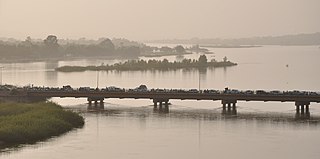
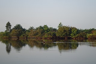
WThe Ouémé River, also known as the Weme River, is a river in Benin. It rises in the Atakora Mountains, and is about 510 kilometres (320 mi) long. It flows past the towns of Carnotville and Ouémé to a large delta on the Gulf of Guinea near the seaport city of Cotonou. The largest tributaries are the Okpara River and the Alpouro River. Ouémé River is the largest River of Benin Republic. It is located between 6° 30° and 10° north latitude and 0° 52 'and 3° 05' east longitude(Oba S. Alain 2018). It crosses several agro-ecological zones and feeds downstream, the lagoon system ‘'Lake Nokoué-lagoon of Porto-Novo'’ through a Delta zone. The lower Delta of Ouémé, is located between latitude 6° 33'N and 8° 15 'and the meridians 1° 50' and 2° 00 '. The lower Delta of Ouémé begins after municipality of Adjohoun in the department of Ouémé and ends at the south facade where the river flows into the lagoon complex ‘'Nokoué-Porto-Novo'’. The subequatorial climate type, characterized by two rainy seasons and two dry seasons. On the other hand, its hydrological regime depends on the Sudanian climate (north-Benin) with a low water period usually lasts seven months and a flood period. The plant formations along the area are characterized by swamps inhabited by floating plants dominated by water hyacinth, water lily, water lettuce and lemna. There are also undeveloped marshy forests, dominated by the Raphia palm and the oil palm. The part of the valley covered by the water is very productive in fish.
WThe Sota is a river of northern Benin flowing through the departments of Borgou and Alibori. It is a tributary of the Niger River and the Tassiné River is one of its tributaries. The river is approximately 250 km in length and covers a basin area of 13,650 km2.
WThe Tassiné River is a river in northeast Benin. It is a tributary of the Sota River.
 W
WThe Yewa River is a trans-boundary river between Republic of Benin and Nigeria, running along the Bight of Benin; at one point it crosses the border between the two countries. Other variants of the name are Yeoua, Yewa, Yéoua, and Yéwa. Its elevation is sea level. The Yewa's major sources are the Atan and Ilaro rivers. The Yewa empties into Badagry Creek which empties, in turn, into Lagos Harbor.
WThe Zou is a river of south-western Benin. It drains into the Ouémé River. The river banks are inhabited in parts by the Mahi people near the Togo border.