 W
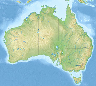
WBruny Island is a 362-square-kilometre (89,000-acre) island located off the south-eastern coast of Tasmania, Australia. The island is separated from the Tasmanian mainland by the D'Entrecasteaux Channel, and its east coast lies within the Tasman Sea. Storm Bay is located to the island's northeast. Both the island and the channel are named after French explorer Bruni d'Entrecasteaux. Its traditional Aboriginal name is lunawanna-allonah, which survives as the name of two island settlements, Alonnah and Lunawanna.
 W
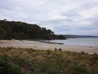
WAdventure Bay is the name of a locality, a township and a geographical feature on the eastern side of Bruny Island, Tasmania. At the 2006 census, Adventure Bay and the surrounding area had a population of 152.
 W
WAlonnah is a small township on the western side of Bruny Island, Tasmania, facing the D'Entrecasteaux Channel. Originally named Mill's Reef, it was renamed in the early 1900s after part of the Tasmanian aboriginal name for Bruny Island, Lunawanna-alonnah. Mill's Reef Post Office opened on 1 February 1905 and was renamed Alonnah in 1909. At the 2006 census, Alonnah had a population of 302.
 W
WArra-Maïda was an Aboriginal Tasmanian woman who was encountered by members of the French expedition to Australia led by Nicolas Baudin in January 1802 on the shores of Bruny Island.
WBarnes Bay is both a geographical feature and a small hamlet near the northern end of Bruny Island, Tasmania. During the early 19th century it was a centre for the firewood trade to Hobart and later the fruit industry, mostly apples and pears. It is now mostly a centre for the tourist industry and light grazing.
 W
WThe Bruny Island Ferry links Bruny Island to the Tasmanian mainland. Once operated by North Western Shipping and Towage Co. Pty Ltd and owned by the Tasmanian Government, the ferry Mirambeena travels between Kettering on the Tasmanian mainland and Roberts Point on Bruny Island, the service is now run by Sealink. The service is subsidised by the Tasmanian Government.
 W
WBruny Island Radio Specrometer, or BIRS, was a radio telescope on Bruny Island that was operated privately by Bill Erickson, who was then a research associate at the University of Tasmania. It was designed to measure relatively low frequency radio emissions from the sun; ranging from around 62 MHz down to the lowest possible frequencies that can penetrate the ionosphere, which typically fluctuates between 7 and 13 MHz, but can be as low as 3 MHz. Reliable measurements below 20 MHz are difficult to obtain with ground-based telescopes due to interference, both from local sources and distant ones. BIRS' main purpose was to detect and study coronal type II radio bursts, but has on occasion also measured radio bursts below 3 MHz believed to have originated from Jupiter. In January 2015, BIRS' sustained a hardware failure and has stopped publishing data.
 W
WThe Cape Bruny Lighthouse is an inactive lighthouse located at the southern tip of Bruny Island, Tasmania, Australia.
 W
WCloudy Bay is located at the southernmost end of Bruny Island in the Australian state of Tasmania.
 W
WThe D'Entrecasteaux Channel is a body of water located between Bruny Island and the south-east of the mainland of Tasmania, Australia. The channel is the mouth for the estuaries of the Derwent and the Huon Rivers and empties into the Tasman Sea of the South Pacific Ocean. It was sighted by Abel Tasman in 1642 and surveyed in 1792 by Bruni d'Entrecasteaux.
WDennes Point is a semi-rural locality in the local government area (LGA) of Kingborough in the Hobart LGA region of Tasmania. The locality is about 3 kilometres (1.9 mi) north-east of the town of Killora. The 2016 census has a population of 49 for the state suburb of Dennes Point. It is also a geographical feature and a small hamlet at the northern tip of Bruny Island.
WGreat Bay is a rural locality on Bruny Island in the local government area of Kingborough in the Hobart region of Tasmania. It is located about 18 kilometres (11 mi) north-east of the town of Alonnah, the largest town on the island. The 2016 census determined a population of 57 for the state suburb of Great Bay.
WKillora is a rural locality on Bruny Island in the local government area of Kingborough in the Hobart region of Tasmania. It is located about 39 kilometres (24 mi) north of the town of Alonnah, the largest town on the island. The 2016 census has no population information for the state suburb of Killora.
 W
WLunawanna is a small township on the western side of Bruny Island, Tasmania, facing the D'Entrecasteaux Channel. It is named after part of the Tasmanian aboriginal name for Bruny Island, Lunawanna-alonnah, a nearby township about 5 kilometres (3.1 mi) to its north being named Alonnah.
WNorth Bruny is a rural locality on Bruny Island in the local government area of Kingborough in the Hobart region of Tasmania. It is located about 34 kilometres (21 mi) north-east of the town of Alonnah, the largest town on the island. The 2016 census determined a population of 95 for the state suburb of North Bruny.
WSimpsons Bay is a rural locality on Bruny Island in the local government area of Kingborough in the Hobart region of Tasmania. It is located about 9 kilometres (5.6 mi) north-east of the town of Alonnah, the largest town on the island. The 2016 census has a population of 55 for the state suburb of Simpsons Bay.
 W
WThe South Bruny National Park is a national park located on Bruny Island, Tasmania, Australia, about 50 kilometres (31 mi) south of Hobart. The park contains the Cape Bruny Lighthouse. The highest point of the park is Mount Bruny at 504 metres (1,654 ft).
WSouth Bruny is a rural locality on Bruny Island in the local government area of Kingborough in the Hobart region of Tasmania. It is located about 14 kilometres (8.7 mi) south of the town of Alonnah, the largest town on the island. The 2016 census determined a population of 84 for the state suburb of South Bruny.