 W
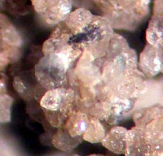
WThe Allenby formation is a sedimentary rock formation deposited during the early to early Middle Eocene. It consists of conglomerates, sandstones with interbedded with shales and coal. The coal seams contain an abundance of insect, fish and plant fossils, known from the shales since 1877 but best known from the Princeton Chert.
WThe Bjorne Formation is a formation of sandstones and shales in the Canadian Arctic Archipelago. The southern edge of the formation includes petroleum reserves in Melville Island. The basin also includes Mackenzie King Island, Lougheed Island and portions of Prince Patrick Island, Borden Island, Ellef Ringnes Island, Amund Ringnes Island, and Cornwall Island.
WThe Blood Reserve Formation, also known as the Blood Reserve Sandstone, is a geologic formation of Late Cretaceous (Campanian) age in the Western Canada Sedimentary Basin. It is present in southwestern Alberta, Canada, and was named for Blood Indian Reserve No. 148 by L.S. Russell in 1932. It is an aquifer and a source of fresh groundwater.
 W
WThe Cardium Formation is a stratigraphic unit of Late Cretaceous age in the Western Canada Sedimentary Basin. It takes the name from the fossilized Cockle (Cardiidae) shells that it contains, and it was first described along the Bow River banks by James Hector in 1895. It is present throughout western Alberta and in northeastern British Columbia, and it is a major source of petroleum and natural gas.
 W
WThe Crowsnest Formation, also called the Crowsnest Volcanics, is a geological formation in southwestern Alberta, Canada, on the southwestern margin of the Western Canada Sedimentary Basin. It was named for the Crowsnest Pass near Coleman, Alberta. The formation consists mostly of pyroclastic rocks that were laid down in a series of explosive eruptions about 100 million years ago during the Albian stage of the Early Cretaceous epoch. It contains unusual minerals such as melanite and analcime.
 W
WThe Dakota is a sedimentary geologic unit of formation and group rank composed of sandstones, mudstones, and shales deposited in the late-Early to early-Late Cretaceous Western Interior Seaway. The unit is noted for being exceptionally widespread; from British Columbia and Alberta to Montana and Wisconsin to Colorado and Kansas to Utah and Arizona. It is famous for producing massive colorful rock formations, and preserving both dinosaur footprints and early deciduous tree leaves.
 W
WThe Dunvegan Formation is a stratigraphical unit of Cenomanian age in the Western Canadian Sedimentary Basin.
WThe Fannin Formation is a geologic formation in British Columbia. It preserves fossils dating back to the Early Jurassic period.
WThe Gorman Creek Formation is a geologic formation of Early Cretaceous (Valanginian) age in the Western Canada Sedimentary Basin that consists primarily of nonmarine sediments. It is present in the northern foothills of the Canadian Rockies and the adjacent plains in northeastern British Columbia. Plant fossils and dinosaur tracks have been described from its strata.
 W
WJacobsville Sandstone is a red sandstone formation, marked with light-colored streaks and spots, primarily found in northern Upper Michigan, portions of Ontario, and under much of Lake Superior. Desired for its durability and aesthetics, the sandstone was used as an architectural building stone both locally and around the United States. The stone was extracted by thirty-two quarries throughout the Upper Peninsula approximately between 1870 and 1915.
WThe Kanguk Formation is a geological formation in the Northwest Territories and Nunavut, Canada whose strata date back to the Late Cretaceous. Dinosaur remains are among the fossils that have been recovered from the formation.
WThe Margaret Formation is a geologic formation of the Eureka Sound Group in the Sverdrup Basin in Northwest Territories and Nunavut, Canada. The unit belonging to the Eureka Sound Group which crops out at Ellesmere Island preserves fossils dating back to the Early Eocene period, or Wasatchian in the NALMA classification.
 W
WThe McCoy Brook Formation is a geological formation dating to roughly between 200 and 190 million years ago and covering the Hettangian to Sinemurian stages. The McCoy Brook Formation is found in outcrops around the Bay of Fundy, Nova Scotia.
 W
WThe Morrison Formation is a distinctive sequence of Upper Jurassic sedimentary rock found in the western United States which has been the most fertile source of dinosaur fossils in North America. It is composed of mudstone, sandstone, siltstone, and limestone and is light gray, greenish gray, or red. Most of the fossils occur in the green siltstone beds and lower sandstones, relics of the rivers and floodplains of the Jurassic period.
WThe Phantom Creek Formation is a geologic formation of the Maude Group in British Columbia. It preserves fossils dating back to the Early Jurassic period.
 W
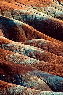
WThe Queenston Formation is a geological formation of Upper Ordovician age, which outcrops in Ontario, Canada and New York, United States. A typical outcrop of the formation is exposed at Bronte Creek just south of the Queen Elizabeth Way. The formation is a part of the Queenston Delta clastic wedge, formed as an erosional response to the Taconic Orogeny. Lithologically, the formation is dominated by red and grey shales with thin siltstone, limestone and sandstone interlayers. As materials, comprising the clastic wedge, become coarser in close proximity to the Taconic source rocks, siltstone and sandstone layers are predominant in New York.
 W
WThe Scollard Formation is an Upper Cretaceous to lower Palaeocene stratigraphic unit of the Western Canada Sedimentary Basin in southwestern Alberta. Its deposition spanned the time interval from latest Cretaceous to early Paleocene, and it includes sediments that were deposited before, during, and after the Cretaceous-Paleogene (K-Pg) extinction event. It is significant for its fossil record, and it includes the economically important coal deposits of the Ardley coal zone.
 W
WThe St. Mary River Formation is a geologic formation of Late Cretaceous age of the Western Canada Sedimentary Basin in southwestern Alberta and northwesternmost Montana. It was first described from outcrops along the St. Mary River by George Mercer Dawson in 1883, and it takes its name from the river.
 W
WThe Two Medicine Formation is a geologic formation, or rock body, that was deposited between 83.5 ± 0.7 Ma and 70.6 ± 3.4 Ma, during Campanian time, and is located in northwestern Montana and southern Alberta. It crops out to the east of the Rocky Mountain Overthrust Belt, and the western portion of this formation is folded and faulted while the eastern part, which thins out into the Sweetgrass Arch, is mostly undeformed plains. Below the formation are the nearshore deposits of the Virgelle Sandstone, and above it is the marine Bearpaw Shale. Throughout the Campanian, the Two Medicine Fm. was deposited between the western shoreline of the Late Cretaceous Interior Seaway and the eastward advancing margin of the Cordilleran Overthrust Belt. The Two Medicine Fm. is mostly sandstone, deposited by rivers and deltas.