 W
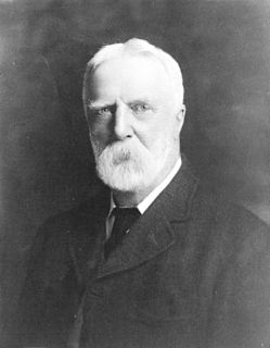
WMontague Aldous was a Dominion Topographical Surveyor from Charlottetown, Prince Edward Island. He was a participant in foundation surveys of the Northwest Territories. He was associated with A.L. Russell in 1877 in a survey west to the third meridian. Taken on Special Survey in 1879, he surveyed the fourth meridian to a point north of Lloydminster, Alberta/Saskatchewan, then ran in the 14th base line west to Stony Plain where it intersected the 5th meridian. His assistant, Charles Alexander Magrath, was later the first mayor of Lethbridge, Northwest Territories. In 1880 Aldous surveyed the fifth meridian south to Waterton Lakes. He spent the rest of the summer in southern Alberta's Porcupine Hills, then being taken up for ranching.
 W
WCharles Arkoll Boulton is noted for his role in the Red River and North-West Rebellions.
 W
WThomas Burrowes (1796–1866) was a Captain with the Corps of Royal Sappers and Miners who served as both a surveyor and overseer during the construction of the Rideau Canal in Ontario, Canada. Burrowes is known, however, for having documented the construction of the canal and the landscape of the surrounding area in a series of watercolour paintings, thus creating an important eyewitness record of one of the most important engineering projects of 19th century Canada.
 W
WMahlon Burwell was a surveyor and political figure in Upper Canada.
 W
WHenry John Cambie was a Canadian surveyor, civil engineer, and a notable figure in the completion of that country's transcontinental railway. He was also a notable pioneer resident of Vancouver.
 W
WÉdouard-Gaston Daniel Deville, was the first to perfect a practical method of photogrammetry, the making of maps based on photography. He was the Surveyor General of Canada (1885–1924) and Canada's Director General for the Bureau of Surveys (1922–24). During his lifetime, Canadian surveyors had used his phototopography to map 83,678 square kilometres, roughly the size of Ireland.
 W
WPeter Fidler was a British surveyor, map-maker, fur trader and explorer who had a long career in the employ of the Hudson's Bay Company (HBC) in what later became Canada. He was born in Bolsover, Derbyshire, England and died at Fort Dauphin in present-day Manitoba. He married Mary Mackagonne, a Cree woman, and together they had 14 children.
 W
WSir Sandford Fleming was a Scottish Canadian engineer and inventor. Born and raised in Scotland, he emigrated to colonial Canada at the age of 18. He promoted worldwide standard time zones, a prime meridian, and use of the 24-hour clock as key elements to communicating the accurate time, all of which influenced the creation of Coordinated Universal Time. He designed Canada's first postage stamp, left a huge body of surveying and map making, engineered much of the Intercolonial Railway and the Canadian Pacific Railway, and was a founding member of the Royal Society of Canada and founder of the Canadian Institute, a science organization in Toronto.
 W
WAugustus Jones was an American-born Upper Canadian farmer, land speculator, magistrate, militia captain and surveyor. Jones trained as a surveyor in New York City, and fled as a United Empire Loyalist to Upper Canada. In Upper Canada, he worked as a crown surveyor in the Nassau District, where he quickly rose to the position of Deputy Surveyor General, the highest position in a district of Upper Canada. He occupied that position from 1789 informally, and 1791 formally, until his retirement in 1799. During that time he laid down many of the township boundaries in the Niagara Peninsula and on the north shore of Lake Ontario. He led various teams that cut many of the first sideroads and concession roads into these areas, facilitating their settlement by European and American immigrants. Jones also surveyed the routes for Dundas Street and Yonge Street, and supervised their construction. After his retirement, Jones farmed first in Saltfleet Township, later moving to Brantford and finally an estate outside Paris named Cold Springs, where he died in 1836.
 W
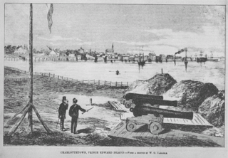
WFrancis Kelly, was a Canadian surveyor, business agent, farmer, and politician, noted for his long service as a member of the government of Prince Edward Island (PEI), and as an advocate for Catholic issues on PEI during the period of Canadian Confederation.
 W
WWilliam Frederick King was a Canadian surveyor, astronomer, and civil servant.
 W
WJames Joseph McArthur was a Canadian surveyor and mountaineer who was the first to climb several peaks in the Canadian Rocky Mountains. Two mountains and a lake are named after him, and he gave names to various other features. He was a pioneer in the use of photography for surveying, under the direction of the Surveyor General, Édouard-Gaston Deville. He did extensive work on surveying the borders between Canada and the United States in the Yukon and west of Lake Superior.
 W
WWilliam Ogilvie FRGS was a Canadian Dominion land surveyor, explorer and Commissioner of the Yukon Territory.
 W
WFrederick Page was a Canadian ice hockey administrator and ice hockey referee. He originated from Port Arthur, Ontario, where he played junior ice hockey, refereed locally and later at the Memorial Cup and Allan Cup competitions. He was a league executive in Fort William, then served as president of the Thunder Bay Amateur Hockey Association from 1958 to 1962. He was elected second vice president of the Canadian Amateur Hockey Association (CAHA) in 1962, and rose up the ranks to be its president from 1966 to 1968. Page wanted the CAHA to gain more control over its affairs, and become less dependent on the National Hockey League (NHL). Under his leadership, the NHL ended direct sponsorship of junior hockey teams. He was instrumental in negotiating the revised agreement for the NHL Amateur Draft in 1967, and later served as co-chairman of the resulting joint player development committee.
 W
WBenjamin William Pearse was a public servant for the colonies of Vancouver Island and of British Columbia. Pearse most notably served on the Executive Council, which served as the interim government in British Columbia after it joined the Dominion of Canada.
 W
WJoseph Despard Pemberton was a surveyor for the Hudson's Bay Company, Surveyor General for the Colony of Vancouver Island, a pre-Confederation politician, a businessman and a farmer. He was born in 1821 in Dublin, Ireland and died in 1893 in Oak Bay, British Columbia. Joseph Pemberton laid out Victoria's town site, southern Vancouver Island and townsites along the Fraser River. He married Teresa Jane Grautoff and they are the parents of Canadian painter Sophie Pemberton. The town of Pemberton was named after him.
 W
WFrank Cyril Swannell was one of British Columbia's most famous surveyors.
 W
WEugène-Étienne Taché, ISO was a French Canadian surveyor, civil engineer, illustrator and architect. He devised Quebec's provincial coat-of-arms and motto Je me souviens.
 W
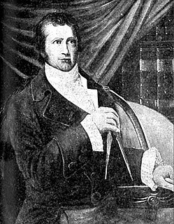
WDavid Thompson was a British-Canadian fur trader, surveyor, and cartographer, known to some native peoples as Koo-Koo-Sint or "the Stargazer". Over Thompson's career, he traveled some 90,000 kilometres (56,000 mi) across North America, mapping 4.9 million square kilometres of North America along the way. For this historic feat, Thompson has been described as the "greatest practical land geographer that the world has produced".
 W
WArthur Oliver Wheeler was born in Ireland and immigrated to Canada in 1876 at the age of 16. He became a land surveyor and surveyed large areas of western Canada, including photo-topographical surveys of the Selkirk Mountains and the British Columbia-Alberta boundary along the continental divide through the Canadian Rockies. In 1906, he and journalist Elizabeth Parker were the principal founders of the Alpine Club of Canada (ACC). He was its first president, from 1906 to 1910, and editor of the Canadian Alpine Journal from 1907 to 1930. He remained Honorary President of the ACC from 1926 until his death in 1945. The Arthur O. Wheeler hut of the ACC is named after him.