 W
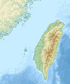
WPakua Plateau or Bagua Plateau, also known as the Pakua Mountain Range (八卦山脈), is a plateau located at the central-western Taiwan. It is stretching across Changhua County and Nantou County. The plateau faces the Changhua Plain on the west and Taichung Basin on the east. It is long and narrow, has a length of about 32 km, and a width of about 4 to 7 km. The highest peak of the plateau is the Mt. Hengshan, which has a height of 424m.
 W
WThe Chenyoulan River or Chenyulan River is a river in Nantou County, Taiwan. It is a tributary of the Zhuoshui River. Villages in the water shed include Dongpu and Fengqui. Its tributary streams are Junkeng, Shibachong, Shalixian, Heshe and Neimaopu Streams. The catchment area is 450 m2 and its length is 42.4 km. The average slope is 5%. The upper reaches drain the north slopes of Yushan up to 3910 metres elevation. The path of the river has been set by the Chenyulan fault.
 W
WThe Dadu River, also known by other names, is a river on Taiwan Island.
WDan Mountain or Danda Mountain is a mountain in Taiwan with an elevation of 3,340 m (10,960 ft).
WDongjun Mountain is a mountain in Xinyi Township, Nantou County, Taiwan with an elevation of 3,619 m (11,873 ft).
 W
WThe Pa-hsien Mountain, or Eight Immortals Mountain, is a mountain in Heping District, Taichung, Taiwan. It is a branch of Mount Yu. Its height is 2,448 metres, which is around 8,000 Taiwanese feet (台尺). The pronunciation of eight thousand (baqian) and eight immortals are similar in Chinese, hence the name.
 W
WMount Hehuan is a 3,416-metre-high (11,207 ft) mountain in Central Taiwan. The peak lies on the borders of Nantou and Hualien counties and is located within Taroko National Park. Hehuanshan is a popular destination in central Taiwan. The 3,421-metre east peak and 3,422-metre north peak of Hehuanshan are both higher than the main peak.
WThe Kashe River is a 47 km (29 mi) long river in Nantou County, central Taiwan. It is a tributary of the Zhuoshui River.
 W
WLalu Island is a small island in Sun Moon Lake, Yuchi Township, Nantou County, Taiwan. The island used to be much bigger, separating the lake into a part shaped like crescent moon and another part shaped like a round sun. When the island was still bigger, people lived on it; in fact, the locals called it "Pearl Mountain"(Chinese: 珠仔山 or 珠嶼) ever since the Ch'ing dynasty. Under Japanese rule, the island was renamed "Jade Island" , and in the 1930s, the Japanese built a dam that raised the water level in the lake and almost entirely flooded the island. After Chiang Kai-shek's Nationalist Government moved to Taiwan in 1949, the island was renamed Kwanghwa Island. In 1999 the island shrank as portions sank during the 921 earthquake, which also destroyed a wedding pavilion constructed by the local government in 1978.
WThe Mabolasi Mountain is a mountain in Taiwan. The peak is located in Xinyi Township, Nantou County, near the border of Hualien County. It is also known as the Wulameng Mountain.
 W
WThe Maoluo River is a tributary of the Wu River in Taiwan. It is the main tributary on the left bank of the Wu River. Originating from the Jialishan Range, it flows east of the Bagua Plateau through Nantou County, Changhua County, and Taichung City for 47 kilometers.
 W
WNenggao Mountain is a mountain in Taiwan. Its southern peak has an elevation of 3,349 metres (10,988 ft). The main peak has an elevation of 3,261 metres (10,699 ft).
 W
WPuli Basins is a group of several small basins located around the mountainous area of Nantou in the central Taiwan. It includes the Yuchih Basin (魚池盆地), Jihyuehtan Basin (日月潭盆地), Toushe Basin (頭社盆地), Chungkui Basin (銃櫃盆地), Lienhuachih Basin (蓮華池盆地) and, the largest one, Puli Basin (埔里盆地). Generally speaking, the term "Puli Basin" also means the whole group of basins.
 W
WThe Shimen Mountain is a mountain in Ren'ai Township, Nantou County and Xiulin Township, Hualien County of Taiwan.
 W
WSun Moon Lake is a lake in Yuchi Township, Nantou County, Taiwan. It is the largest body of water in Taiwan. The area around the lake is home to the Thao tribe, one of aboriginal tribes of Taiwan. Sun Moon Lake surrounds a tiny island called Lalu. The east side of the lake resembles a sun while the west side resembles a moon, hence the name.
 W
WTaichung Basin is located in the central region of western Taiwan. It occupies some parts of Taichung City, Nantou County and Changhua County. It faces the Choshui River on the south; the hill lands of Nantou on the east; Tatu Plateau on the northwest; and Pakua Plateau on the southwest. A notch connecting Taichung Basin to the seacoast of Taichung City is located between two plateaus.
 W
WWuling, formerly known as Sakuma Pass , is a mountain pass located in Ren'ai, Nantou, Taiwan, transversing the Central Mountain Range near the peak of Hehuanshan within Taroko National Park. It is the highest paved road in elevation in Taiwan.
 W
WYu Shan or Yushan, also known as Mount Jade, Jade Mountain, or Mount Yu, and known as Mount Niitaka during Japanese rule, is the highest mountain on Taiwan at 3,952 m (12,966 ft) above sea level, giving Taiwan the 4th-highest maximum elevation of any island in the world. It is the highest point in the western Pacific region outside of the Kamchatka Peninsula. Yushan and surrounding mountains belong to Yushan Range. The area was once in the ocean; it rose to its current height because of the Eurasian Plate's movement over the Philippine Sea Plate.
 W
WThe Yushan Range, formerly the Niitaka Range and also known as the Jade Mountain Range, is a mountain range in the central-southern region of Taiwan Island. It spans Chiayi County, Kaohsiung City, and Nantou County. It faces the Central Mountain Range on the east, and is separated by the Qishan River from the Alishan Range which is on the west of the Yushan Range. The Yushan Range is one of the five major ranges on Taiwan.
 W
WThe Zhuoshui River, also spelled Choshui or Jhuoshuei River, is the longest river in Taiwan. It flows from its source in Nantou County up to the western border of the county, subsequently forming the border between Yunlin County and Changhua County, with a total length of 186 km.