 W
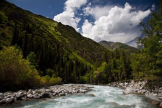
WThis list of rivers of Issyk Kul includes rivers draining into lake Issyk-Kul in Kyrgyzstan.. It is reported that the basin of Issyk-Kul encounter 1,976 river and streams with a total length of 7,139 km. Of them, 1,842 streams are shorter than 10 km with a total length of 4,241 km, and 106 streams range from 10 to 25 km in length totaling 1,708 km. There are 24 small rivers with length varying between 25 and 50 km, and 3 medium-size rivers with a total length of 217 km (4%). Finally, there is only one comparatively large Tyup river with a length of 120 km, which is 1% of total length. Overall, 118 streams and rivers flow into the lake.
 W
WThe Ak-Buura is a river in Kyrgyzstan and Uzbekistan. It flows through the city Osh, and discharges into the Shahrixonsoy, one of the canals of the Fergana Valley. The river is formed at the north slopes of Alai Mountains. The river is 148 kilometres (92 mi) long, and the watershed covers 2,530 square kilometres (980 sq mi). The long-term average discharge of the river at Tuleyken gauging post is 21.4 cubic metres per second (760 cu ft/s), high-water discharge (June–July) ranging from 50 cubic metres per second (1,800 cu ft/s) to 67 cubic metres per second (2,400 cu ft/s) and low-water discharge (January) from 5 cubic metres per second (180 cu ft/s) to 6 cubic metres per second (210 cu ft/s).
 W
WThe Ak-Suu or Aq-Suu is a river running through mostly Moskva District, Chuy Region, Kyrgyzstan and Shu District, Jambyl Region, Kazakhstan. It is 155 kilometres (96 mi) long, and has a drainage basin of 483 square kilometres (186 sq mi). It takes its rise on the northern slope of the Kyrgyz Ala-Too, and it runs through the Narzan Valley north into the Chuy Valley and through the city of Belovodskoye, which is named after it. It flows into the Chu in southern Kazakhstan.
 W
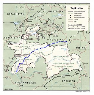
WThe Ak-Suu is a left tributary of the Syr Darya, flowing through Batken Province of Kyrgyzstan and Sughd Province of Tajikistan. The river is formed at the north slopes of Turkestan Range. It flows into the river Syr Darya near the town Nau in northern Tajikistan. The main settlements on the river are the village Ak-Suu in Kyrgyzstan and the town Nau in Tajikistan.
 W
WThe Aksu River is a transboundary river in the Xinjiang province in China and Ak-Suu District of Issyk Kul Province of Kyrgyzstan. In Kyrgyzstan it is known as the Saryjaz. The total length of the river is 282 kilometres (175 mi), of which 197 kilometres (122 mi) are in Kyrgyzstan. It has a drainage basin of 12,900 square kilometres (5,000 sq mi) in Kyrgyzstan. The Aksu is the only one of the Tarim's source rivers to run throughout the year.
 W
WThe Ala-Archa is a river flowing through Alamüdün District of Chuy Region of Kyrgyzstan. It rises on the northern slopes of Kyrgyz Ala-Too and flows north to enter the Chu River in Chuy Valley. The Ala-Archa is 78 kilometres (48 mi) long and has a basin area of 270 square kilometres (100 sq mi). Its water comes mostly from glaciers and snow.
 W
WThe Alamüdün or Alamedin river is a left tributary of the Chu in Northern Kyrgyzstan.
 W
WThe At-Bashy is a left tributary of the Naryn in Naryn Region of Kyrgyzstan. The river is formed at the north slope of Jangy-Jer Range by confluence of rivers Ulan and Jangy-Jer. It is 180 kilometres (110 mi) long, and has a drainage basin of 5,540 square kilometres (2,140 sq mi). Average altitude - 3,060 m, annual average flow rate - 33.1 m³/s, and average specific discharge - 5.98 l/s•km². Settlements located along the banks of the At-Bashy include: At-Bashy, Taldy-Suu, Bosogo.
 W
WThe Chalkuyruk is a river in Osh Region of Kyrgyzstan. It is a right tributary of the Ak-Buura.
 W
WThe Chatkal is a river of Jalal-Abad Region, Kyrgyzstan and Tashkent Region in Uzbekistan. It is the left source river of the Chirchiq in the Syr Darya basin.
 W
WThe Chong-Kemin is a river in Kemin District of Chuy Province of Kyrgyzstan. It is a right tributary of the Chu in the Boom Gorge.
 W
WThe Chu is a river in Northern Kyrgyzstan and Southern Kazakhstan. Of its total length of 1,067 kilometres (663 mi), the first 115 kilometres are in Kyrgyzstan, then for 221 kilometres the river is the border between Kyrgyzstan and Kazakhstan and the last 731 kilometres are in Kazakhstan. It is one of the longest rivers in Kyrgyzstan and in Kazakhstan. It has a drainage basin of 62,500 square kilometres (24,100 sq mi).
 W
WThe Great Fergana Canal is an irrigation canal located on the Fergana Valley between Uzbekistan and Tajikistan in Central Asia. The project was constructed in 1939 by 160,000 Uzbek and Tajik collective farm workers from the former Soviet Union and was completed in forty-five days. The canal is 270 kilometers long with over 1,000 hydrotechnical plants located along the waterway, 50 of which are known to be significantly important.
 W
WThe Joon Aryk is a river in Kochkor District of Naryn Province of Kyrgyzstan. It is formed by confluence of Kara-Kujur and Telek rivers. It is 34.8 kilometres (21.6 mi) long, and has a drainage basin of 1,340 square kilometres (520 sq mi). Average annual discharge - 11.4 cubic meters per second. The Chu is formed by the confluence of Kochkor and Joon Aryk near the village Kochkor.
 W
WThe Kara Darya or Qaradaryo is a tributary of the Syr Darya in Kyrgyzstan and eastern Uzbekistan. The river is formed by the confluence of the rivers Kara-Kulja and Tar. Its length is 177 kilometres (110 mi), and watershed area 30,100 square kilometres (11,600 sq mi). The upper Kara Darya flows northwest across eastern Osh Region southwest of and parallel to the Fergana Range. It enters the Ferghana Valley and Uzbek territory a few kilometres west of Uzgen at Andijan Dam. The lower course is through the Fergana Valley, where it is used for irrigation. In the Fergana Valley its confluence with the Naryn River forms the Syr Darya, the second largest river of Central Asia. There are several dams on the river.
 W
WThe Naryn rises in the Tian Shan mountains in Kyrgyzstan, Central Asia, flowing west through the Fergana Valley into Uzbekistan. Here it merges with the Kara Darya to form the Syr Darya. It is 807 kilometres (501 mi) long and its basin area is 59,100 square kilometres (22,800 sq mi). It has an annual flow of 13.7 cubic kilometres (11,100,000 acre⋅ft).
 W
WThe Talas is a river that rises in the Talas Region of Kyrgyzstan and flows west into Kazakhstan. It is formed from the confluence of the Karakol and Uch-Koshoy. It runs through the city of Taraz in Zhambyl Province of Kazakhstan and vanishes in the Muyunkum Desert before reaching Lake Aydyn. The river is 661 kilometres (411 mi) long and has a basin area of 52,700 square kilometres (20,300 sq mi).
WThe Toshkan is a river in the Tien Shan mountains in the border area between China and Kyrgyzstan. It is 345 kilometres (214 mi) long, and has a drainage basin of 8,270 square kilometres (3,190 sq mi) in Kyrgyzstan. The Toshkan has its sources in the mountains south of the Kyrgyzstani city of Naryn. It then flows towards the east and into the Xinjiang province of China. It continues east, running parallel to the Tien Shan mountains, until its confluence with the Aksu River near the city Aksu. The Toshkan is the largest tributary of the Aksu.
 W
WThe Vakhsh (River), also known as the Surkhob, in north-central Tajikistan, and the Kyzyl-Suu, in Kyrgyzstan, is a Central Asian river, and one of the main rivers of Tajikistan. It is a tributary of the Amu Darya river.
 W
WThe Ysyk-Ata is a river in Ysyk-Ata District of Chuy Region of Kyrgyzstan. It is a left tributary of the Chu. It is 81 kilometres (50 mi) long, and has a drainage basin of 58 square kilometres (22 sq mi), weighted average elevation - 3030 m, annual average flow rate - 7.05 m3/s.