 W
WThe Broken Ridge or Broken Plateau is an oceanic plateau in the south-eastern Indian Ocean. The Broken Ridge once formed a large igneous province (LIP) together with the Kerguelen Plateau. When Australia and Antarctica started to separate, the Broken Ridge and the Kerguelen Plateau got separated by the Southeast Indian Ridge. Alkalic basalt from the Broken Ridge has been dated to 95 Ma.
 W
WThe Casma Group is a stratigraphic group of Cretaceous sedimentary formations exposed along the coast and within the Cordillera Occidental near Casma, Peru.
 W
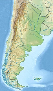
WThe Chon Aike Formation is an extensive geological formation, present in the Deseado Massif in north-central Santa Cruz Province, Patagonia, Argentina. It covers an area of approximately 100,000 square kilometres (39,000 sq mi) and consists of rhyolitic volcanic rocks, particularly ignimbrites and lavas, with smaller amounts of agglomerates and tuffs. Within dacitic rocks, plant fossils have been found.
 W
WThe Coast Range Arc was a large volcanic arc system, extending from northern Washington through British Columbia and the Alaska Panhandle to southwestern Yukon. The Coast Range Arc lies along the western margin of the North American Plate in the Pacific Northwest of western North America. Although taking its name from the Coast Mountains, this term is a geologic grouping rather than a geographic one, and the Coast Range Arc extended south into the High Cascades of the Cascade Range, past the Fraser River which is the northward limit of the Cascade Range proper.
 W
WThe Crowsnest Formation, also called the Crowsnest Volcanics, is a geological formation in southwestern Alberta, Canada, on the southwestern margin of the Western Canada Sedimentary Basin. It was named for the Crowsnest Pass near Coleman, Alberta. The formation consists mostly of pyroclastic rocks that were laid down in a series of explosive eruptions about 100 million years ago during the Albian stage of the Early Cretaceous epoch. It contains unusual minerals such as melanite and analcime.
 W
WThe Deccan Traps is a large igneous province of west-central India. They are one of the largest volcanic features on Earth. They consist of multiple layers of solidified flood basalt that together are more than 2,000 m (6,600 ft) thick, cover an area of c. 500,000 km2 (200,000 sq mi), and have a volume of c. 1,000,000 km3 (200,000 cu mi). Originally, the Deccan Traps may have covered c. 1,500,000 km2 (600,000 sq mi), with a correspondingly larger original volume.
 W
WThe Divisadero Group is a group of geological formations in the Magallanes Basin (Chile) or Austral Basin (Argentina) of northwestern Patagonia. It overlies the Coihaique Group. The group is chiefly made up of pyroclastic rocks and lavas of the calc-alkaline magma series. Rocks are of andesite and rhyolite composition.
 W
WGeologists Seamounts are seamounts in the Pacific Ocean, 100 miles (160 km) south of Honolulu, Hawaii and 100–200 kilometres (62–124 mi) southwest from Big Island. Clockwise from north they are named Perret, Jaggar, McCall, Pensacola, Daly, Swordfish, Cross, Washington and Ellis. The seamounts developed during the Cretaceous, about 80 million years ago, and there is no geological relationship to the neighbouring Hawaiian Islands although there may be one to the Musicians Seamounts.
 W
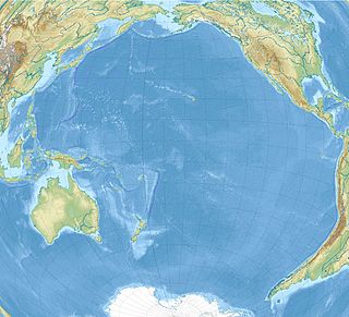
WThe Hawaiian–Emperor seamount chain is a mostly undersea mountain range in the Pacific Ocean that reaches above sea level in Hawaii. It is composed of the Hawaiian ridge, consisting of the islands of the Hawaiian chain northwest to Kure Atoll, and the Emperor Seamounts: together they form a vast underwater mountain region of islands and intervening seamounts, atolls, shallows, banks and reefs along a line trending southeast to northwest beneath the northern Pacific Ocean. The seamount chain, containing over 80 identified undersea volcanoes, stretches about 6,200 kilometres (3,900 mi) from the Aleutian Trench in the far northwest Pacific to the Loʻihi seamount, the youngest volcano in the chain, which lies about 35 kilometres (22 mi) southeast of the Island of Hawaiʻi.
 W
WThe Insular Islands were a giant chain of active volcanic islands somewhere in the Pacific Ocean during the Cretaceous period that rode on top a microplate called the Insular Plate, beginning around 130 million years ago. The Insular Islands were surrounded by two prehistoric oceans, the Panthalassa Ocean to the west and the Bridge River Ocean to the east. About 115 million years ago, these islands collided with the North American continent, fusing onto the North American Plate and closing the Bridge River Ocean during the Mid-Cretaceous time.
 W
WThe Kerguelen Plateau, also known as the Kerguelen–Heard Plateau, is an oceanic plateau and a large igneous province (LIP) located on the Antarctic Plate, in the southern Indian Ocean. It is about 3,000 km (1,900 mi) to the southwest of Australia and is nearly three times the size of Japan. The plateau extends for more than 2,200 km (1,400 mi) in a northwest–southeast direction and lies in deep water.
 W
WThe Manihiki Plateau is an oceanic plateau in the south-west Pacific Ocean. The Manihiki Plateau was formed by volcanic activity 125 to 120 million years ago during the mid-Cretaceous period at a triple junction plate boundary called the Tongareva triple junction. 125 million years ago the Manihiki Plateau formed part of the giant Ontong Java-Manihiki-Hikurangi plateau.
 W
WThe Monteregian Hills is a linear chain of isolated hills in Montreal and Montérégie, between the Laurentians and the Appalachians.
 W
WMusicians Seamounts are a chain of seamounts in the Pacific Ocean, north of the Hawaiian Ridge. There are about 65 seamounts, some of which are named after musicians. These seamounts exist in two chains, one of which has been attributed to a probably now-extinct hotspot called the Euterpe hotspot. Others may have formed in response to plate tectonics associated with the boundary between the Pacific Plate and the former Farallon Plate.
 W
WThe Ontong Java Plateau (OJP) is a huge oceanic plateau located in the southwestern Pacific Ocean, north of the Solomon Islands. The OJP was emplaced around 120 million years ago (Ma) with a much smaller volcanic event around 90 Ma. Two other southwestern Pacific plateaus, Manihiki and Hikurangi, now separated from the OJP by Cretaceous oceanic basins, are of similar age and composition and probably formed as a single plateau and a contiguous large igneous province together with the OJP. When emplaced this Ontong Java–Manihiki–Hikurangi plateau covered 1% of Earth's surface and represented a volume of 80 million km3 (19 million cu mi) of basaltic magma. This "Ontong Java event", first proposed in 1991, represents the largest volcanic event of the past 200 million years, with a magma emplacement rate estimated at up to 22 km3 (5.3 cu mi) per year over 3 million years, several times larger than the Deccan Traps. The smooth surface of the OJP is punctuated by seamounts such as the Ontong Java Atoll, one of the largest atolls in the world.
 W
WThe Paraná-Etendeka traps (or Paraná and Etendeka Plateau; or Paraná and Etendeka Province) comprise a large igneous province that includes both the main Paraná traps (in Paraná Basin, a South American geological basin) as well as the smaller severed portions of the flood basalts at the Etendeka traps (in northwest Namibia and southwest Angola). The original basalt flows occurred 138 to 128 million years ago. The province had a post-flow surface area of 1,500,000 square kilometres (580,000 sq mi) and an original volume projected to be in excess of 2.3 x 10⁶ km³.
 W
WThe Rajmahal Traps is a volcanic igneous province in Eastern India, covering the parts of Jharkhand, West Bengal and Meghalaya. The Rajmahal Hills of Jharkhand is the type area of this province. Multiple layers of solidified lava made the 608-metre-thick (1,995 ft) Rajmahal Traps which are dipping 2–5° towards the north-east. Individual layers vary in thickness from less than one metre to more than 70 metres (230 ft).
 W
WMont Saint-Hilaire, is an isolated hill, 414 m (1,358 ft) high, in the Montérégie region of southern Quebec. It is about thirty kilometres east of Montreal, and immediately east of the Richelieu River. It is one of the Monteregian Hills. Around the mountains are the towns of Mont-Saint-Hilaire and Saint-Jean-Baptiste. Other nearby towns include Otterburn Park, Beloeil and McMasterville.
 W
WThe Sverdrup Basin Magmatic Province is a large igneous province located on Axel Heiberg Island and Ellesmere Island, Nunavut, Canada near the rifted margin of the Arctic Ocean at the end of Alpha Ridge.
 W
WWhistler Mountain is a mountain in the Fitzsimmons Range of the Pacific Ranges of the Coast Mountains, located on the northwestern edge of Garibaldi Provincial Park. It is the location of the Whistler-Blackcomb ski resort and the town of Whistler, British Columbia.
 W
WWolf Rock Lighthouse is on the Wolf Rock, a single rock located 18 nautical miles east of St Mary's, Isles of Scilly and 8 nautical miles southwest of Land's End, in Cornwall, England. The fissures in the rock produce a howling sound in gales, hence the name.
 W
WThe Yellowstone hotspot is a volcanic hotspot in the United States responsible for large scale volcanism in Idaho, Montana, Nevada, Oregon, and Wyoming as the North American tectonic plate moved over it. It formed the eastern Snake River Plain through a succession of caldera-forming eruptions. The resulting calderas include the Island Park Caldera, the Henry's Fork Caldera, and the Bruneau-Jarbidge caldera. The hotspot currently lies under the Yellowstone Caldera. The hotspot's most recent caldera-forming supereruption, known as the Lava Creek eruption, took place 640,000 years ago and created the Lava Creek Tuff, and the most recent Yellowstone Caldera. The Yellowstone hotspot is one of a few volcanic hotspots underlying the North American tectonic plate; another example is the Anahim hotspot.