 W
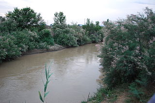
WThe Archeda is a river in Volgograd Oblast, Russia. It is a left tributary of the Medveditsa, and is 162 kilometres (101 mi) long, with a drainage basin of 2,050 square kilometres (790 sq mi). The Archeda begins in the southwestern part of the Volga Uplands. Most of its water are from melting snow, and during periods of low water the river dries up entirely in its upper and middle flow. The town of Frolovo lies along the Archeda.
 W
WBalanda is a river in Volgograd and Saratov Oblasts in Russia, a right tributary of the Medveditsa (a tributary of the Don. It is 164 kilometres long, with a drainage basin of 1,900 square kilometres.
 W
WThe Bityug is a river in Voronezh Oblast, Russia, a left tributary of the Don. Its upper reaches are located in Tambov Oblast. The Bityug is 379 kilometres (235 mi) long, with a basin of 8,840 square kilometres (3,410 sq mi). There are more than 400 lakes in the Bityug basin. The river freezes up in mid-December and stays icebound until late March or early April.
 W
WThe Bystraya Sosna is a river in Oryol and Lipetsk oblasts in Russia. It is a right tributary of the Don, and it is 296 kilometres (184 mi) long, with a drainage basin of 17,400 square kilometres (6,700 sq mi). The river is usually frozen over from the end of November until the end of March.
 W
WThe Chir is a river in Rostov and Volgograd oblasts of Russia. It is a right tributary of the Don, and is 317 kilometres (197 mi) long, with a drainage basin of 9,580 square kilometres (3,700 sq mi).
 W
WThe Seversky Donets, Siverskyi Donets, usually simply called the Donets, is a river on the south of the East European Plain. It originates in the Central Russian Upland, north of Belgorod, flows south-east through Ukraine and then again through Russia to join the Don River, about 100 km (62 mi) from the Sea of Azov. The Donets is the fourth longest river in Ukraine and the biggest in the Eastern Ukraine. It is an important source of fresh water in the east of the country. It gives its name to the Donets Basin, known commonly as the Donbass, an important coal mining region in Ukraine.
 W
WGoluboy Dunay River is a river in Voronezh Oblast of Russia. It is a left tributary of the Don River. The Goluboy Dunay is 12 kilometres (7 mi) long. It flows over the north-western part of Voronezh. Most of the river's waters are from melting snow.
 W
WThe Ilovlya is a river in Saratov and Volgograd Oblasts of Russia. It is a left tributary of the Don, and is 358 kilometres (222 mi) long, with a drainage basin of 9,250 square kilometres (3,570 sq mi).
 W
WThe Kalaus is a north-flowing river on the Black Sea-Caspian Steppe of southern Russia, in Stavropol Krai. It is 436 kilometres (271 mi) long, and has a drainage basin of 9,700 square kilometres (3,700 sq mi). It is a tributary of the Manych. Formerly, when it reached the Manych, part of its waters would flow east and part west. Today a low dam blocks flow into the East Manych.
 W
WThe Khava is a river in the Voronezh Oblast in Russia. It is a left tributary of the river Usman. It is 97 kilometres (60 mi) long, and has a drainage basin of 1,460 square kilometres (560 sq mi).
 W
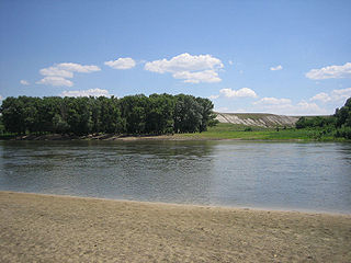
WThe Khopyor is a river in European Russia, the biggest left tributary of the river Don. It is 979 kilometres (608 mi) long, with a watershed of 61,100 square kilometres (23,600 sq mi). The mouth width is 300 metres (980 ft). The Khopyor is navigable up to 323 kilometres (201 mi) from the mouth. The maximum discharge is 3,720 cubic metres per second (131,000 cu ft/s); the average discharge is 150 cubic metres per second (5,300 cu ft/s), and the minimum discharge is 45 cubic metres per second (1,600 cu ft/s).
 W
WKrasivaya Mecha is a river in Tula and Lipetsk oblasts in Russia. It is a right tributary of the Don, and is 244 kilometres (152 mi) long, with a drainage basin of 6,000 square kilometres (2,300 sq mi). The river freezes over in late November and is icebound until early April.
 W
WThe Livenka is a river in Oryol Oblast, Russia. It is a left tributary of the Bystraya Sosna. It is 32 kilometres (20 mi) long, and has a drainage basin of 318 square kilometres (123 sq mi). The river usually freezes over from the end of November until the end of March.
 W
WThe Manych is a river in the Black Sea–Caspian Steppe of Southern Russia. It flows through the western and central part of the Kuma–Manych Depression. In ancient times, it was known as the Lik.
 W
WThe Matyra is a river in the Tambov and Lipetsk oblasts of Russia. It is a left tributary of the river Voronezh. It has a length of 180 kilometres (110 mi) and a drainage basin of 5,180 square kilometres (2,000 sq mi). The average discharge 39 kilometres (24 mi) from its mouth is 11.7 cubic metres per second (410 cu ft/s). The town of Gryazi is along the Matyra.
 W
WThe Medveditsa is a river in Volgograd and Saratov Oblasts in Russia, a left tributary of the Don. The name means she-bear, and according to legend alludes to the large population of bears in the area in earlier times. It is 745 kilometres (463 mi) long, with a drainage basin of 34,700 square kilometres (13,400 sq mi).
 W
WThe Osered is a river in Voronezh Oblast in Russia. It is a tributary of the Don. It has a total length of 89 km (55 mi) and a drainage area of 2,420 km2 (930 sq mi).
 W
WThe Temernik is a small river in Rostov Oblast of Russia. It is a right tributary of the Don, and is 33 km long, with a drainage basin of 293 km². Temernik is very polluted.
 W
WTikhaya Sosna is a river in Belgorod and Voronezh oblasts of Russia. It is a right tributary of the river Don. It is 161 kilometres (100 mi) long, with a drainage basin of 4,350 square kilometres (1,680 sq mi).
 W
WThe Usman is a river in the Voronezh and Lipetsk oblasts of Russia. It is a left tributary of the river Voronezh, and is 151 kilometres (94 mi) long, with a drainage basin of 2,840 square kilometres (1,100 sq mi). The Usman is home to diverse species of aquatic life.
 W
WThe Veduga is a right tributary of the river Don, flowing through the northwestern corner of Voronezh Oblast in Russia. It is 94 kilometres (58 mi) long, and has a drainage basin of 1,570 square kilometres (610 sq mi). It is meandering, never wider than 15 metres (49 ft), and never deeper than 3 metres (10 ft). There are settlements almost continuously along its banks; the nearest large town is Semiluki.
 W
WThe Voronezh, also romanized as Voronež, is a river in Tambov, Lipetsk, and Voronezh oblasts in Russia, a left tributary of the Don. The Voronezh is 342 kilometres (213 mi) long, with a drainage basin of 21,600 square kilometres (8,300 sq mi). It freezes up in the first half of December and stays under the ice until late March. The lower reaches of the river are navigable. The cities of Lipetsk and Voronezh are along the Voronezh River.
 W
WThe Yegorlyk is a north-flowing river on the Black Sea-Caspian Steppe of southern Russia, a left tributary of the Manych. It is 448 kilometres (278 mi) long, and has a drainage basin of 15,000 square kilometres (5,800 sq mi). Since the Manych flows into the Don it is the southernmost tributary of the Don, if one excludes the Kalaus.