 W
WSuperior National Forest, part of the United States National Forest system, is located in the Arrowhead Region of the state of Minnesota between the Canada–United States border and the north shore of Lake Superior. The area is part of the greater Boundary Waters region along the border of Minnesota and the Canadian province of Ontario, a historic and important thoroughfare in the fur trading and exploring days of New France and British North America.
 W
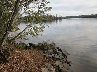
WAnderson Lake is a 28-acre lake in Cook County, Minnesota which is tributary to the Poplar River. It consists of a western lobe of 15 acres and an eastern lobe of 13 acres. Anderson Lake should not be confused with the Anderson Lake which is tributary to the Temperance River and lies slightly more than one mile northwest.
WBouder Lake is a 136-acre lake in Cook County, Minnesota which is tributary to the Poplar River. Bouder Lake reaches a maximum depth of 17 feet (5.2m). Bouder is accessible through a navigable channel leading into Crescent Lake. A fisheries survey turned up populations of walleye, muskellunge, smallmouth bass, yellow perch, and white suckers. An aquatic plants survey found the lake to be home to several species of water marigolds, pondweed, bladderwort, water lily, burreed, sedges, and cattails.
 W
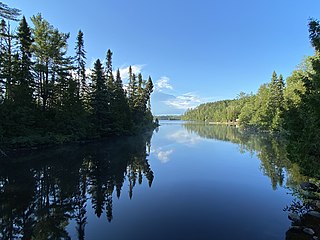
WThe Boundary Waters Canoe Area Wilderness, is a 1,090,000-acre (4,400 km2) wilderness area within the Superior National Forest in northeastern part of the US state of Minnesota under the administration of the U.S. Forest Service. A mixture of forests, glacial lakes, and streams, the BWCAW's preservation as a primitive wilderness began in the 1900s and culminated in the Boundary Waters Canoe Area Wilderness Act of 1978. It is a popular destination for canoeing, hiking, and fishing, and is one of the most visited wildernesses in the United States.
WBulge Lake is a 12-acre lake in Cook County, Minnesota which is tributary to the Poplar River. Bulge Lake reaches a maximum depth of 19 feet in a sudden depression just west of the mouth of the stream leading to Dogtrot Lake. Bulge lake is accessible through portages to Silver Lake and Dogtrot Lake. A fisheries survey turned up populations of walleye, northern pike, yellow perch, and white suckers.
 W
WCanoe Country Outfitters was formed in 1946 in Ely, Minnesota, to provide canoe trip outfitting services for Quetico Provincial Park and Superior National Forest and what was to become Boundary Waters Canoe Area Wilderness (BWCAW). Bill Rom started the business and then sold it to Bob Olson Sr. in 1975. At times they have been dubbed to be the largest canoe outfitter in the world. They operate from two locations, one in downtown Ely, Minnesota, the other on Moose lake, about 20 miles east of Ely.
WCorny Lake is an 11-acre lake in Cook County, Minnesota which is tributary to the Poplar River.
 W
WCrescent Lake is a lake located in Tofte Township and Lutsen Township, Cook County, Minnesota.
WDogtrot Lake is a 15-acre lake in Cook County, Minnesota which is tributary to the Poplar River. Dogtrot Lake reaches a maximum depth of 24 feet in a depression just south of the mouth of the stream leading to Slip Lake. Dogtrot lake is accessible through portages to Bulge Lake and Slip Lake. A fisheries survey turned up populations of walleye, northern pike, yellow perch, and white suckers.
 W
WEagle Mountain is the highest natural point in Minnesota, United States, at 2,301 feet (701 m). It is in northern Cook County, in the Boundary Waters Canoe Area Wilderness and Superior National Forest in the Misquah Hills, northwest of Grand Marais. It is a Minnesota State Historic Site.
 W
WThe Hegman Lake Pictographs are a well-preserved example of a Native American pictograph, located on North Hegman Lake in the Boundary Waters Canoe Area Wilderness in Minnesota, USA. The rock art is considered "Perhaps the most visited and photogenic pictograph within the State of Minnesota." The rock wall overlooking the lake has a panel of images as described below.
 W
WHeight of Land Portage is a portage along the historic Boundary Waters route between Canada and the United States. Located at the border of the Canadian province of Ontario and the U.S. state of Minnesota, the path is a relatively easy crossing of the Laurentian Divide separating the watersheds of the Atlantic and Arctic oceans.
WIowa Lake is a 30-acre lake in Cook County, Minnesota which is tributary to the Poplar River. It has a maximum depth of 13 feet and is clear down to 7 feet. Water access is provided by a portage trail leading to its northeast shore. The lake is fed primarily by a stream on its northwest shore, with secondary intake coming from a pond of less than 100 feet to the north and an intermittent stream located to the south of the portage trail. Its outlet, on the south, empties into Corny Lake through a wetland area. A 1972 survey by Minnesota's DNR indicated the presence of a beaver lodge on the south outlet, and multiple beaver dams along the course of the creek have converted patches of the marsh into open water. A 1971 survey by the fisheries department indicated the lake was home to populations of northern pike, white sucker, and yellow perch.
WLichen Lake is a 276-acre lake in Cook County, Minnesota which is tributary to the Poplar River. It sits 1781 feet above sea level. Lichen Lake previously also went by the name Beaver Lake, but was formally affirmed in the present name in 1959 by the United States Board on Geographic Names.
WManymoon Lake is a 24-acre lake in Cook County, Minnesota belonging to the Poplar River watershed. At its deepest point it measures only 6.5 feet deep and has abundant aquatic plant life to a depth of 2.5 feet. Water clarity as of 2008 measured 1.41 meters. The substrate consists of muck and stones of no uniform size. Manymoon lake has neither inlet nor permanent outlet, although an intermittent stream feeds a wetland on the end of the southeastern bay. Nonetheless, Manymoon is located in the sub-watershed dominated by Rice Lake to the north, and water from Manymoon enters into lower portions of the Poplar River through Rice Lake's outflow. Manymoon is accessible through a portage off Rice Lake Road.
 W
WThe Misquah Hills are a range of mountains in northeastern Minnesota, in the United States. They are located in or near the Boundary Waters Canoe Area Wilderness within Superior National Forest. Eagle Mountain, the highest point in Minnesota at 2,301 feet, is considered to be part of the Misquah Hills.
 W
WThe Paulson Mine is a former iron ore mine located in Cook County, Minnesota, United States, 53 kilometres north-west of Grand Marais, Minnesota near the end of the historic Gunflint Trail. The Port Arthur, Duluth and Western Railway was built to the mine in 1892 to access the ore, but both the mine and railway failed.
WSaganaga Lake is a large lake on the Minnesota – Ontario international border. It is protected by the Boundary Waters Canoe Area Wilderness in the United States and by Quetico Provincial Park and La Verendrye Provincial Park in Canada.
 W
WSawbill Lake is a lake in Cook County, Minnesota. The closest town to Sawbill Lake is Tofte. It is a popular entry point to the Boundary Waters Canoe Area Wilderness in the Superior National Forest. Sawbill is a nickname of the common merganser duck. There is a United States Forest Service cabin, a canoe outfitter, and a campground located at the southern end of the lake. During the Great Depression there was a Civilian Conservation Corps camp six miles south of the lake.
WScreech Lake is a 16-acre lake in Cook County, Minnesota, which is tributary to the Poplar River. Water clarity surveys performed by the University of Minnesota indicated Screech Lake had a visibility of 1.36 meters in 2008, although earlier surveys have yielded values of nearly 5 meters.
WSilver Lake is a 22-acre lake in Cook County, Minnesota which is tributary to the Poplar River. Silver Lake is six feet deep and has clarity down to 4.5 feet. It has one inflow from Bulge Lake, and drains into Rice Lake South of the inflow on the northwest shore, most of the west shore is a brush bog. Silver Lake has a shoreline of 1.1 miles.
WSlip Lake is a 22-acre lake in Cook County, Minnesota which is tributary to the Poplar River. Slip Lake reaches a maximum depth of 18 feet in a depression just south of the mouth of the stream leading to Fleck Lake. Slip Lake is accessible through portages to Dogtrot Lake and Fleck Lake. A fisheries survey turned up populations of walleye, northern pike, yellow perch, and white suckers.
WTack Lake is a 16-acre lake in Cook County, Minnesota which is tributary to the Poplar River through Rice Lake. Water clarity surveys performed by the University of Minnesota indicated Tack Lake had a visibility of 2.48 meters in 2008.
 W
WThe Temperance River is a 39.2-mile-long (63.1 km) river in northern Minnesota, the United States. It drains into Lake Superior along its north shore just south of Tofte. It flows out of Brule Lake in Cook County generally south towards its mouth within Temperance River State Park. Its name is supposedly a pun on its lack of a sand bar.