 W
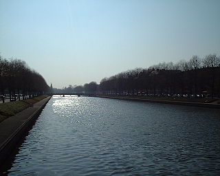
WThe river Arques is a watercourse located in the Seine-Maritime département of the Normandy region of north-western France. Only 6 kilometres in length, the river is formed by the confluence of three rivers at Arques-la-Bataille: the Eaulne, the Béthune and the Varenne which drain the pays de Caux and the pays de Bray. The Béthune is also considered the upper part of the Arques, which is then 67 km (42 mi) long. The last part of its course takes it past the industrial zone of Rouxmesnil-Bouteilles and it then forms the waters of the port of Dieppe.
 W
WThe Authie is a river in northern France whose 108-kilometre (67 mi) course crosses the departement of the Pas-de-Calais and the Somme. Its source is near the village of Coigneux. It flows through the towns of Doullens, Auxi-le-Château, Nempont-Saint-Firmin and Nampont, finally flowing out into the Channel near Berck.
 W
WThe Bresle is a river in the northwest of France that flows into the English Channel at Le Tréport. It crosses the departements of Oise, Somme and Seine-Maritime. It is 68.1 km (42.3 mi) long.
 W
WThe river Canche is one of the rivers that flow from the plateau of southern Boulonnais and Picardy, into the English Channel, of which the Somme is the largest example. It is 100.2 km (62.3 mi) long. The basin of the Canche extends to 1,274 square kilometres (492 sq mi) and lies in the south of the département of Pas-de-Calais. Forming an alluvial valley from 1 to 2 kilometres wide, the Canche valley also contains marshes, meadows and small woods. The gentle gradient, averaging 1.5 percent, gives the river a meandering course.
 W
WThe Couesnon is a river running from the département of Mayenne in north-western France, forming an estuary at Mont Saint-Michel. It is 97.8 km (60.8 mi) long, and its drainage basin is 1,124 km2 (434 sq mi). Its final stretch forms the border between the historical duchies of Normandy and Brittany. Its historically irregular course, alternating between two beds on the north and south of the Mont Saint-Michel but eventually definitely settling to the south bed, inspired the saying "The Couesnon in its madness placed the Mont in Normandy", as the Mont is just to the Norman side of the river's current mouth. However, the administrative boundary separating the two regions does not depend on the course of the river, and is about six kilometers west of the Mont.
 W
WThe Dives is a 105 km long river in the Pays d'Auge, Normandy, France. It flows into the English Channel in Cabourg.
 W
WThe Douve or Ouve is a river, 78.6 km (48.8 mi) in length, which rises in the commune of Tollevast, near Cherbourg in the department of Manche. Ouve is considered its old name : Ouve appears to have been misspelled over the course of time as "Douve river" and then as "River of the Douve". The French name for this watercourse is la Douve.
 W
WThe river Durdent is one of the many small coastal rivers that flow from the plateau of the Pays de Caux into the English Channel. It is 25.4 km (15.8 mi) long.
 W
WThe Gouët is a French river, located in the department of Côtes-d'Armor, in the region of Brittany, which drains into the English Channel.
 W
WThe Liane is a 38 km long river in the Pas-de-Calais department in northern France. It rises in Quesques and flows into the English Channel at Boulogne-sur-Mer. Other communes along its length include: Selles, Brunembert, Bournonville, Alincthun, Crémarest, Wirwignes, Questrecques, Samer, Carly, Hesdigneul-lès-Boulogne, Isques, Saint-Léonard, Hesdin-l'Abbé, Condette, Saint-Étienne-au-Mont, and Outreau.
 W
WThe Orne is a river in Normandy, within northwestern France. It is 170 km (110 mi) long. It discharges into the English Channel at the port of Ouistreham. Its source is in Aunou-sur-Orne, east of Sées. Its main tributaries are the Odon and the Rouvre.
 W
WThe Saâne is a river of Normandy, France, 40 kilometres (25 mi) in length, flowing through the department of Seine-Maritime.
 W
WThe Scie is a river that flows from the plateau of the southern Pays de Caux in the Seine-Maritime département of Normandy into the English Channel. It is 38 km (24 mi) long.
 W
WThe Sée is a 79 km long river in the Manche department, Normandy, France, beginning near Sourdeval. It empties into the bay of Mont Saint-Michel in Avranches, close to the mouth of the Sélune river. Another town along the Sée is Brécey.
 W
WThe Sélune is an 85 km long river in the Manche department, Normandy, France, beginning near Saint-Cyr-du-Bailleul. It empties into the bay of Mont Saint-Michel near Avranches, close to the mouth of the Sée river. Other towns along the Sélune are Barenton, Saint-Hilaire-du-Harcouët and Ducey.
 W
WThe Seulles is a river in Normandy, France. Its tributaries include the Mue. It is 71.7 km (44.6 mi) long.
 W
WThe Slack is a 22-kilometre-long (14 mi) coastal river in the Pas-de-Calais department, in northern France.
 W
WThe Thar is a small river of France, in the administrative region Normandie, département de la Manche. It is 24.8 km (15 mi) long, rising to the east of La Haye-Pesnel and emptying into the Bay of Mont Saint-Michel, in the English Channel.
 W
WThe Touques is a small 108-kilometre-long (67 mi) coastal river in Pays d'Auge in Normandy, France. The Touques is officially navigable up to the Pont des Belges, 800 m (2,600 ft) from its estuary. Its source is in the Perche hills, south of Gacé. The river runs northwards, and flows into the English Channel between the communes of Deauville and Trouville-sur-Mer in North-Western Calvados. Two ports, the Port of Trouville-sur-Mer and Port of Deauville are situated on the river mouth opposite each other.
 W
WThe river Valmont is one of the small rivers that flow from the plateau of the Pays de Caux into the English Channel. It is 13.8 km (8.6 mi) long.
 W
WThe Vire is a river in Normandy, France whose 128 km (80 mi) course crosses the départements of Calvados and Manche, flowing through the towns of Vire, Saint-Lô and Isigny-sur-Mer, finally flowing out into the English Channel. Its main tributaries are the Aure, the Elle and the Souleuvre.
 W
WThe Yères is a river of Normandy, France, 40 kilometres (25 mi) in length, flowing through the department of Seine-Maritime.
 W
WThe Leff is a river in Brittany, France. It is 62.4 km (38.8 mi) long. It flows into the Trieux near Pontrieux.
 W
WThe Merderet is a 36.4-kilometre-long (22.6-mile) river in Normandy, France which is tributary to the river Douve. It runs roughly north-south down the middle of the Cotentin peninsula from Valognes to the junction with the Douve at Beuzeville la Bastille.
 W
WThe Rance is a river of northwestern France. It is 103.6 km (64.4 mi) long. It flows into the English Channel between Dinard and Saint-Malo.
 W
WThe Trieux is a 72-kilometre-long (45 mi) river in the Côtes-d'Armor department, Brittany, France, beginning near Kerpert. It empties into the English Channel near Lézardrieux. Other towns along the Trieux are Guingamp and Pontrieux. Its longest tributary is the Leff.