 W
WThe Amundsen Sea, an arm of the Southern Ocean off Marie Byrd Land in western Antarctica, lies between Cape Flying Fish to the east and Cape Dart on Siple Island to the west. Cape Flying Fish marks the boundary between the Amundsen Sea and the Bellingshausen Sea. West of Cape Dart there is no named marginal sea of the Southern Ocean between the Amundsen and Ross Seas. The Norwegian expedition of 1928–1929 under Captain Nils Larsen named the body of water for the Norwegian polar explorer Roald Amundsen while exploring this area in February 1929.
 W
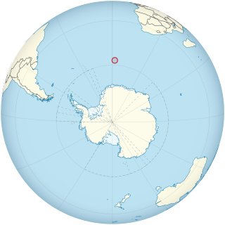
WThe Antarctic is a polar region around the Earth's South Pole, opposite the Arctic region around the North Pole. The Antarctic comprises the continent of Antarctica, the Kerguelen Plateau and other island territories located on the Antarctic Plate or south of the Antarctic Convergence. The Antarctic region includes the ice shelves, waters, and all the island territories in the Southern Ocean situated south of the Antarctic Convergence, a zone approximately 32 to 48 km wide varying in latitude seasonally. The region covers some 20 percent of the Southern Hemisphere, of which 5.5 percent is the surface area of the Antarctic continent itself. All of the land and ice shelves south of 60°S latitude are administered under the Antarctic Treaty System. Biogeographically, the Antarctic realm is one of eight biogeographic realms of the Earth's land surface.
 W
WThe Antarctic Circle is the most southerly of the five major circles of latitude that mark maps of the Earth. The region south of this circle is known as the Antarctic, and the zone immediately to the north is called the Southern Temperate Zone. South of the Antarctic Circle, the sun is above the horizon for 24 continuous hours at least once per year and the centre of the sun is below the horizon for 24 continuous hours at least once per year ; this is also true within the equivalent polar circle in the Northern Hemisphere, the Arctic Circle.
 W
WThe Antarctic realm is one of eight terrestrial biogeographic realms. The ecosystem includes Antarctica and several island groups in the southern Atlantic and Indian Oceans. The continent of Antarctica is so cold that it has supported only 2 vascular plants for millions of years, and its flora presently consists of around 250 lichens, 100 mosses, 25-30 liverworts, and around 700 terrestrial and aquatic algal species, which live on the areas of exposed rock and soil around the shore of the continent. Antarctica's two flowering plant species, the Antarctic hair grass and Antarctic pearlwort, are found on the northern and western parts of the Antarctic Peninsula. Antarctica is also home to a diversity of animal life, including penguins, seals, and whales.
 W
WAntarctica is Earth's southernmost continent. It contains the geographic South Pole and is situated in the Antarctic region of the Southern Hemisphere, almost entirely south of the Antarctic Circle, and is surrounded by the Southern Ocean. At 14,200,000 square kilometres, it is the fifth-largest continent and nearly twice the size of Australia. At 0.00008 people per square kilometre, it is by far the least densely populated continent. About 98% of Antarctica is covered by ice that averages 1.9 km in thickness, which extends to all but the northernmost reaches of the Antarctic Peninsula.
 W
WThe Australian Antarctic Territory (AAT) is a part of East Antarctica administered by the Australian Antarctic Division, an agency of the federal Department of the Environment and Energy. The territory's history dates to a claim on Enderby Land made by the United Kingdom in 1841, which was subsequently expanded and eventually transferred to Australia in 1933. It is the largest territory of Antarctica claimed by any nation by area. In 1961, the Antarctic Treaty came into force. Article 4 deals with territorial claims, and although it does not renounce or diminish any preexisting claims to sovereignty, it also does not prejudice the position of Contracting Parties in their recognition or non-recognition of territorial sovereignty. As a result, only four other countries—New Zealand, the United Kingdom, France, and Norway—recognise Australia's claim to sovereignty in Antarctica.
 W
WThe Bellingshausen Sea is an area along the west side of the Antarctic Peninsula between 57°18'W and 102°20'W, west of Alexander Island, east of Cape Flying Fish on Thurston Island, and south of Peter I Island. In the south are, from west to east, Eights Coast, Bryan Coast and English Coast of West Antarctica. To the west of Cape Flying Fish it joins the Amundsen Sea.
 W
WBouvet Island is an uninhabited subantarctic high island and dependency of Norway located in the South Atlantic Ocean at 54°25′S 3°22′E, thus locating it north of and outside the Antarctic Treaty System. It lies at the southern end of the Mid-Atlantic Ridge and is the most remote island in the world, approximately 1,700 kilometres (1,100 mi) north of the Princess Astrid Coast of Queen Maud Land, Antarctica, 1,900 kilometres (1,200 mi) east of the South Sandwich Islands, 1,600 kilometres (990 mi) south of Gough Island, and 2,600 kilometres (1,600 mi) south-southwest of the coast of South Africa.
 W
WThe British Antarctic Territory (BAT) is a sector of Antarctica claimed by the United Kingdom as one of its 14 British Overseas Territories, of which it is by far the largest by area. It comprises the region south of 60°S latitude and between longitudes 20°W and 80°W, forming a wedge shape that extends to the South Pole, overlapping the Antarctic claims of Argentina and Chile.
 W
WThe Antarctic Convergence or Antarctic Polar Front is a curve continuously encircling Antarctica, varying in latitude seasonally, where cold, northward-flowing Antarctic waters meet the relatively warmer waters of the Subantarctic. Antarctic waters predominantly sink beneath the warmer subantarctic waters, while associated zones of mixing and upwelling create a zone very high in marine productivity, especially for Antarctic krill.
WCooperation Sea, also called Commonwealth Sea (erratum) or Sodruzhestvo Sea, is a proposed sea name for part of the Southern Ocean, between Enderby Land and West Ice Shelf (85°E), off the coast of MacRobertson Land and Princess Elizabeth Land. It would stretch over an area of 258,000 km². It would be bordered by the Davis Sea on the east, and by another Russian proposal to the 2002 International Hydrographic Organization (IHO) draft, a Cosmonauts Sea to the west.
WThe Cosmonauts Sea was a proposed sea name as part of the Southern Ocean, off the Prince Olav Coast and Enderby Land, Antarctica, between about 30°E and 50°E. It would have an area of 699,000 square kilometres (270,000 sq mi). It would be bordered by two other proposals from a 2002 International Hydrographic Organization (IHO) draft, a Cooperation Sea to the east, and to the west a Riiser-Larsen Sea.
 W
WD'Urville Sea is a sea of the Southern Ocean, north of the coast of Adélie Land, East Antarctica. It is named after the French explorer and officer Jules Dumont d'Urville.
WDavis Sea is an area of the sea along the coast of East Antarctica between West Ice Shelf in the west and the Shackleton Ice Shelf in the east, or between 82° and 96°E. The name "Davis Sea" appears in most leading geographically authoritative publications such as the 2014 10th edition World Atlas from the National Geographic Society and the 2014 12th edition of the Times Atlas of the World, unlike neighboring proposed water body names such as a Russian proposed "Cooperation Sea" name to the west.
 W
WThe Drake Passage is the body of water between South America's Cape Horn, Chile and the South Shetland Islands of Antarctica. It connects the southwestern part of the Atlantic Ocean with the southeastern part of the Pacific Ocean and extends into the Southern Ocean.
 W
WGrytviken was the largest whaling station on South Georgia, part of the British Overseas Territory of South Georgia and the South Sandwich Islands in the South Atlantic. The settlement, which is located at the head of King Edward Cove within the larger Cumberland East Bay, was considered the best harbour on South Georgia Island. It was founded on November 16, 1904, by Carl Anton Larsen of Sandefjord, Norway.
 W
WHerschel Island is an island belonging to Chile. The island is located just north of the Drake Passage and southeast of Tierra del Fuego. It is part of the Hermite Islands. The Franklin Channel on the north side of the island separates Herschel from the southernmost Wollaston Islands. Herschel Island is part of the Cabo de Hornos National Park.
 W
WKiev Peninsula is the predominantly ice-covered, oval shaped peninsula projecting 35 km in northwest direction from the west side of Graham Land, Antarctic Peninsula. It is bounded by Flandres Bay to the northeast and Beascochea Bay to the southwest, and separated from Wilhelm Archipelago to the northwest by Lemaire Channel and Penola Strait. The peninsula's north extremity Cape Renard divides Graham Coast to the southwest from Danco Coast to the northeast.
 W
WThe Late Cenozoic Ice Age, or Antarctic Glaciation began 33.9 million years ago at the Eocene-Oligocene Boundary and is ongoing. It is Earth's current ice age or icehouse period. Its beginning is marked by the formation of the Antarctic ice sheets. The Late Cenozoic Ice Age gets its name due to the fact that it covers roughly the last half of Cenozoic era so far.
 W
WThe Lazarev Sea is a proposed name for a marginal sea of the Southern Ocean. It would be bordered by two proposals from a 2002 International Hydrographic Organization (IHO) draft, a King Haakon VII Sea to the west and a Riiser-Larsen Sea to the east, or between the Prime Meridian of 0° and 14°E. It would stretch over an area of 929,000 km2 (359,000 sq mi).
WMawson Sea is a proposed sea name along the Queen Mary Land coast of East Antarctica east of the Shackleton Ice Shelf. West of it, on the western side of Shackleton Ice Shelf, would be the Davis Sea. To the east would be Bowman Island and Vincennes Bay.
WThe Riiser-Larsen Sea is one of the marginal seas located in the Southern Ocean off East Antarctica and south of the Indian Ocean. It is delimited Astrid Ridge in the west and the Gunnerus Ridge and the Kainanmaru Bank in the east. It is bordered by the Lazarev Sea to the west and the Cosmonauts Sea to the east, or between 14°E and 30°E. Its northern border is defined to be the 65th parallel south. The name, proposed by the Soviet Union, was never officially approved by the International Hydrographic Organization (IHO).
 W
WThe Ross Sea is a deep bay of the Southern Ocean in Antarctica, between Victoria Land and Marie Byrd Land and within the Ross Embayment, and is the southernmost sea on Earth. It derives its name from the British explorer James Ross who visited this area in 1841. To the west of the sea lies Ross Island and Victoria Land, to the east Roosevelt Island and Edward VII Peninsula in Marie Byrd Land, while the southernmost part is covered by the Ross Ice Shelf, and is about 200 miles (320 km) from the South Pole. Its boundaries and area have been defined by the New Zealand National Institute of Water and Atmospheric Research as having an area of 637,000 square kilometres (246,000 sq mi).
 W
WThe Scotia Sea is a sea located at the northern edge of the Southern Ocean at its boundary with the South Atlantic Ocean. It is bounded on the west by the Drake Passage and on the north, east, and south by the Scotia Arc, an undersea ridge and island arc system supporting various islands. The sea sits atop the Scotia Plate. It is named after the expedition ship Scotia. Many icebergs melt there.
 W
WAntarctic sea ice is the sea ice of the Southern Ocean. It extends from the far north in the winter and retreats to almost the coastline every summer, getting closer and closer to the coastline every year due to sea ice melting. Sea ice is frozen seawater that is usually less than a few meters thick. This is the opposite of ice shelves, which are formed by glaciers, they float in the sea, and are up to a kilometer thick. There are two subdivisions of sea ice: fast ice, which are attached to land; and ice floes, which are not.
WSomov Sea was a proposed name for part of the Southern Ocean. It would be located north of the easternmost part of the Antarctic subcontinent East Antarctica, north of Oates Coast, Victoria Land, and of George V Coast, between 150° and 170° East. West of it would be the D'Urville Sea. East of Cape Adare, at 170°14' East, is the Ross Sea.
 W
WSouth Georgia and the South Sandwich Islands (SGSSI) is a British Overseas Territory in the southern Atlantic Ocean. It is a remote and inhospitable collection of islands, consisting of South Georgia and a chain of smaller islands known as the South Sandwich Islands. South Georgia is 165 kilometres (103 mi) long and 35 kilometres (22 mi) wide and is by far the largest island in the territory. The South Sandwich Islands lie about 700 kilometres (430 mi) southeast of South Georgia. The territory's total land area is 3,903 km2 (1,507 sq mi). The Falkland Islands are about 1,300 kilometres (810 mi) west from its nearest point.
WThe Weddell Sea is part of the Southern Ocean and contains the Weddell Gyre. Its land boundaries are defined by the bay formed from the coasts of Coats Land and the Antarctic Peninsula. The easternmost point is Cape Norvegia at Princess Martha Coast, Queen Maud Land. To the east of Cape Norvegia is the King Haakon VII Sea. Much of the southern part of the sea is covered by a permanent, massive ice shelf field, the Filchner-Ronne Ice Shelf.