 W
WThis is a non-exhaustive list of the major glaciers in Switzerland. It contains their surface area, their lengths since the start of measurement and the most current year, their height and their outflow. Most of them are retreating and many will vanish.
 W
WThe Albigna Glacier is a 3.5 km long glacier (2005) situated in the Bregaglia Range in the canton of Graubünden in Switzerland. In 1973 it had an area of 3.53 km2.
 W
WThe Basòdino Glacier is a 1.5 km long glacier (2005) situated in the Lepontine Alps in the canton of Ticino in Switzerland. In 1973 it had an area of 2.31 km².
 W
WThe Biferten Glacier is a 4-kilometre-long (2.5 mi) glacier (2005) situated in the Glarus Alps in the canton of Glarus in Switzerland. In 1973 it had an area of 2.81 square kilometres (1.08 sq mi). The glacier is located east of the Tödi.
 W
WThe Chelen Glacier is a 2.5 km long glacier (2005) situated in the Urner Alps in the canton of Uri in Switzerland. In 1973 it had an area of 3.15 km².
 W
WThe Damma Glacier is a 2 km long glacier (2005) situated in the Urner Alps in the canton of Uri in Switzerland. In 1973 it had an area of 5.09 km².
 W
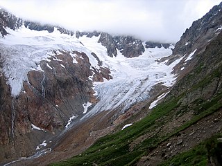
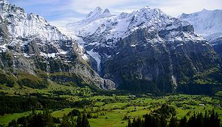
WThe Eiger Glacier is a glacier situated on the north-west side of the Eiger in the Bernese Alps of Switzerland. The glacier is within the municipality of Lauterbrunnen in the canton of Bern.
 W
WThe Forno Glacier is a 6 km long glacier (2005) situated in the Bregaglia Range in the canton of Graubünden in Switzerland. In 1973 it had an area of 8.72 km2.
 W
WThe Gauli Glacier is a 6.2 km (3.9 mi) long glacier (2005) in the Bernese Alps in the canton of Bern in Switzerland. In 1973, it had an area of 17.7 km2 (6.8 sq mi). The glacier is famous for the 1946 C-53 Skytrooper crash on the Gauli Glacier and the following rescue mission, which was the first carried out by an aircraft landing on a glacier.
 W
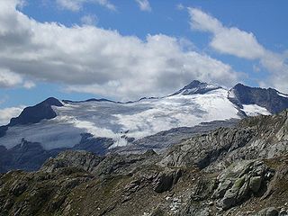
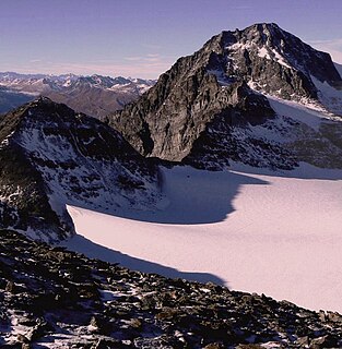
WThe Glärnisch is a mountain massif of the Schwyz Alps, overlooking the valley of the Linth in the Swiss canton of Glarus. It consists of several summits, of which the highest, Bächistock, is 2,915 metres above sea level. Until 2013, the highest point was considered to be an unnamed point with a summit cross at 2,914 metres. The other main summits are Vrenelisgärtli and the Ruchen.
 W
WThe Hüfi Glacier is a 7 km (4.3 mi) long glacier (2005) situated in the Glarus Alps in the canton of Uri in Switzerland. In 1973 it had an area of 13.64 km2 (5.27 sq mi).
 W
WThe Kander Neve is a 6.6 km (4.1 mi) long glacier (2005) of the Bernese Alps, situated south of Kandersteg in the canton of Berne. The glacier lies at the upper end of the Gasterental, at the foot of the Blüemlisalp and the Tschingelhorn. It borders the valley of Lauterbrunnen on the east and the canton of Valais on the south (Petersgrat). In 1973 it had an area of 13.9 km2 (5.4 sq mi).
 W
WLa Cudera is a 2 km long glacier (2005) situated in the Silvretta Range in the canton of Graubünden in Switzerland. In 1973 it had an area of 2.07 km².
 W
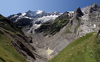
WThe Lower Grindelwald Glacier is a Glacier in the Swiss Bernese Alps, situated to the south-east of Grindelwald. It starts below the Agassizhorn and the Strahlegghörner and is connected with the Finsteraar Glacier via the Finsteraarjoch.
 W
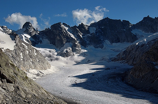
WThe Morteratsch Glacier is the largest glacier by area in the Bernina Range of the Bündner Alps in Switzerland.
 W
WThe Oberaargletscher, literally "Upper Aare-Glacier" is a 4 km (2.5 mi) long glacier (2005) situated in the Bernese Alps in the canton of Berne in Switzerland. In 1973 it had an area of 5.82 km2 (2.25 sq mi). The lower end of this glacier lies almost 400 m higher than the (original) lower end of neighbouring Unteraargletscher.
 W
WThe Palü Glacier is a 3.5 km long glacier (2005) on the southeastern flank of Piz Palü in the Bernina Range. It belongs to the valley of Poschiavo in the canton of Graubünden. In 1973 it had an area of 6.47 km2.
 W
WThe Paradies Glacier is a 2.27 km long glacier (2007) situated in the Lepontine Alps in the canton of Graubünden in Switzerland. In 1973 it had an area of 3.99 km².
 W
WThe Porchabella Glacier is a 2.5 km long glacier (2005) situated in the Albula Range in the canton of Graubünden in Switzerland. In 1973 it had an area of 2.58 km2.
 W
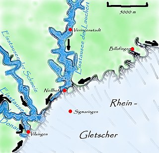
WThe Rhine Glacier was a glacier during the last glacial period and was responsible for the formation of the Lake Constance.
 W
WThe Roseg Glacier is a 4 km long glacier (2005) situated in the Bernina Range, in the Val Roseg (Graubünden). In 1973 it had an area of 8.52 km2.
 W
WThe Rosenlaui Glacier is a 5-km-long glacier (2005) situated in the Bernese Alps in the canton of Berne in Switzerland. In 1973 it had an area of 6.14 km2.
 W
WThe Silvretta Glacier is a 3 km long glacier (2005) situated in the Silvretta Range in the canton of Graubünden in Switzerland. In 1973 it had an area of 3.35 km².
 W
WThe Trift Glacier is a 5 km (3.1 mi) long glacier (2005) in the Urner Alps near Gadmen, in the extreme east of the canton Berne in Switzerland.
 W
WThe Tsanfleuron Glacier is a 3.5 km (2.2 mi) long glacier (2005) situated in the western Bernese Alps in the cantons of Valais and Vaud in Switzerland. In 1973 it had an area of 3.81 km2 (1.47 sq mi). It culminates at the Dôme, at approximately 3,000 metres above sea level, where it is separated from the Diablerets Glacier. The lowest point is at approx. 2,500 metres. The glacier is overlooked by the Scex Rouge and the Oldenhorn on the north, and by the Quille du Diable on the south.
 W
WThe Tschierva Glacier is a 4 km long glacier (2005) situated in the Bernina Range in the canton of Graubünden/Grisons in Switzerland. In 1973 it had an area of 6.2 km2.
 W
WThe Tschingel Glacier is a 3 km long glacier (2005) situated in the Bernese Alps in the canton of Berne in Switzerland. In 1973 it had an area of 6.19 km².
 W
WThe Unteraargletscher, literally "Lower Aare-Glacier", is the larger of the two sources of the Aare river in the Bernese Alps. It emerges from the association of the Finsteraargletscher and the Lauteraargletscher and flows for about 6 km (3.7 mi) to the east down to the Grimselsee near the Grimsel Pass. In total the glacier was 12.95 km (8.05 mi) long and 29.48 km2 (11.38 sq mi) in area in 1973. Its lower end is almost 400 metres lower than that of the neighbouring Oberaargletscher.
 W
WThe Upper Grindelwald Glacier is one of the two valley glaciers near Grindelwald on the northern side of the Bernese Alps, in the Canton of Berne. It had a length of about 6.6 km (4.1 mi) and covered an area of 9.6 km2 (3.7 sq mi) in 1973.
 W
WThe Vorab Glacier is a 2 km long glacier (2005) situated in the Glarus Alps in the cantons of Glarus and Graubünden. It lies on the east side of the Vorab, between 2,600 and 3,000 metres above sea level. In 1973 it had an area of 2.17 km².
 W
WThe Wenden Glacier is a glacier in the Urner Alps in the canton of Berne in Switzerland.