 W
WThis is a list of rivers in Angola. This list is arranged by drainage basin, with respective tributaries indented under each larger stream's name.
 W
WThe Bengo is a river in northern Angola with a source in the Crystal Mountains. Its mouth is at the Atlantic Ocean 20 kilometres (12 mi) north of Luanda in Bengo Province. The river is 300 kilometres (190 mi) long with a drainage area of 7,370 square kilometres (2,850 sq mi). There is a large reservoir called Kiminha on the Bengo. There are several small lakes on the lower 90 kilometres (56 mi) of the river floodplain including Lakes Panguila, Quilunda and Lalama. The Bengo River floodplain is the main source of the agricultural produce for Luanda. Drinking water from the Bengo River was transported to Luanda in barrels by boat before an aqueduct was built in 1889. Trucks deliver much of the city's modern water supply, loaded by pumps in the river.
WThe Bentiaba is a river in southern Angola. Its mouth is at the Atlantic Ocean near the commune of Bentiaba in Namibe Province.
WThe Bero is a river in southern Angola. Its mouth is at Little Fish Bay in the Atlantic Ocean on the north side of the city of Moçâmedes in Namibe Province.
 W
WThe Catumbela is a river in central Angola. The river mouth is at the Catumbela Estuary on the Atlantic Ocean at Catumbela, between Lobito and Benguela, and 240 kilometres (150 mi) from where it rises in the hills of Cassoco. The Catumbela supplies water to the city of Lobito. The mouth of the Catumbela was noted as a green vegetated region surrounded by barren land along the coast and a couple miles inland where it cuts a gorge through bare mountains. Alternate spellings are Catumbella and Cata-Bella.
 W
WThe Chiloango River is a river in western Central Africa. It forms the westernmost part of the border between the Democratic Republic of the Congo and the Republic of Congo, and then forms approximately half of the border between the DRC and Cabinda, Angola passing just south of the town of Necuto. The river then bisects Cabinda, making it the most important river in the province. It enters the Atlantic Ocean just north of the town of Cacongo.
 W
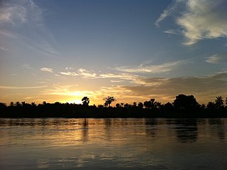
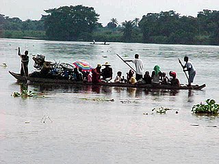
WThe Congo River, formerly known as the Zaire River during the dictatorship of Mobutu Sese Seko, is the second longest river in Africa, shorter only than the Nile, as well as the second largest river in the world by discharge volume, following only the Amazon. It is also the world's deepest recorded river, with measured depths in excess of 220 m (720 ft). The Congo-Lualaba-Chambeshi River system has an overall length of 4,700 km (2,920 mi), which makes it the world's ninth-longest river. The Chambeshi is a tributary of the Lualaba River, and Lualaba is the name of the Congo River upstream of Boyoma Falls, extending for 1,800 km (1,120 mi).
WThe Coporolo is an intermittent river in Angola. It flows through Dombe Grande in Benguela Province. It has sometimes been considered a permanent stream. Its mouth is at the Atlantic Ocean and the drainage area is 15,674 square kilometres (6,052 sq mi).
 W
WThe Cuando River is a river in south-central Africa flowing through Angola and Namibia's Caprivi Strip and into the Linyanti Swamp on the northern border of Botswana. Below the swamp, the river is called the Linyanti River and, farther east, the Chobe River, before it flows into the Zambezi River.
 W
WThe Cuanza River, also known as the Coanza, the Quanza, and the Kwanza, is one of the longest rivers in Angola. It empties into the Atlantic Ocean just south of the national capital Luanda.
 W
WThe Cunene or Kunene is a river in Southern Africa. It flows from the Angola highlands south to the border with Namibia. It then flows west along the border until it reaches the Atlantic Ocean. It is one of the few perennial rivers in the region. It is about 1,050 kilometres (652 mi) long, with a drainage basin 106,560 square kilometres (41,143 sq mi) in area. Its mean annual discharge is 174 m3/s at its mouth. The Epupa Falls lie on the river. Olushandja Dam dams a tributary of the river, the Etaka, and helps provide the Ruacana Power Station with water.
WThe Curoca is an intermittent river in Namibe Province, southern Angola which has residual lagoons in dry seasons. It is one of only two rivers in Iona National Park, which also includes moving sand dunes of the Namib Desert. The Curoca forms part of the northern border of the park and also runs through the Lagoa dos Arcos and the Regional Natural Park of Namibe. Its mouth is at the Atlantic Ocean, north of the community of Tômbwa. The lagoons support plants including bamboo and thorn trees and animals such as springbok and oryx. Lagoa dos Arcos oasis is noted as a tourist destination. The seasonal flooding of the river supports the limited agriculture and grazing conducted in the area.
 W
WThe Cutato is a river of central Angola, tributary of the Cuanza River. It flows to the northeast of Benguela. The town of Cutato lies on the river.
WThe Cuvo is a river in central Angola. The river mouth is at the Atlantic Ocean at Benguela Bay, in Cuanza Sul Province. Cuvo is its name in its upper reaches; its lower course is called the Keve or Queve. The river is navigable upstream to Binga Falls near Gabela.
WThe Dande is a river in northern Angola with a source in the Crystal Mountains. Its mouth is at the Atlantic Ocean at Barra do Dande in Bengo Province. It also flows through the city of Caxito, and Uige Province. The river is 285 kilometres (177 mi) long. The lower section of the river is a floodplain with several small lakes including Lakes Sungue, Ibendua and Morima.
 W
WThe Kasai River is a tributary of the Congo River, located in Central Africa. The river begins in central Angola and flows to the east until it reaches the border between Angola and the Democratic Republic of the Congo (DRC), where it turns north and serves as the border until it flows into the DRC. From Ilebo, between the confluences with Lulua river and Sankuru river, the Kasai river turns to a westerly direction. The lower stretch of the river from the confluence with Fimi river, is known as the Kwa(h) River, before it joins the Congo at Kwamouth northeast of Kinshasa. The Kasai basin consists mainly of equatorial rainforest areas, which provide an agricultural land in a region noted for its infertile, sandy soil. It is a tributary of Congo river and diamonds are found in this river. Around 60% of diamonds in Belgium go from Kasai river for cutting and shaping.
 W
WThe Cuango or Kwango is a transboundary river of Angola and Democratic Republic of Congo. It is the largest left bank tributary of the Kasai River in the Congo River basin. It flows through Malanje town in Angola. The Kwango River basin has large resources of diamonds in the Chitamba-Lulo Kimberlite Cluster in Lunda Norte Province, discovered in the main river channel and on flats and terraces in its flood plains.
 W
WThe Kwenge River is a stream in the Bandundu Province of the Democratic Republic of the Congo.
 W
WThe Kwilu River is a major river that originates in Angola and flows north through Bandundu Province in the Democratic Republic of the Congo (DRC) to the city of Bandundu, where it joins the Kwango River just before this stream enters the Kasai River. In the DRC the river flows past the towns of Gungu, Kikwit, Bulungu, Bagata, Rutherfordia and Bandundu. Lusanga, formerly Leverville, lies at the location where the Kwenge River joins the Kwilu, between Kikwit and Bulungu.
WThe Loange River is a tributary of the Kasai River. Originating in Angola, the river flows north into the Democratic Republic of the Congo, through the eastern part of Kwango. The river then continues north along the boundary between Kwilu and Kasai provinces to its mouth on the Kasai.
WThe Longa is a river in central Angola. The river forms the southern border of Kissama National Park and the border of Bengo Province and Cuanza Sul Province. Its mouth is protected by a long sand spit at the Atlantic Ocean. It has two major tributaries, Nhia and Mugige. The floodplain in the lower reaches of the river includes Lake Hengue and Lake Toto.
 W
WThe Luanginga is a river rising in Angola, which flows into the Zambezi in western Zambia.
 W
WThe Lucala River is a river in Angola, a right tributary of Angola's largest river, the Cuanza River.
 W
WThe Luena River in eastern Angola rises near the town of Luena, Angola and flows south-east to the Zambezi. The name is also used for an ethnic group in the area, the Luena people.
 W
WThe Lufu River or Luvo River is a river of Angola and the Democratic Republic of the Congo. It is a left tributary of the Congo River.
 W
WThe Lungwebungu River of south-west-central Africa is the largest tributary of the upper Zambezi River. The headwaters of the Lungwebungu are in central Angola at an elevation around 1,400 metres (4,600 ft), and it flows south-east across the southern African plateau. Within 50 kilometres (31 mi) it has developed the character which it keeps for most of its course, of extremely intricate meanders, with multiple channels and oxbow lakes, in a swampy channel about 800 m (2,600 ft) wide which in turn is in a shallow valley with a floodplain 3 to 5 km wide, inundated in the rainy season. The edges of the floodplain are a white sandy soil covered in thin forest. The main river channel grows from 50 m (160 ft) wide to 200 m (660 ft) wide near the Zambezi, and its floodplain suddenly broadens as it merges with that of the Zambezi, at the beginning of the Barotse Floodplain, which is 25 km (16 mi) wide at that point.
 W
WThe M'pozo is a river in the province of Bas-Congo in the Democratic Republic of the Congo. Its source is located in Angola and it forms part of the Angola–Democratic Republic of the Congo border. The river ends on the left bank of the Congo River, a few kilometres upstream of Matadi.
WThe Mbridge is a river in northern Angola. Its mouth is at the Atlantic Ocean near the town of N'Zeto in Zaire Province. Its origin is near the city of Cuimba, and it forms part of the boundary between Zaire and Uige Provinces. Its tributaries include the Lufunde, the Lucunga, the Luqueia, and Lufua.
 W
WThe Okavango River is a river in southwest Africa. It is the fourth-longest river system in southern Africa, running southeastward for 1,600 km (990 mi). It begins at 1,300 m altitude in the sandy highlands of Angola, where it is known by the Portuguese name Rio Cubango. Farther south, it forms part of the border between Angola and Namibia, and then flows into Botswana. The Okavango does not have an outlet to the sea. Instead, it discharges into the Okavango Delta or Okavango Alluvial Fan, in an endorheic basin in the Kalahari Desert.
 W
WThe Rio Quicombo, also known as the Rio Kikombo, is a river south of Sumbe, Angola and just north of Kikombo in Cuanza Sul Province, Angola.
WThe Wamba River is a river in the Democratic Republic of the Congo (DRC) and Angola. It arises at an elevation of around 3,250 feet (990 m) as the confluence of several small streams in the Lunda Norte Province of Angola, a region of low hills and shallow ravines. In Angola it is known as the Uamba River.
WThe Zambezi is the fourth-longest river in Africa, the longest east-flowing river in Africa and the largest flowing into the Indian Ocean from Africa. The area of its basin is 1,390,000 square kilometres (540,000 sq mi), slightly less than half of the Nile's. The 2,574-kilometre-long river (1,599 mi) arises in Zambia and flows through eastern Angola, along the north-eastern border of Namibia and the northern border of Botswana, then along the border between Zambia and Zimbabwe to Mozambique, where it crosses the country to empty into the Indian Ocean.