 W
WWasatch–Cache National Forest is a United States National Forest located primarily in northern Utah (81.23%), with smaller parts extending into southeastern Idaho (16.42%) and southwestern Wyoming (2.35%). The name is derived from the Ute word Wasatch for a low place in high mountains, and the French word Cache meaning to hide. The term cache originally referred to fur trappers, the first Europeans to visit the land. The Wasatch–Cache National Forest boundaries include 1,607,177 acres (6,504.01 km2) of land.
 W
WAmerican Fork Canyon is a canyon in the Wasatch Mountains of Utah, United States. The canyon is famous for the Timpanogos Cave National Monument, which resides on its south side. It is named after the American Fork River which runs through the bottom of the canyon.
 W
WBald Mountain is a 11,949-foot (3,642 m) peak in the western Uinta Mountain Range in the Uinta-Wasatch-Cache National Forest on the border between Summit and Wasatch counties in northeastern Utah, United States.
 W
WThe Bear River Range, is a mountain range located in northeastern Utah and southeastern Idaho in the western United States.
 W
WBig Cottonwood Canyon is a canyon in the Wasatch Range 12 miles (19 km) southeast of Salt Lake City in the U.S. state of Utah. The 15-mile (24 km)-long canyon provides hiking, biking, picnicking, rock-climbing, camping and fishing in the summer. Its two ski resorts, Brighton and Solitude, are popular among skiers and snowboarders. The canyon is accessed by The Big Cottonwood Canyon Scenic Byway (SR-190), which runs its length to Guardsman Pass at the top of the canyon, allowing travel to Park City in the summer months.
 W
WBlacks Fork is a 175-mile-long (282 km) tributary of the Green River in Utah and Wyoming. The river rises on the northern side of the Uinta Mountains as the combination of three streams draining the area around Tokewanna Peak near the Utah–Wyoming border. Right as the river crosses the Wyoming border, it flows into Meeks Cabin Reservoir which is used for irrigation and flood control. From there the river flows through the town of Lyman before joining with the Smiths Fork, which forms just east of the Blacks Fork in the Uintas, and parallels it for most of its course. The river continues northeast to Granger, where the river meets the Hams Fork from the north. Shortly thereafter the river makes a sharp turn south, eventually joining the Green River at Flaming Gorge Reservoir.
 W
WDean Lake is a lake in the northwestern corner of Duchesne County, Utah, United States.
 W
WDeseret Peak is the highest peak in the Stansbury Mountains with an elevation of 11,035 ft. It is located in the Deseret Peak Wilderness area west of Grantsville, Utah and east of Skull Valley Indian Reservation. It is the fourth most topographically prominent peak in the state of Utah. The site is a popular destination for hikers and backcountry skiers as the area is a contrast of the alpine wilderness with the surrounding desert basin. The trail that leads to the peak is easily accessible from Salt Lake City. The mountain offers views of the Bonneville Salt Flats, the Great Salt Lake, and the surrounding towns and mountain ranges. On a clear day, it is possible to see Mount Nebo, the highest peak in the adjacent Wasatch Mountains.
WThe Deseret Peak Wilderness is located in the Stansbury Mountains of Tooele County, Utah, United States near the towns of Tooele and Grantsville, not far from the Great Salt Lake. It is part of the Wasatch-Cache National Forest. This semi-arid wilderness is part of the Great Basin ecosystem. Elevations range from about 6,000 feet to the top of Deseret Peak's limestone escarpment at 11,031 feet (3,362 m). In this high country, with barren Skull Valley to the west, you'll find some springs and intermittent creeks, despite the general dryness of the area.
 W
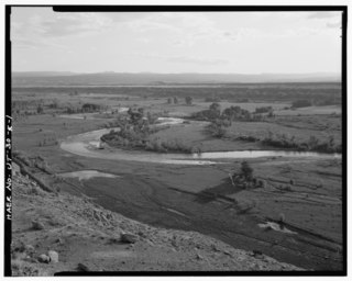
WThe Duchesne River, located in the Uintah Basin region of Utah in the western United States, is a tributary of the Green River. The watershed of the river covers the Northeastern corner of Utah. The Duchesne River is 115 miles (185 km) long, and drains a total land area of 3,790 square miles (9,800 km2).
 W
WGilbert Peak is the third highest peak in the U.S. state of Utah, with an elevation of 13,448 feet (4,099 m). It lies on the spine of the central Uinta Mountains, on the border between Uinta-Wasatch-Cache National Forest and Ashley National Forest in northeastern Utah, and on the border between Summit County and Duchesne County. It is the highpoint of Summit County, and lies within the boundaries of the High Uintas Wilderness.
 W
WHardware Ranch Wildlife Management Area is owned by the State of Utah and managed by the Utah Division of Wildlife Resources. It is located in the Blacksmith Fork Canyon, about 15 mi (24 km) east of Hyrum, Utah. Rocky Mountain elk are fed here through the winter to prevent them from coming to inhabited areas further down the canyon in search of food. Horse-drawn sleigh rides and a visitor center are offered from mid December to February.
WHardware Ranch Wildlife Management Area is owned by the State of Utah and managed by the Utah Division of Wildlife Resources. It is located in the Blacksmith Fork Canyon, about 15 mi (24 km) east of Hyrum, Utah. Rocky Mountain elk are fed here through the winter to prevent them from coming to inhabited areas further down the canyon in search of food. Horse-drawn sleigh rides and a visitor center are offered from mid December to February.
 W
WHarker Canyon is located 10 km (6.2 mi) south of the town of Vernon, in Tooele County, Utah, USA. The canyon is oriented east-west on the southern side of the Sheeprock Mountains, a small mountain group in the larger Wasatch Range. The canyon is entirely encompassed by the boundaries of the Wasatch-Cache National Forest, and is accessible from Harker Road by a forest road designated NF 586. There are many abandoned mines in the canyon. Bird watching and horseback riding are popular recreational activities in the canyon.
 W
WThe High Uintas Wilderness is a wilderness area located in northeastern Utah, United States. The wilderness covers the Uinta Mountains, encompassing parts of Duchesne and Summit counties. Designated as a wilderness in 1984, the area is located within parts of Ashley National Forest and Uinta-Wasatch-Cache National Forest, managed by the U.S. Forest Service. The highest peak in Utah, Kings Peak, lies within the wilderness area along with some of Utah's highest peaks, particularly those over 13,000 feet.
WJordan Lake is lake on the northern edge of Duchesne County, Utah, United States.
 W
WLittle Cottonwood Canyon lies within the Wasatch-Cache National Forest along the eastern side of the Salt Lake Valley, roughly 15 miles from Salt Lake City, Utah. The canyon is part of Granite, a CDP and "Community Council" designated by Salt Lake County. The canyon is a glacial trough, carved by an alpine glacier during the last ice age, 15,000 to 25,000 years ago. A number of rare and endemic plant species are found in the canyon's Albion Basin. Mountain goats inhabit the surrounding mountains.
 W
WThe Lone Peak Wilderness is a 30,088-acre (121.76 km2) wilderness area located within the Uinta and the Wasatch-Cache National Forest in the U.S. state of Utah.
 W
WMillcreek Canyon is a canyon in the Wasatch Mountains and part of Millcreek City on the east side of the Salt Lake Valley, Utah. It is a popular recreation area both in the summer and in the winter. It was named by Brigham Young on August 22, 1847 before all of the mills that were built in and below the densely forested canyon. It is home to two restaurants and six Boy Scout Day Camps.
 W
WMirror Lake is a lake in the high Uinta Mountains in Utah. It is a popular fishing and recreation spot. The lake contains three species of trout: rainbow, brook, and tiger. The lake has a Forest Service campground, picnic facilities, and a boat ramp for non-motorized watercraft. Access to the lake is by the Mirror Lake Highway, which is only open during the summer.
WThe Monte Cristo Range of Utah is a 30 miles (48 km) long mountain range in the extreme northeast of the state. It parallels the Bear River Mountains to the west, but is only about half its length.
WMount Naomi Wilderness is a 44,523-acre (180.18 km2) wilderness area located within the Uinta-Wasatch-Cache National Forest in the U.S. state of Utah. It lies between the Logan River and the Utah-Idaho state line northeast of Logan, Utah.
 W
WMount Timpanogos Wilderness is a 10,518-acre (42.56 km2) wilderness area protecting Mount Timpanogos and the surrounding area. It is located in the front range of the Wasatch Mountain Range, between American Fork Canyon on the north and Provo Canyon on the south, within the Uinta-Wasatch-Cache National Forest on the north eastern edge of Utah County, Utah, United States. The wilderness area receives fairly heavy use due to its proximity to the heavily populated cities of Provo and Salt Lake City. It is bordered on the north by the Lone Peak Wilderness.
 W
WMount Olympus in the U.S. state of Utah is one of the most prominent and recognizable mountains viewable from practically every location in the Salt Lake Valley. Mount Olympus is not the tallest peak along the Wasatch Front, but its unusual form and location make it a popular hiking destination for locals. The mountain is situated immediately east of the center of the Salt Lake Valley. Distinctive features of the mountain are its twin peaks and other outcroppings, the highest of which is called "Summit Peak" and which towers above the valley to an elevation of 9,030 feet (2,752 m). Thus, the peak looms about 4,800 feet (1,463 m) above the valley floor.
 W
WThe Pfeifferhorn is the 11,331 feet (3,454 m) triangularly-shaped peak located in the most isolated part of the Lone Peak Wilderness Area of the Wasatch Mountains in northern Utah, United States. This rugged Utah mountain, commonly referred to as the Little Matterhorn, is the fifth-highest peak in the Wasatch Range. The summit can be reached by hiking, though some scrambling is required. There are several technical rock climbing routes with the north ridge being the most popular. This summit also makes an excellent winter mountaineering adventure.
WThe Stansbury Mountains are a 28-mile (45 km) long mountain range located in eastern Tooele County, Utah. It is named for U.S. Army Major Howard Stansbury, a topographical engineer, who led an expedition that surveyed the region.
 W
WThe Tank Hollow Fire was a fire that burned in the Uinta-Wasatch-Cache National Forest in Utah in the United States. The fire was started by a lightning strike on August 11, 2017. Since then, it burned a total of 11,067 acres (45 km2). The fire threatened homes along US Route 40. It was contained on December 5, 2017.
WTwin Peaks Wilderness is a 11,396 acres (46.12 km2) wilderness area in the Wasatch Range of Uinta-Wasatch-Cache National Forest in Salt Lake County, Utah, United States. The Mount Olympus Wilderness is directly north of the Twin Peaks Wilderness and separated by Utah State Route 190. The Lone Peak Wilderness is directly to the south and separated by Utah State Route 210. Elevations in the wilderness range from under 5,000 feet (1,500 m) to 11,330 feet (3,450 m) on Twin Peaks.
 W
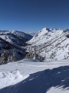
WThe Uinta Mountains are an east-west trending chain of mountains in northeastern Utah extending slightly into southern Wyoming in the United States. As a subrange of the Rocky Mountains, they are unusual for being the highest range in the contiguous United States running east to west, and lie approximately 100 miles (160 km) east of Salt Lake City. The range has peaks ranging from 11,000–13,528 feet (3,353–4,123 m), with the highest point being Kings Peak, also the highest point in Utah. The Mirror Lake Highway crosses the western half of the Uintas on its way to Wyoming.
WThe Wasatch and Uinta montane forest is a temperate coniferous forest ecoregion in the Wasatch Range and Uinta Mountains of the western Rocky Mountains system, in the Western United States.
 W
WThe Wasatch Range is a mountain range in the western United States that runs about 160 miles (260 km) from the Utah-Idaho border south to central Utah. It is the western edge of the greater Rocky Mountains, and the eastern edge of the Great Basin region. The northern extension of the Wasatch Range, the Bear River Mountains, extends just into Idaho, constituting all of the Wasatch Range in that state.
 W
WThe Wellsville Mountains are located in northern Utah, United States and are often considered part of the Wasatch Mountains.