 W
WThe Chiltern Hills or the Chilterns, is a chalk escarpment in England.
 W
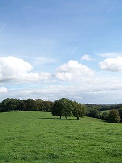
WAldbury Nowers is a 19.7 hectares biological Site of Special Scientific Interest (SSSI) in the Chiltern Hills, north-east of Tring in Hertfordshire. The site was notified in 1990 under the Wildlife and Countryside Act 1981. It is managed by the Hertfordshire and Middlesex Wildlife Trust. The site, formerly known as "Duchie's Piece," comprises two areas of hillside, linked by The Ridgeway. The calcareous meadow element of the site hosts the flowers of chalk grassland and has butterfly habitats with thirty-four different species of butterfly recently recorded, including the Duke of Burgundy, hairstreaks and the Essex skipper. The site also includes a "beech hanger", a type of upland ancient woodland, and is considered one of the best examples of this feature in Hertfordshire.
 W
WAshridge is a country estate and stately home in Hertfordshire, England in the United Kingdom. It is situated in the Chiltern Hills, an Area of Outstanding Natural Beauty, about 2 miles (3.2 km) north of Berkhamsted and 23 miles (37 km) north west of London. The estate comprises 5,000 acres (20 km2) of woodlands, commons and chalk downland which supports a rich variety of wildlife.
 W
WAston Rowant Cutting is a 3.5-hectare (8.6-acre) geological Site of Special Scientific Interest south of Aston Rowant in Oxfordshire. It is a Geological Conservation Review site.
 W
WAston Rowant National Nature Reserve is located on the north-west escarpment of the Chiltern Hills, in the Chilterns Area of Outstanding Natural Beauty. It has an area of 159.1 hectares, and most of it is a 128.5 hectares biological Site of Special Scientific Interest. It is listed as a Grade 1 site in A Nature Conservation Review. The reserve is in several sections, mostly in the parish of Lewknor in Oxfordshire, with smaller sections in the parish of Stokenchurch in Buckinghamshire.
 W
WAston Rowant Woods is a 209.7-hectare (518-acre) biological Site of Special Scientific Interest near Aston Rowant in Oxfordshire and Buckinghamshire. Part of it is in Aston Rowant National Nature Reserve, and a large part is in the Chiltern Beechwoods Special Area of Conservation. The site is also in the Chilterns Area of Outstanding Natural Beauty.
 W
WBarton Hills are situated southeast of the village of Barton-le-Clay in the English county of Bedfordshire. They are part of the Chilterns and hiking routes are marked on maps at the entrance to the hills. From the foot of the hillside, a spring marks the start of a chalk stream river. During the summer, Dartmoor ponies roam the hills.
 W
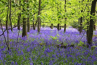
WBottom Wood is a 14.5-hectare (36-acre) woodland in the English county of Buckinghamshire, located just north of the A40 near the hamlet of Studley Green. Since 1984, the wood has been owned by the Chiltern Society, which manages it as a nature reserve with the help of volunteers. Although an ancient woodland, most of the trees in the wood date from the end of the 1940s or later, as much of the wood was felled during the Second World War to produce Bryant and May matches. The wood is now home to a diverse range of flora and fauna, including rare species of butterfly and moth.
 W
WChequers, or Chequers Court, is the country house of the Prime Minister of the United Kingdom. A 16th-century manor house in origin, it is located near the village of Ellesborough, halfway between Princes Risborough and Wendover in Buckinghamshire, United Kingdom, at the foot of the Chiltern Hills. It is about 40 miles (64 km) north-west of central London. Coombe Hill, once part of the estate, is located two-thirds of a mile (1.1 km) northeast. Chequers has been the country home of the serving Prime Minister since 1921 after the estate was given to the nation by Sir Arthur Lee by a Deed of Settlement, given full effect in the Chequers Estate Act 1917. The house is listed Grade I on the National Heritage List for England.
 W
WChiltern Open Air Museum is an independent open-air museum of vernacular buildings and a tourist attraction located near Chalfont St Peter and Chalfont St. Giles in the Chiltern Hills, Buckinghamshire, England. The museum is a registered charity under English law and has a small number of full-time staff and a volunteer workforce of approximately 200.
 W
WCoombe Hill is a hill in The Chilterns, located next to the hamlet of Dunsmore, Buckinghamshire, England, near the small town of Wendover, and overlooking Aylesbury Vale. It is not to be confused with another Coombe Hill on the flank of Haddington Hill, some two miles (3.2 km) to the north-east. It is part of the Bacombe and Coombe Hills Site of Special Scientific Interest.
 W
WCowleaze Wood is a 70-acre (28 ha) woodland in the Chiltern Hills, a chalk ridge in South East England. The wood is in the civil parish of Lewknor, about 1 1⁄4 miles (2 km) southeast of the village. It is next to the county boundary with Buckinghamshire, and adjoins Lydall's Wood on the Buckinghamshire side of the boundary.
 W
WDunstable Downs are part of the Chiltern Hills, in southern Bedfordshire in England. They are a chalk escarpment forming the north-eastern reaches of the Chilterns. At 797 ft (243 m), Dunstable Downs are the highest point of the county of Bedfordshire.
 W
WThe Goring Gap is the narrow valley, occupied by the River Thames, between the Chiltern Hills and the Berkshire Downs. It is approximately 10 miles (16 km) upstream of Reading and 27 miles (43 km) downstream of Oxford. The river here forms the county boundary between Berkshire and Oxfordshire.
 W
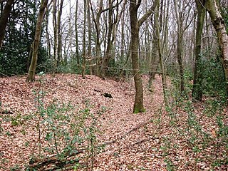
WGrim's Ditch is a series of linear earthwork in the Chilterns. A complete outline cannot be identified but separate sections exist over a 30-kilometre (19 mi) span between Bradenham, Buckinghamshire, Berkhamsted, Hertfordshire and as far as Pitstone and Ivinghoe Buckinghamshire. Pottery shards have been unearthed in excavations during the 1970s and 1980s suggesting that its origin may have been during the Iron Age and was believed to have been during a period when the landscape was clearer of scrub and the dense woodland than today as the straighter sections would have required clear lines of sight. The first mention of Grim's Ditch was a grant of 1170–90 in the Missenden Cartulary referring to it as Grimesdic. The Anglo Saxons commonly named features of unexplained or mysterious origin Grim. The word derives from the Norse word grimr meaning devil and a nickname for Odin or Wodin the God of War and Magic. Another mention is to be found in a 10th-century Anglo Saxon boundary charter for the Mongewell area.
 W
WHaddington Hill is a hill in The Chilterns, and the highest point in the English county of Buckinghamshire. On the north-eastern flank is Coombe Hill, not to be confused with another Coombe Hill 4 kilometres (2.5 mi) to the south-west.
 W
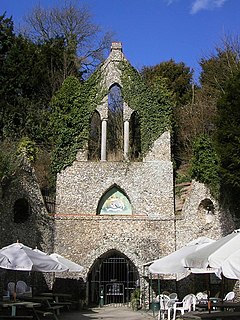
WThe Hellfire Caves are a network of man-made chalk and flint caverns which extend 0.25 miles (400 m) underground. They are situated above the village of West Wycombe, at the southern edge of the Chiltern Hills near High Wycombe in Buckinghamshire, Southeast England.
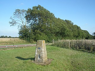
Ivinghoe Beacon is a prominent hill and landmark in Buckinghamshire, England, 233 m (757 ft) above sea level in the Chiltern Hills, close to Ivinghoe and Aldbury. Dunstable, Berkhamsted and Tring are nearby.
Ivinghoe Hills is a 210.4 hectares Site of Special Scientific Interest in Ivinghoe in Buckinghamshire, and part of the Chilterns Area of Outstanding Natural Beauty. It is listed in A Nature Conservation Review. The Ridgeway long-distance footpath ends and the Icknield Way Path starts in the site on Ivinghoe Beacon. An Iron Age fort on Ivinghoe Beacon and a tumulus on Gallows Hill are Scheduled Monuments. The site is part of the National Trust's Ashridge Estate, apart from a small area which belongs to Buckinghamshire County Council.
 W
WJones Hill Wood is a 1.8-hectare (4.4-acre) piece of ancient woodland near Wendover in Buckinghamshire, south England. Formed mainly of beech trees, the wood is part of the Chiltern Hills Area of Outstanding Natural Beauty. Almost half of the wood is planned to be chopped down to make way for the route of High Speed 2 (HS2) and the topsoil will be translocated. In October 2020, a protest camp was evicted.
 W
WLodge Hill is a 31.8-hectare (79-acre) Site of Special Scientific Interest north of Bledlow Ridge in Buckinghamshire. The local planning authorities are Wycombe District Council and Buckinghamshire County Council. The site is in the Chilterns Area of Outstanding Natural Beauty, and The Ridgeway long distance footpath crosses it.
 W
WPavis Wood is an area of woodland on a hill located near Hastoe in Tring, north-western Hertfordshire, England. A point on its eastern slopes is the highest point in the county of Hertfordshire at 244 metres (801 ft). The area is often considered as ancient woodland containing a wide variety of plants such as the yellow pimpernel and wood melick. A bridleway crosses the woodland which can be accessed throughout the year as well as the Ridgeway National Trail which is dominated mainly by beech, oak and ash.
 W
WPegsdon Hills and Hoo Bit is a 79-hectare (200-acre) nature reserve in Pegsdon in Bedfordshire. It is managed by the Wildlife Trust for Bedfordshire, Cambridgeshire and Northamptonshire. The site is on the border between Bedfordshire and Hertfordshire, and it covers Pegsdon Hills and part of the adjacent Deacon Hill in Bedfordshire, and Hoo Bit in Hertfordshire. It is in the Chilterns Area of Outstanding Natural Beauty, and part of the site is designated by Natural England as the Deacon Hill SSSI.
 W
WPhilipshill Wood is a 77 acres (31 ha) area of woodland in the English county of Buckinghamshire, situated on the border with Hertfordshire about 1 mile (1.6 km) from the village of Chorleywood. It is within the Chiltern Hills Area of Outstanding Natural Beauty, and is owned by the Woodland Trust. The wood is fully open to the public, with some parking available in Old Shire Lane, to the east of the wood.
 W
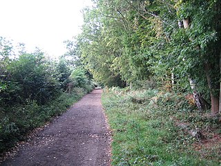
WThe Ridgeway is a ridgeway or ancient trackway described as Britain's oldest road. The section clearly identified as an ancient trackway extends from Wiltshire along the chalk ridge of the Berkshire Downs to the River Thames at the Goring Gap, part of the Icknield Way which ran, not always on the ridge, from Salisbury Plain to East Anglia. The route was adapted and extended as a National Trail, created in 1972. The Ridgeway National Trail follows the ancient Ridgeway from Overton Hill, near Avebury, to Streatley, then follows footpaths and parts of the ancient Icknield Way through the Chiltern Hills to Ivinghoe Beacon in Buckinghamshire. The National Trail is 87 miles (140 km) long.
 W
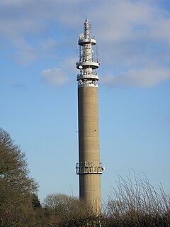
WStokenchurch BT Tower is a telecommunications tower built of reinforced concrete at Stokenchurch, Buckinghamshire, England. Reaching to 340.5 metres (1,117 ft) above mean sea level, it dates from 1963 and is 99.4 metres (326 ft) tall. There are four platforms at the top that are used to attach microwave transmission drums and other antennas.
 W
WTotternhoe Knolls is a 13.1 hectare Site of Special Scientific Interest (SSSI) in Totternhoe in Bedfordshire. It is also a local nature reserve, and part of the Chilterns Area of Outstanding Natural Beauty. The site is owned by Central Bedfordshire Council and leased to the National Trust. Most of the site is maintained jointly by the National Trust and the Wildlife Trust for Bedfordshire, Cambridgeshire and Northamptonshire (WTBCN), and is part of the WTBCN Totternhoe nature reserve, which also includes Totternhoe Chalk Quarry and Totternhoe Stone Pit. The SSSI also includes Totternhoe Castle, the earthworks of a Norman motte-and-bailey castle which is a Scheduled monument.
 W
WTotternhoe Stone is a relatively hard chalk outcropping in the middle of the Lower Chalk in the Chiltern Hills in Hertfordshire, Buckinghamshire, Bedfordshire and Cambridgeshire, England. Geologically, it is located in the upper part of the Cenomanian stage of the Cretaceous.
 W
WTurville Hill is a 22.4 hectare biological Site of Special Scientific Interest in Turville in Buckinghamshire. It is in the Chilterns Area of Outstanding Natural Beauty. Cobstone Windmill, also known as Turville Windmill, is located at the top.
 W
WWatlington and Pyrton Hills is a 112.7-hectare (278-acre) biological Site of Special Scientific Interest east of Watlington in Oxfordshire. An area of 1.6 hectares is Watlington Chalk Pit, which is a Local Nature Reserve.
WWendover Woods is an area of woodland on the north edge of the Chiltern Hills in England. Named after the nearby town of Wendover, the woods are part of the Public Forest Estate and are managed by Forestry England.
ZSL Whipsnade Zoo, formerly known as Whipsnade Wild Animal Park, is a zoo and safari park located at Whipsnade, near Dunstable in Bedfordshire, England. It is one of two zoos that are owned by the Zoological Society of London (ZSL), a charity devoted to the worldwide conservation of animals and their habitats.
 W
WWhiteleaf is a hamlet in the civil parish of Princes Risborough and the ecclesiastical parish of Monks Risborough in Buckinghamshire, England. It is located 7 miles south of the county town of Aylesbury and 8 miles north of High Wycombe. It lies halfway up the northern scarp of the Chilterns, about half a mile from the parish church of Monks Risborough.
 W
WWindsor Hill is a 61.8 hectare biological Site of Special Scientific Interest in Princes Risborough in Buckinghamshire. It lies within the Chilterns Area of Outstanding Natural Beauty, and it is featured in the Nature Conservation Review. A small part is managed by the Berkshire, Buckinghamshire and Oxfordshire Wildlife Trust, and access to this area requires a permit.
 W
WZouches Farm transmitting station is a microwave radio link site located near the top of Blows Downs at Zouches Farm, Caddington, Bedfordshire, England. It was part of the London to Birmingham chain designed in the 1940s, and is now owned and maintained by BT Group.