 W
WSome of the Rivers of Hungary include:
 W
WThe Barcău or Bereteu is a river which has its origin in Sălaj County, Romania. It is about 167 kilometres (104 mi) long with a watershed area of 5,812 km2 (2,244 sq mi). After crossing Bihor County in Romania and Hajdú-Bihar and Békés County in Hungary, it flows into the Sebes-Körös near Szeghalom. Its length in Romania is 134 km (83 mi).
 W
WThe Bodrog is a river in eastern Slovakia and north-eastern Hungary. It is a tributary to the river Tisza. The Bodrog is formed by the confluence of the rivers Ondava and Latorica near Zemplin (village) in eastern Slovakia. It crosses the Slovak–Hungarian border at the village of Felsőberecki in Hungary, and Streda nad Bodrogom in Slovakia, where it is also the lowest point in Slovakia, and continues its flow through the Hungarian county Borsod-Abaúj-Zemplén, until it meets the river Tisza, in Tokaj. A town along its course is Sárospatak, in Hungary.
 W
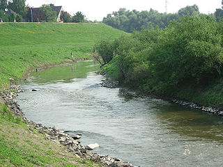
WThe Bodva is a 110-km long river in Slovakia and Hungary. Its source is in the Slovak Ore Mountains. The river crosses the border with Hungary near Turňa nad Bodvou, and it flows into the river Sajó in Boldva, north of Miskolc. Two of its tributaries are the Turňa and the Ida.
 W
WThe Crasna (Romanian) or Kraszna (Hungarian) is the name of a river in northwestern Romania and northeastern Hungary. The Crasna is a left tributary of the Tisza. Its source is in Transylvania, Romania, near the village of Crasna. It flows through the Romanian counties Sălaj and Satu Mare and the Hungarian county Szabolcs-Szatmár-Bereg. It flows into the Tisza in Vásárosnamény. Cities along the Crasna are Șimleu Silvaniei in Romania, Nagyecsed and Mátészalka in Hungary.
 W
WThe Crișul Alb (Romanian), is a river in western Romania in the historical region of Transylvania and south-eastern Hungary. Its source is in the southern Apuseni Mountains. It flows through the towns Brad, Ineu, Chișineu-Criș in Romania, and Gyula in Hungary. Crossing the border of Hungary, the river, now called Fehér-Körös, joins the Fekete-Körös a few kilometres north from Gyula to form the river Körös (Criș). In Romania, its length is 234 km (145 mi) and its basin size is 4,240 km2 (1,640 sq mi).
 W
WThe Crișul Negru (Romanian), is a river in western Romania (Transylvania) and south-eastern Hungary. The river has its source in the western Apuseni Mountains. It flows through the towns Ștei and Beiuș in Romania. Crossing the border of Hungary the river, now called Fekete-Körös, joins the Fehér-Körös a few kilometres north from Gyula to form the Körös river. In Romania, its length is 164 km (102 mi) and its basin size is 3,820 km2 (1,470 sq mi). Part of the water from the river Crișul Repede is diverted towards the Crișul Negru by the Criș Collector Canal.
 W
WThe Crișul Repede is a river in Bihor County, Crișana, Romania and in southeastern Hungary (Körösvidek). Together with the rivers Crișul Alb and Crișul Negru, it makes up the Three Criș rivers. These are considered the main rivers in the Crișana region of Romania. Historically, when Crișana was recognised as an official region, the Criș rivers were the most important rivers of the region. Its basin size is 9,119 km2 (3,521 sq mi). Its length in Romania is 171 km (106 mi).
 W
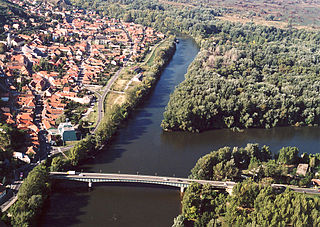
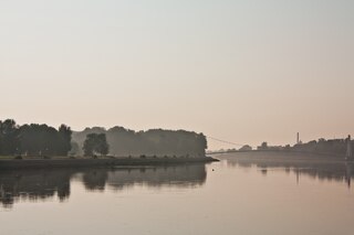
WThe Danube is Europe's second-longest river, after the Volga. It is located in Central and Eastern Europe.
 W
WThe Drava or Drave is a river in southern Central Europe. With a length of 710 kilometres (440 mi), 724 kilometres (450 mi) including the Sextner Bach source, it is the fifth or sixth longest tributary of the Danube, after the Tisza, Sava, Prut, Mureș and perhaps Siret. Its source is near the market town of Innichen, in the Puster Valley of South Tyrol, Italy. The river flows eastwards through East Tirol and Carinthia in Austria into the Styria region of Slovenia. It then turns southeast, passing through Croatia and, after merging with its main tributary Mur, forms most of the border between Croatia and Hungary, before it joins the Danube near Osijek.
 W
WHornád or Hernád is a river in eastern Slovakia and north-eastern Hungary.
 W
WThe Ier or Eriu is a right tributary of the river Barcău (Berettyó) in Romania and Hungary. It discharges into the Barcău in Pocsaj. The Andrid Dam is constructed on this river. The Ier flows through the villages Mihăieni, Eriu-Sâncrai, Ghirolt, Rădulești, Hotoan, Sudurău, Dindești, Andrid, Sălacea, Cherechiu, Săcueni, Diosig in Romania, and Pocsaj in Hungary. In Romania, its length is 100 km (62 mi) and its basin size is 1,392 km2 (537 sq mi).
 W
WThe Ipeľ or Ipoly (Hungarian) is a 232-kilometre (144 mi) long river in Slovakia and Hungary, a tributary of the Danube River. Its source is in central Slovakia in the Slovak Ore Mountains. It flows south to the Hungarian border, and then southwest, west, and again south along the border until it flows into the Danube near Szob.
 W
WKarašica or Baranjska Karašica or Karassó is a river in southern Hungary and eastern Croatia. It is 81 kilometres (50 mi) long, of which 30.46 km (18.93 mi) in Croatia. Its basin covers a total of 910 km2 (350 sq mi).
 W
WThe Körös-ér or Kereš, is a river in southern Hungary and northern Serbia, a 90-kilometre-long (56 mi) right tributary to the Tisa river. It flows entirely within the Bačka region of both Hungary and Serbia (Vojvodina): 37 km (23 mi) in Hungary, 15 km (9.3 mi) as a border river and 29 km (18 mi) in Serbia.
 W
WKobilje Creek is a brook in northeastern Slovenia and western Hungary. The brook is 33 kilometres (21 mi) long; 24 km (15 mi) of the course is in Slovenia. Its source is at Kamenek Hill and it flows through Kobilje, crosses the Slovenian–Hungarian border, returns to Slovenia, and joins the Ledava from its left side in the town Lendava. It is the longest tributary of the Ledava.
 W
WThe Körös or Criș is a river in eastern Hungary and western Romania. Its length is 128.6 km (79.9 mi) from the confluence of its two source rivers Fehér-Körös and Fekete-Körös to its outflow into the Tisza. Its drainage basin area is 27,537 km2 (10,632 sq mi). It has three source rivers, all of which have their origin in the Apuseni Mountains in Transylvania, Romania: Crișul Alb (Fehér-Körös), Crișul Negru (Fekete-Körös) and Crișul Repede (Sebes-Körös). The confluence of the rivers Fehér-Körös and Fekete-Körös is near the town Gyula. The Körös downstream from Gyula is also called the Kettős-Körös. 37.3 km further downstream, near Gyomaendrőd, the Sebes-Körös joins the Criș/Körös. The section downstream from Gyomaendrőd is also called the Hármas-Körös. The Körös flows into the Tisza River near Csongrád.
 W
WThe Lafnitz is a river in southeastern Austria and (briefly) western Hungary.
 W
WThe Leitha is a river in Austria and Hungary, a right tributary of the Danube. It is 120.8 km (75.1 mi) long.
 W
WThe Marcal is a right tributary of the Rába which rises near Sümeg in the Bakony region of western Hungary. The river flows north and reaches Ukk on the Little Hungarian Plain. It follows a path similar to the Rába, and in many places the two rivers are only a kilometer apart. The two rivers meet at Győr.
 W
WThe Mur or Mura is a river in Central Europe rising in the Hohe Tauern national park of the Central Eastern Alps in Austria with its source being 1,898 m (6,227 ft) above sea level. It is a tributary of the Drava and subsequently the Danube.
 W
WThe Mureș is a 789-kilometre-long (490 mi) river in Eastern Europe. Its drainage basin covers an area of 30,332 km2 (11,711 sq mi). It originates in the Hășmașu Mare Range in the Eastern Carpathian Mountains, Romania, rising close to the headwaters of the river Olt, and joins the Tisza at Szeged in southeastern Hungary. In Romania, its length is 761 km (473 mi) and its basin size is 27,890 km2 (10,770 sq mi).
 W
WThe Pinka is a river in Central Europe with a length of approximately 100 km (60 mi). Its source is located in Styria, eastern Austria, next to the provincial border of Burgenland. It passes into Hungary between the villages of Burg and Felsőcsatár, and crosses the Austrian-Hungarian border five times. Further it flows into the Rába river near Körmend. Its main tributary is the Strem.
 W
WThe Plazović or Kiđoš, is a river in southern Hungary and northern Serbia. It flows entirely within the Bačka region, and during its 129 km long course, on a section of only 15 km, it crosses the Hungarian-Serbian border eight times.
 W
WThe Rába is a river in southeastern Austria and western Hungary and a right tributary of the Danube.
 W
WThe Sajó (Hungarian) or Slaná (Slovak) is a river in Slovakia and Hungary.
 W
WThe Sárvíz is a river in Hungary. It is 110 kilometres (68 mi) long and flows into the Sió in the village of Sióagárd.
 W
WSéd is a river in western Hungary, north of Lake Balaton. It is 70 kilometres (43 mi) long and flows through the city of Veszprém. It starts in the Bakony region and is a tributary to the Sárvíz near Cece.
 W
WThe Sió or Sió-csatorna (Sió-Channel) is a fully regulated river in midwest Hungary. It is the outlet of Lake Balaton, flowing out of the lake in Siófok. It flows into the river Danube near the city of Szekszárd. Sió flows through the Hungarian counties Somogy, Fejér and Tolna, its main tributaries are Kapos from the right and Sárvíz from the left. The drainage basin of Sió covers nearly 15 000 km², more than a third of Transdanubia.
 W
WThe Someș, located in northwestern Romania, is a left tributary of the Tisza in Hungary. It has a length of 415 km (258 mi), of which 50 km are in Hungary. The Someș is the fifth largest river by length and volume in Romania. The hydrographic basin forms by the confluence at Mica, a commune about 4 km upstream of Dej, of Someșul Mare and Someșul Mic rivers. Someșul Mic originates in the Apuseni Mountains, and Someșul Mare springs from the Rodna Mountains.
 W
WThe Sugovica is a small river in southern Hungary, near Baja. It is also known as Kamarás-Duna. The Sugovica is an old tributary of the Danube.
 W
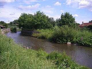
WSzinva is a stream in northern Hungary, a tributary to the river Sajó. It originates in the Bükk Mountains. It is 30 kilometres (19 mi) long, 20 kilometres (12 mi) of which can be found the city of Miskolc, through which the stream flows from west to east. More than 70 bridges were built over the stream, and in parts of the city centre it flows underground.
 W
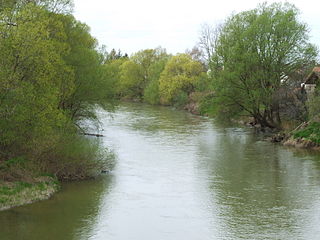
WThe Tisza, Tysa or Tisa, is one of the main rivers of Central and Eastern Europe. Once, it was called "the most Hungarian river" because it flowed entirely within the Kingdom of Hungary. Today, it crosses several national borders.
 W
WVálicka is a small river in Zala County of western Hungary. Also known as Felső-Válicka, Baki-Valicka, Baki-Válicka, Eszaki-Valicka, Valicka, Valicka-patak, Válicka-patak, Északi-Válicka. It originates in the Southwest of Zala County and merges into the Zala River. It flows by several villages including Bak, Sárhida, Bocfölde, Csatár, Botfa, Csácsbozsok. It is 27.3 kilometres (17.0 mi) long and collects water from 104 square kilometres (40 sq mi).
 W
WThe Zagyva is a river in Hungary. Its length is 179 km, and drains an area of about 5,677 km². The source is near Salgótarján in Nógrád county. It flows through the towns of Bátonyterenye, Pásztó, Hatvan and Jászberény and flows into the Tisza at Szolnok. Average discharge at Szolnok is 9 m³/s.
 W
WThe Zala is a river in south-western Hungary. Its source is in the hills northwest of Szalafő near the borders with Austria and Slovenia. Its length is 139 kilometres (86 mi) and drains water from 2,622 km2 (1,012 sq mi). Several smaller rivers feed into it, including the Felső-Válicka, Szentmihályfalvai patak (brook), Szévíz csatorna (channel), Foglár csatorna on the right bank, and Szentjakabi patak, Sárvíz (Zala) patak, Széplaki patak, Csörgető patak and Nádas patak on the left bank. It flows through the city of Zalaegerszeg before flowing into Lake Balaton near Keszthely. The River Zala flows through the Hungarian counties of Vas and Zala.