 W
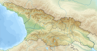
WThis List of Mountains in Georgia names the highest mountains in Georgia, country in the western part of the Caucasus. Georgia has 2672 prominent peaks. The highest peak in the country is the Shchara, at 5193 meters one of the country's three five-thousanders. The highest peaks in the country are in the Greater Caucasus. Another remarkable mountain is the Mtatsminda in the capital Tbilisi.
 W
WMount Adishi also known as Hadishi, is a peak in the central part of the Greater Caucasus Mountain Range. The elevation of the mountain is 4,290 m (14,070 ft) above sea level. The mountain is made up of paleozoic granites. The slopes of Adishi are covered by glaciers.
 W
WAilama or Ahlama is a peak in the central part of the Svaneti section of the Greater Caucasus Mountain Range, located on the border between Samegrelo-Zemo Svaneti region of Georgia, and Kabardino-Balkaria, Russia at the source of the river Koruldashi. The lower slopes are covered with alpine and sub alpine meadows, while the upper slopes have glacial landscapes. There is a mountaineering camp named "Ailama" at the base of the mountain's southern slope.
 W
WBabis Mta is a glacier-covered peak in the central part of the Greater Caucasus Mountain Range. The mountain is located on the border of Georgia and Kabardino-Balkaria, Russia. The elevation of the mountain is 4,454 metres (14,613 ft) above sea level. The Tsalgmili Range branches off from the southern flank of the mountain. The glaciers of Ledeshdvi, Dolra and Donguzorun descend from the slopes of Babis Mta.
 W
WBaghnarhesi is a 1,442-metre-high (4,731 ft) mountain of the Gagra Range in Abkhazia, Georgia.
 W
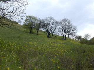
WMount Didgori, 1647 m, is situated some 40 km west of Georgia’s capital Tbilisi in the eastern part of the Trialeti Range, which is part of the Lesser Caucasus. It was a site of the celebrated victory won by the Georgian king David IV over the Seljuk armies on August 12, 1121. The battlefield extends for several kilometers and is covered by abundant subalipine meadows. Early in the 1990s, an impressive monument was erected at the site of the battle, consisting of dozens of massive swords pushed into the ground and posing as crosses, and colossal sculptures of dismembered bodies of warriors scattered in the meadows. The monument is located at 41º45'38 N, 44º30'29 E.
 W
WDidi Abuli is one of the highest peak of the Lesser Caucasus Mountains in the nation of Georgia. The mountain is located in the Abul-Samsari Range at an elevation of 3,300 m (10,830 ft) above sea level. Didi Abuli is an extinct stratovolcano
 W
WDiklosmta or simply Diklo is a peak in the eastern part of the Caucasus Mountains on the border of the Russian Republics of Chechnya and Dagestan and the Tusheti region of Georgia.
 W
WDombai-Ulgen or Dombay-Ulgen is a 4,046-metre-high (13,274 ft) mountain of the Greater Caucasus and the highest point of Abkhazia, a state with limited international recognition otherwise seen to be part of Georgia. It is located on the border with Karachay–Cherkessia, an autonomous republic of Russia. The mountain is composed of gneiss, crystalline schist, and granite. The top is covered by snow and glaciers at all times of the year.
 W
WMount Dzhimara or Jimara is the second highest point of North Ossetia–Alania, a Russian republic, with an altitude of 4,780 meters (15,680 ft). It is located on the border between Russia and Georgia.
 W
WGistola is a peak in the central part of the Greater Caucasus Mountain Range on Georgia–Russia border. The elevation of the mountain is 4,860 m (15,940 ft) above sea level. The mountain is made up of paleozoic granites. The slopes of Gistola are covered with ice.
WJanga or Jangi-Tau or Dzhangi-Tau is a summit in the central part of the Greater Caucasus Mountain Range. Mountain has three peaks - the main peak Jangi-Tau with elevation above sea level 5,085 m (16,683 ft), West Peak with elevation 5,059 m (16,598 ft) and East Peak with elevation 5,034 m (16,516 ft) Mountain lies on the border of Svaneti (Georgia) and Kabardino-Balkaria (Russia). The slopes of the mountain are heavily glaciated. They are most famous for the dormant volcanoes that are hidden under the ice caps.
 W
WJavalkheti Plateau is a volcanic plateau within the Caucasus Mountains that covers the Samtskhe-Javakheti region of Georgia, along the border with Turkey and Armenia. Its elevation is over 2,000 m.
WKabargin Oth Group is a group of volcanoes located in Georgia. It consists of a dozen cinder cones and lava domes and is located near the border with Russia, southwest of Mount Kazbek volcano.
 W
WKatyn-Tau is a summit in the central part of the Greater Caucasus Mountain Range. It lies on the border of Svaneti and Kabardino-Balkaria (Russia). The elevation of the mountain is 4979 m above sea level. The mountain is made up of paleozoic granites. The slopes of summit are covered nival landscape.
 W
WMount Kazbegi is a dormant stratovolcano and one of the major mountains of the Caucasus located on the border of Georgia's Kazbegi District
 W
WMount Khabarjina is a mountain and dormant volcano in the Caucasus of Georgia. It has an elevation of 3,142 metres. It is located near Mount Kazbek and is a part of its volcanic group. It is better known under the name Mount Kabardzhin.
WMount Khalatsa or Khalaskhokh is the highest point of South Ossetia, a disputed region in Georgia, with an altitude of 3,938 metres (12,920 ft). It is located on the border between South Ossetia and North Ossetia–Alania, a Russian autonomous republic.
 W
WKhvamli or Khomli (ხომლი) is a limestone massif in western Georgia, located on the territories of Tsageri and Tsqaltubo municipalities and forming the watershed division between the Rioni and Tskhenis-Tsqali river valleys. It stands at 2,002 metres (6,568 ft) and forms a double cuesta, consisting of Cretaceous limestone units and covered by mixed forests. It presents to the south a bluff face of 300 metres (984 ft) height. Both cuestas have a northward-facing scarp perforated by numerous sinkholes and caves. Most important of the caves is called Tekenteri (თეკენთერი) and has only one entrance—through the hollow of a large beech tree.
 W
WKldekari is a mountain and a rocky pass in the Trialeti range, southeastern Georgia. In the vicinity are the ruins of a medieval Kldekari Fortress.
 W
WLalveri is a peak of the Greater Caucasus Mountain Range in the Svaneti region of Georgia adjacent to the Georgia–Russia border. The elevation of the mountain is 4,350 meters (14,268 ft.) above sea level. The most accessible climbing route to the summit of Lalveri is through the Tsaneri Glacier.
WLatsga is a peak of the Greater Caucasus Mountain Range in the Svaneti region of Georgia. Latsga's main glacier, Lekhzir, covers the mountain's southern slopes and portions of the adjacent valleys.
 W
WMount Leyli, also Leili is a 3,157 m (10,358 ft) tall mountain between the Georgian provinces of Samtskhe-Javakheti and Kvemo Kartli. Leyli is second highest peak of the Javakheti Range in the Lesser Caucasus Mountains.
 W
WMount Bagineti, is a mountain on the eastern slope of Trialeti Range, a part of Lesser Caucasus Mountains, in the Republic of Georgia, situated at the confluence of rivers Kura and Aragvi, near the ancient city of Mtskheta. According to The Georgian Chronicles, the eponymous ancestor of the Georgians, Kartlos, settled at the mountain, built a fortress, own house and named it by his name, Kartli, and eventually was buried at the top of Bagineti. The country also received its name after the mountain, Kartli. Later, in the times of the first Georgian king Pharnavaz, idol of god Armazi was put on the top of the mountain, and it changed its name to Armazi. The King Pharnavaz was also buried at the top of the mountain. Ruins of the ancient city of Armazi are found at the base of the mountain.
 W
WSakornia, is a mountain in Georgia. Part of the Meskheti Range, it is located within the Chokhatauri Municipality of Guria and has an elevation of 2752 metres.
 W
WMount Samsari is a peak of the Abul-Samsari Range in Southern Georgia. The elevation of the mountain is 3,285 metres (10,778 ft) above sea level. Mount Samsari represents a volcanic cone, inside of which lies a caldera with a diameter of 3 kilometres (1.9 mi) with a semicircular ridge surrounding it. The formation of the caldera is linked to local fault systems. The floor of the caldera is lined with rocks and glacial debris as well as small lakes and contains volcanokarst formations. The caldera rim contains traces of previous glaciation, including cirques. The mountain was built up during the late Quaternary period and is made up of andesites, dacites and rhyolites. The slopes of Samsari are mainly devoid of vegetation. The caldera formed roughly 200ka ago.
WMt. Shani is a mountain in the Caucasus. It has an elevation of 4,451 metres (14,603 ft) and is on the international border between Georgia and Ingushetia, Russia. The mountain rises immediately to the east of Stepantsminda, Georgia.
 W
WShavnabada is a mountain and extinct volcano of 770 m height in southeastern Georgia, some 96 km from the nation’s capital Tbilisi.
 W
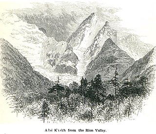
WShkhara is the highest point in the nation of Georgia. Located in the Svaneti region along the Georgia–Russia border, Shkhara lies 88 kilometres (55 mi) north of the city of Kutaisi, Georgia's second-largest city. The summit lies in the central part of the Greater Caucasus Mountain Range, to the south-east of Mount Elbrus, Europe's highest mountain. Shkhara is the third-highest peak in the Caucasus, just behind Dykh-Tau.
 W
WShota Rustaveli is a mountain in the central part of the Greater Caucasus Mountain Range, straddling the border of Svaneti (Georgia) and Kabardino-Balkaria (Russia). The elevation of the mountain is 4,960 meters. Shota Rustaveli is generally considered to be the 9th highest peak of the Caucasus. The slopes of the mountain are glaciated and some of the glaciers descend well into the adjacent valleys. Its name comes from famous Georgian poet Shota Rustaveli.
 W
WMount Tavkvetili is a volcanic mountain in the northern part of the Abul-Samsari Range in the Samtskhe-Javakheti region of Southern Georgia. It is also known as Gora Tavk'vetili and Mta Tavk'vetili. The elevation of the mountain is 2,583 metres (8,474 ft) above sea level and is the 323rd highest mountain in Georgia. The mountain has the shape of a decapitated cone and is composed of young andesitic and andesitic-dacitic lavas. The lower slopes of Mount Tavkvetili are covered by subalpine meadows while the upper slopes are covered by alpine meadows.
 W
WTebulosmta is the highest mountain of the Eastern Caucasus and the highest mountain of the Chechen Republic at an elevation of 4,493 meters above sea level. The mountain is located on the border of Georgia and Chechnya to the east of Mount Kazbek. The glaciers of the mountain are not large.
 W
WTetnuldi is a prominent peak in the central part of the Greater Caucasus Mountain Range, located in the Svaneti region of Georgia. According to most sources, Tetnuldi is the 10th highest peak of the Caucasus. The slopes of the mountain are glaciated generally above the 3,000 metre (9,840 ft) line. The most prominent glacier of the mountain is called Adishi.
 W
WThe Tsalka Plateau is a volcanic plateau in central Georgia, in the upper reaches of the Khrami River, roughly corresponding to the territory of the Tsalka Municipality and a small portion of the adjacent Borjomi Municipality. It is considered part of the greater Javakheti Plateau.
WTsiteli Khati is a summit of the Kharuli Range in Northern Georgia. The elevation of the peak is 3,026 metres (9,928 ft) above sea level. The mountain is located within the Kheli Volcanic Region of Georgia, an area which is the largest source of volcanism on the southern slopes of the Greater Caucasus Mountain Range within Georgia's boundaries. Tsiteli Khati is built up of holocene age andesites and dacitic lavas. The peak itself is a young volcanic cone with slopes that show no signs of any significant erosion. The vegetation of the mountain consists of subalpine and alpine meadows.
 W
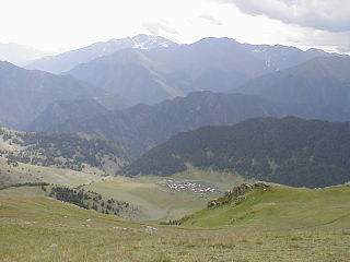
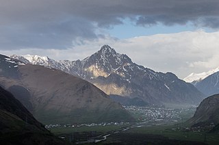
WUshba is one of the most notable peaks of the Caucasus Mountains. It is located in the Svaneti region of Georgia, just south of the border with the Kabardino-Balkaria region of Russia. Although it does not rank in the 10 highest peaks of the range, Ushba is known as the "Matterhorn of the Caucasus" for its picturesque, spire-shaped double summit. Due to its steep profile and unstable weather, Ushba is considered by many climbers as the most difficult ascent in the Caucasus.
 W
WMount Yemlikli, also Emlikli, Emlik'li is a 3,054 m (10,020 ft) tall mountain near Saghamo and between the Georgian provinces of Samtskhe-Javakheti and Kvemo Kartli. Yemlikli is one of the high peaks of the Lesser Caucasus Mountains and is in the Javakheti Range.