 W
WThe Harz is a highland area in northern Germany. It has the highest elevations for that region, and its rugged terrain extends across parts of Lower Saxony, Saxony-Anhalt, and Thuringia. The name Harz derives from the Middle High German word Hardt or Hart, Latinized as Hercynia. The Brocken is the highest summit in the Harz with an elevation of 1,141.1 metres (3,744 ft) above sea level. The Wurmberg is the highest peak located entirely within the state of Lower Saxony.
 W
WThe Upper Harz refers to the northwestern and higher part of the Harz mountain range in Germany. The exact boundaries of this geographical region may be defined differently depending on the context. In its traditional sense, the term Upper Harz covers the area of the seven historical mining towns (Bergstädte) - Clausthal, Zellerfeld, Andreasberg, Altenau, Lautenthal, Wildemann and Grund - in the present-day German federal state of Lower Saxony. Orographically, it comprises the Harz catchment areas of the Söse, Innerste and Grane, Oker and Abzucht mountain streams, all part of the larger Weser watershed.
 W
WThe Alter Stolberg is a wooded karst plateau, up to 357.7 m above sea level (NN), in the South Harz in Central Germany. It lies in the districts of Nordhausen in the state of Thuringia and Mansfeld-Südharz in the state of Saxony-Anhalt.
 W
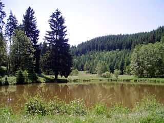
WThe Bauerngraben, also called the Hungersee, is a lake in Germany between Breitungen, Agnesdorf and Roßla in the South Harz. It is an intermittent lake of about 350 metres (1,150 ft) in length and 100 metres (330 ft) in width, into which the Glasebach disappears. A feature of this lake is its sudden disappearance from time to time, when the outlet opens due to the removal of material. The lake can then become dry for a long period. The Bauerngraben ist part of the Gipskarstlandschaft Questenberg nature reserve.
 W
WThe Bode Gorge is a 10 kilometres (6.2 mi) long ravine that forms part of the Bode valley between Treseburg and Thale in the Harz Mountains of central Germany. The German term, Bodetal, is also used in a wider sense to refer to the valleys of the Warme and Kalte Bode rivers that feed the River Bode.
 W
WBodfeld was a small royal palace or lodge that was primarily established for hunting purposes and, when the town of Elbingerode was emerged, for the administration of ore mining in the central Harz that underpinned the power of the Ottonian and Salian kings and emperors in medieval Europe. The term Bodfeld is also used to describe an area of forest that lies predominantly south of Elbingerode.
 W
WThe Bremer Teich is an historic reservoir that lies south of the two villages of Bad Suderode and Gernrode in the Harz Mountains of Germany, and is used as a recreation area. It impounds the Bremer Graben, an artificial channel fed by water from the Bode and the Saale. The water reservoir was built in the 18th century in the Lower Harz (Saxony-Anhalt). It has an area of ca. 4 ha. The pond is located on the Romanesque Road and the North Harz Cycleway.
 W
WThe Brocken Garden is an alpine botanical garden on the summit of the Brocken, the highest peak in the Harz mountains of Germany. It lies within the Harz National Park near Wernigerode in the state of Saxony-Anhalt and has a stock of around 1,600 types of plant. These include species that only grow in the Brocken region, like the Brocken anemone or alpine pasqueflower and the Brocken hawkweed, but its main focus is on alpine plants like the white dryad and the Swiss willow. It is open daily without charge.
 W
WThe Brocken Pond is the name of a waterbody that was created in 1744 in the County of Wernigerode below the summit of the Brocken, the highest mountain in the Harz mountains of Germany. It is located in the present-day district of Harz.
 W
WDicke Tannen is a protected landscape, around 4.2 hectares in area, near the Harz village of Hohegeiß, which lies in the borough of Braunlage. It is the site of the mightiest spruce trees in North Germany; the individual trees reaching heights of 50 metres and trunk diameters of 100 to 180 centimetres. The landscape has been specially protected since 1989 as a natural monument.
 W
WThe Dreieckige Pfahl is an historic boundary stone, about 1.35 metres high and made of granite, located southwest of the Brocken, the highest mountain in the Harz Mountains of central Germany. The stone, erected before 1866, marked the border between the Kingdom of Hanover and the Duchy of Brunswick. Originally this spot was a tripoint. During the division of Germany the border between the German Democratic Republic and the Federal Republic of Germany ran past the Dreieckiger Pfahl. Today it marks the border between the states of Saxony-Anhalt and Lower Saxony, the post lying just within the Lower Saxon side. During the Cold War it was accessible from the west.
 W
WThe Hanskühnenburg is a mountain hut in the Harz mountains. It is located at a height of 811 m (2,661 ft) above sea level in fields known as Auf dem Acker, or simply Acker, in the middle of the Harz National Park and has its own observation tower. Its name comes from the legendary Hanskühnenburg Crag 300 metres to the northwest, which was visited on 14 August 1784 by Johann Wolfgang von Goethe. Opposite the tower are the Hanskühnenburg Rocks that are relatively small by comparison with the Klippe. A bronze plaque was mounted on these rocks in 1999 to commemorate Goethe's visit. In front of the Hanskühnenburg Rocks, a monument was erected in 1924 to Albert Leo Schlageter. It has since fallen over and is rather weathered.
 W
WThe Harz Club is club dedicated to maintaining the traditions of the Harz mountains in Germany and looking after the walking trails in the Harz. It was founded in 1886 in Seesen and, today, has about 16,000 members in some 90 branches.
 W
WHarz National Park is a nature reserve in the German federal states of Lower Saxony and Saxony-Anhalt. It comprises portions of the western Harz mountain range, extending from Herzberg and Bad Lauterberg at the southern edge to Bad Harzburg and Ilsenburg on the northern slopes. 95 % of the area is covered with forests, mainly with spruce and beech woods, including several bogs, granite rocks and creeks. The park is part of the Natura 2000 network of the European Union.
 W
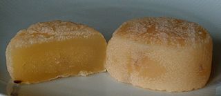
WHarzer cheese is a German sour milk cheese made from low fat curd cheese, which originates in the Harz mountain region south of Braunschweig.
 W
WThe Harzer Wandernadel is a system of hiking awards in the Harz mountains in central Germany. The hiker can earn awards at different levels of challenge by walking to the various checkpoints in the network and stamping his or her passbook to record the visit. With 222 checkpoints in three federal states and across five districts in the Harz and with membership in five figures, the system has gained a following Germany-wide.
 W
WDie Harzreise is a travel report by German poet and author Heinrich Heine on a journey to the Harz mountains. Compiled in autumn 1824, it was first published as a serial in January and February 1826 in the magazine Der Gesellschafter by Friedrich Wilhelm Gubitz and ran for 14 instalments. Some censorship changes were made beforehand. Later in 1826 Die Harzreise appeared in the first part of the Reisebilder collection. For the book, Heine made revisions and changes, and added the famous Göttingen section. Heine himself described his record as a literary fragment. The book was the first of Heine's to be published by Hoffmann & Campe in Hamburg, the publisher who later brought out all Heine's writings.
WThe Hexentanzplatz in the Harz mountains is a plateau that lies high above the Bode Gorge, opposite the Rosstrappe in Saxony-Anhalt, Germany.
 W
WThe Hunrodeiche or, more rarely, the Hunrodseiche, in the Harz Mountains of central Germany is an oak tree over 1,000 years old near Hainfeld in the county of Mansfeld-Südharz in the state of Saxony-Anhalt.
 W
WThe Ilse valley is the ravine of the Ilse stream in the northern boundary of the Harz mountain range in Germany. Part of the Harz National Park, it runs from the town of Ilsenburg at the foot of the mountain range up to the source region near the summit of the Brocken massif, the highest mountain of the range. The scenic valley is a popular hiking area.
 W
WIlsenburg House stands in the town of Ilsenburg (Harz) in the German state of Saxony-Anhalt and was given its present appearance in the 2nd half of the 19th century. The structure was built from 1860 onwards on the west and north sides of the Romanesque monastery of Ilsenburg Abbey. The stately home, designed in the Neo-Romanesque style, was the seat of the princes of Stolberg-Wernigerode until 1945. Since 2005, it has been owned by the Ilsenburg Abbey Foundation.
 W
WThe Kaiser Way, literally "Emperor Way", is a thematic long distance footpath in the Harz mountains of Germany, which is about 110 km long and crosses both the Harz and the Kyffhäuser hills. From Goslar and Bad Harzburg on the northern edge of the Harz it runs across the Harz to Walkenried in the south; and then via Nordhausen to Tilleda on the Kyffhäuser.
 W
WThe Katzsohlteich is an artificially impounded reservoir that lies southwest of the town of Güntersberge in the Harz Mountains of central Germany and is used as a preflooder (Vorfluter) and fishpond. Only a few metres from the pond is the considerably larger lake of Bergsee, past the southern shores of which runs the Selke Valley Railway.
 W
WThe Kleine Renne is a cascading mountain stream and officially designated natural monument near the town of Wernigerode in the Harz Mountains of Germany.
 W
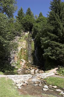
WKönigshütte Waterfall is a waterfall in the village of Königshütte in the borough of Oberharz am Brocken in the Harz Mountains of Central Germany.
 W
WKönigsruhe is a small settlement in the Bode Gorge in the Harz Mountains of Germany, south of the town of Thale in Saxony-Anhalt.
 W
WThe Molkenhaus near Bad Harzburg is a wooden house, built in 1822, where cattle from the hillside pastures used to be milked without having to be driven miles to the surrounding farms. The house was owned by the manor of Bündheim-Bad Harzburg and, today, has been extended into a popular restaurant for day trippers and hikers. The property lies on the shores of the Hasselteich pond, about 3 km (1.9 mi) south of Bad Harzburg east of the Rudolfklippe crags on a valley water meadow.
 W
WThe Northern Harz Boundary Fault is a geological fault where the Harz Block, which consists of rocks formed during the Palaeozoic Era and folded in the course of Hercynian mountain building, borders on the Subhercynian Basin or Harz Foreland. The fault is also known in English as the Harz North Rim Fault or Harznordrand Thrust (Fault).
 W
WPrincess Ilse is the name of a popular tourist destination in the Ilse valley near the town of Ilsenburg in the Harz Mountains of central Germany. The spot was named after the River Ilse, which rises on the highest mountain in the Harz, the legendary Brocken, and flows through the romantic Ilse valley to Ilsenburg.
 W
WSchierker Feuerstein is a German herbal liqueur, a half-bitters at a strength of 35% alcohol by volume, originally produced in the village of Schierke, located in the Upper Harz region of Saxony-Anhalt, Germany. Due to its red-brown coloration, the liqueur is named after the so-called Feuersteinklippe, a rock formation near the village made of reddish granite.
 W
WThe Schurre is a stone run in the Bode Gorge in the Lower Harz near Thale in Saxony-Anhalt, Germany. The stone run is slowly slipping downhill, the sliding of its boulders being audible especially during periods of heavy rain.
 W
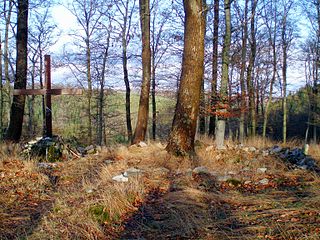
WSelkenfelde is an abandoned village in Saxony-Anhalt in the central German district of Harz. It is located not far from the B 242 federal road between Stiege (Harz) and Güntersberge. According to legend the origins of the village go back to Charlemagne. It was first mentioned as Silicanuelth in AD 961 in two documents by King Otto I and co-regent Otto II dated 15 and 25 July. Selkenfelde had been already abandoned by the Thirty Years' War.
 W
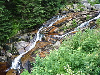
WThe Steinerne Renne is a waterfall and natural monument near the town of Wernigerode in the Harz mountains of central Germany.
 W
WThe Stierbergsteich in the Harz Mountains of central Germany is a storage pond near Rothesütte on the boundary of the counties of Harz (Saxony-Anhalt) and Nordhausen (Thuringia).
 W
WThe County of Stolberg was a county of the Holy Roman Empire located in the Harz mountain range in present-day Saxony-Anhalt, Germany. It was ruled by a branch of the House of Stolberg.
 W
WThe Thuringii, Toringi or Teuriochaimai, were an early Germanic people that appeared during the late Migration Period in the Harz Mountains of central Germania, a region still known today as Thuringia. It became a kingdom, which came into conflict with the Merovingian Franks, and it later came under their influence and Frankish control. The name is still used for one of modern Germany's federal states (Bundesländer).
 W
WThe Trudenstein is a rock formation and popular hiker's destination in the Harz Mountains of central Germany. It is located in the federal state of Saxony-Anhalt.
 W
WThe WeltWald Harz up to 2009 Arboretum Bad Grund, also known as Exotenwald and sometimes called the Arboretum des Forstamtes Grund or the Forstaboretum der Niedersächsischen Landesforstverwaltung, is an arboretum located along the B 242 federal highway near the Hübichenstein, northwest of Bad Grund, Lower Saxony, Germany. It is open daily without charge.