 W
WThe Arun River is a trans-boundary river and is part of the Kosi or Sapt Koshi river system in Nepal. It originates in Tibet Autonomous Region of the People's Republic of China where it is called the Phung Chu or Bum-chu.
 W
WThe Babai River originates in and completely drains Inner Terai Dang Valley of Mid-Western Nepal. Dang is an oval valley between the Mahabharat Range and Siwalik Hills in its eponymous district. Dang was anciently home to indigenous Tharu people and came to be ruled from India by the House of Tulsipur who also counted as one of the Baise Rajya —a confederation of 22 petty kingdoms in the Karnali (Ghagra) region. About 1760 AD all these kingdoms were annexed by the Shah Dynasty during the unification of Nepal, except Tulsipur lands south of the Siwalik Hills were not taken. Since Dang Valley was somewhat higher, cooler, better-drained and therefore less malarial than most of the country's Inner Terai, it was settled to some extent by Shah and Rana courtiers and other Paharis long before DDT was introduced to control the disease-bearing Anopheles mosquito.
 W
WThe Badighat River or Badigad is a river in Gulmi District, Nepal.
 W
WThe Bagmati River runs through the Kathmandu Valley of Nepal and separates Kathmandu from Patan flowing through the Province No. 2 of Southern Nepal that finally drains into the Indian State of Bihar . It is considered holy by both Hindus and Buddhists. A number of Hindu temples are located on its banks.
 W
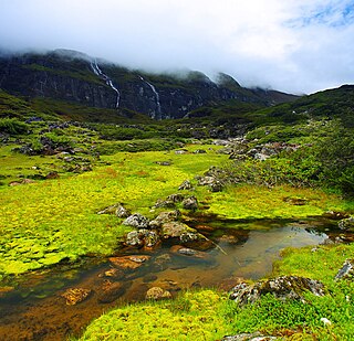
WThe Barun River is a tributary of the Arun River and is part of the Kosi river system in Nepal.
 W
WThe Bhote Koshi is the upper river course of the Sun Kosi, known as Poiqu in Tibet. It is part of the Koshi River system in Nepal.
 W
WThe Bisnumati River, flowing in the Kathmandu Valley, originates at Tokha on Sivapuri Mountain, north of Kathmandu. It flows through the western part of old Kathmandu city. It is a holy river for both Hindu and Buddhist people. Literally, Bishnumati means the beloved river of Lord Vishnu. Sobha Baghwati and Indrayani along with Kankeshowri temple - a few of the holiest places of the Kathmandu Valley are on the opposite banks of this river. Karbir Masan, a revered cemetery is also on the bank of this river. the tributaries of this river are Sapanatirtha Khola, Sangle Khola, Lhora Khola and Binap fall. Bisnap fall locates at the Shivapuri National Park just above the Muhan Pokhari.
 W
WThe Budhi Gandaki River is a tributary of Gandaki River in Nepal. It meets the Trishuli at the small named place of Benighat, astride Dhading and Gorkha Districts.
 W
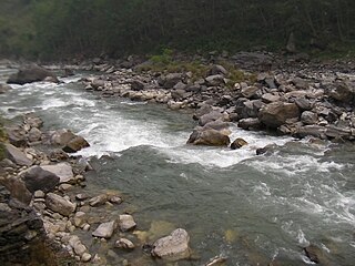
WThe Chhandi River, or Chhandi Khola is a river in Nepal, a tributary of the Dordi River.
 W
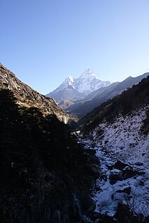
WDudh Koshi is a river in eastern Nepal. It is the highest river in terms of elevation.
 W
WThe East Rapti River flows from east to west through the Chitwan Valley in Nepal, forming the northern border of the Chitwan National Park. It joins the Narayani River inside the protected area.
 W
WThe Gandaki River, also known as the Narayani and the Gandak, is one of the major rivers in Nepal and a left bank tributary of the Ganges in India. Its total catchment area amounts to 46,300 km2 (17,900 sq mi), most of it in Nepal. In the Nepal Himalayas, it is notable for its deep canyon. The basin also contains three mountains over 8,000 m (26,000 ft), namely Dhaulagiri, Manaslu and Annapurna I. Dhaulagiri is the highest point of the Gandaki basin.
 W
WGhaghara, also called Karnali is a perennial trans-boundary river originating on the Tibetan Plateau near Lake Manasarovar. It cuts through the Himalayas in Nepal and joins the Sharda River at Brahmaghat in India. Together they form the Ghaghara River, a major left bank tributary of the Ganges. With a length of 507 kilometres (315 mi) it is the longest river in Nepal. The total length of Ghaghara River up to its confluence with the Ganges at Revelganj in Bihar is 1,080 kilometres (670 mi). It is the largest tributary of the Ganges by volume and the second longest tributary of the Ganges by length after Yamuna.
 W
WGodawari River are two different rivers (tributaries), located in two different regions of Nepal.
 W
WHarpan Khola (river) is a tributary of Phewa Lake in Pokhara.
 W
WThe Imja Khola is a tributary of the Dudh Kosi in Nepal. It drains the slopes of Mount Everest. The Khumbu Glacier melts into the Lobujya (Lobuche) River, which flows southward as the Imja Khola to its confluence with the Dudh Kosi at Tengboche.
 W
WThe Indravati River in Nepal is a tributary of the Sun Koshi River. It used to be called "Melamchi" or "Melamchu" until the 19th century.
 W
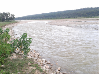
WThe Kamala River originates from Nepal and flows through Indian state of Bihar.
 W
WThe Kankai River (Nepali: कन्काई नदी, is a trans-boundary river flowing through Ilam and Jhapa in north to south direction of Nepal. Holy river of millions of Hindu Devotees living throughout Nepal. Passes through the hills of Ilam and plains of Jhapa District. Kotihom river Bank is the centre for Death rituals of millions of Hindus living in Jhapa and Ilam. Kankai Irrigation Project launched by Nepal government irrigates the southern Jhapa like Shivganj, Pachgachi, Mahavara etc.
WGhaghara, also called Karnali is a perennial trans-boundary river originating on the Tibetan Plateau near Lake Manasarovar. It cuts through the Himalayas in Nepal and joins the Sharda River at Brahmaghat in India. Together they form the Ghaghara River, a major left bank tributary of the Ganges. With a length of 507 kilometres (315 mi) it is the longest river in Nepal. The total length of Ghaghara River up to its confluence with the Ganges at Revelganj in Bihar is 1,080 kilometres (670 mi). It is the largest tributary of the Ganges by volume and the second longest tributary of the Ganges by length after Yamuna.
 W
WThe Kosi or Koshi is a trans-boundary river which flows through Tibet, Nepal and India. It drains the northern slopes of the Himalayas in Tibet and the southern slopes in Nepal. From a major confluence of tributaries north of the Chatra Gorge onwards, the Kosi River is also known as Saptakoshi for its seven upper tributaries. These include the Tamor River originating from the Kanchenjunga area in the east and Arun River and Sun Kosi from Tibet. The Sun Koshi's tributaries from east to west are Dudh Koshi, Bhote Koshi, Tamakoshi River, Likhu Khola and Indravati. The Saptakoshi crosses into northern Bihar, India where it branches into distributaries before joining the Ganges near Kursela in Katihar district.
 W
WThe Likhu Khola is a left tributary of the Sun Koshi in the Himalayas in eastern Nepal. Given named by Kirat kingdom Likhu or Liku in the Sunuwar language means Top (Hill) Water.
 W
WThe Marshyangdi is a mountain river in Nepal. Its length is about 150 kilometres.
 W
WThe Mechi River is a trans-boundary river flowing through Nepal and India. It is a tributary of the Mahananda River.
 W
WModi River or Modi Khola is a tributary of Gandaki River in Parbat district of Nepal. It is a snow-fed perennial river originating from Annapurna Mountains and has a catchment area of 675 km2. It meets the Kali Gandaki River at Modi Beni of Parbat District. The total length of the river is approximately 50km. The main tributaries of Modi river are Bhurangdi Khola, Rati Khola, Pati Khola, Malyangdi Khola, Ghandruk Khola and Ambote Khola. The mean annual precipitation in the basin is approximately 2700mm and 80% of the total annual rainfall occurs during the monsoon.
 W
WMyagdi Khola is a river which has its source at Mt. Dhaulagiri, then passes through Myagdi district to meet to the Kaligandaki river. The term "myagdi" may be originated from the two terms Meng and dee. Meng means thapa magar and Dee means water in magar language. It is the everflow river. The term "khola" means, in local (Nepali) language river.
WThe Gandaki River, also known as the Narayani and the Gandak, is one of the major rivers in Nepal and a left bank tributary of the Ganges in India. Its total catchment area amounts to 46,300 km2 (17,900 sq mi), most of it in Nepal. In the Nepal Himalayas, it is notable for its deep canyon. The basin also contains three mountains over 8,000 m (26,000 ft), namely Dhaulagiri, Manaslu and Annapurna I. Dhaulagiri is the highest point of the Gandaki basin.
WThe Rudi River, or Rudi Khola is a river in Nepal, a left tributary of the Madi River.
 W
WThe Seti Gandaki River, also known as the Seti River or the Seti Khola, is a river of western Nepal, a left tributary of the Trishuli River. Its gorges around Pokhara are a major attraction for tourists worldwide.
 W
WThe Seti River is an important tributary of the Karnali system that drains western Nepal.
 W
WThe Sharda River, also called Kali River and Mahakali River, originates at Kalapani in the Himalayas at an elevation of 3,600 m (11,800 ft) in the Pithoragarh district in Uttarakhand, India. It flows along Nepal's western border with India and has a basin area of 14,871 km2 (5,742 sq mi). It joins Ghaghra River, a tributary of the Ganges. It takes the name Kali River from the union of the two streams at Gunji as it flows through the hills. After Brahmadev Mandi near Tanakpur, it enters the Terai plains, where it is called Sharda River.
 W
WThe Sunkoshi, also called Sunkosi, is a trans-boundary river that originates in Tibet Autonomous Region and is part of the Koshi or Saptkoshi River system in Nepal.
 W
WThe Tamakoshi River is part of the Koshi or Sapt Koshi river system in Nepalese Himalayas. It originates from Rongshar Chu und Lapchi Gang rivers close to the Nepal-Tibet border. It flows in southern direction through Bagmati Pradesh in Nepal, namely through Dolakha District and Ramechhap District.
 W
WThe Tamor River is a major river in eastern Nepal, which begins around Kanchenjunga. The Tamor and the Arun join the Sun Koshi at Tribenighat to form the giant Saptakoshi which flows through Mahabharat Range on to the Gangetic plain
 W
WThuli Bheri River, a tributary of the Karnali River, starts in the Chharka region of Dolpa District where it is known as the Bhargung Khola (river).
 W
WThe Tinau is a Class- II category River originating from the Mahabharat Mountains and flowing through the Siwalik Hills and Terai Plain at Butwal, Nepal before joining the Ganges.
 W
WThe Trishuli River is one of the major tributaries of the Narayani River basin in central Nepal. It originates in Tibet as a stream and enters Nepal at Gyirong Town.
 W
WWest Rapti drains Rapti Zone in Mid-Western Region, Nepal, then Awadh and Purvanchal regions of Uttar Pradesh state, India before joining the Ghaghara—a major left bank tributary of the Ganges known as the Karnali inside Nepal.