 W
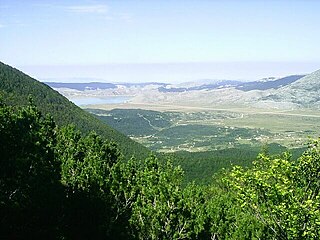
WThe Dinaric Alps, also commonly Dinarides, are a mountain range in Southern and Southeastern Europe, separating the continental Balkan Peninsula from the Adriatic Sea. They stretch from Italy in the northwest through Slovenia, Croatia, Bosnia and Herzegovina, Serbia, Montenegro, Kosovo to Albania in the southeast.
 W
WThe following list consists of Dinaric karst highland plateaus in Bosnia and Herzegovina:
 W
WBić is a mountain on the border of Serbia and Bosnia and Herzegovina, above the town of Priboj. Its highest peak Golet has an elevation of 1,386 m (4,547 ft) above sea level. At the foot, there is the medieval fortress of Jagat.
 W
WBlidinje Nature Park is a nature park in Bosnia and Herzegovina, established on 30 April 1995. It is situated at the Blidinje plateau, in the heart of Dinaric Alps, between major mountains of the range, Čvrsnica, Čabulja and Vran, with characteristic karstic features such as Dugopolje field, Blidinje Lake, Grabovica and Drežanka valleys, and others. It represents important natural, hydrogeological reserves in Dinaric karst of Bosnia and Herzegovina, with significant cultural and historical heritage.
 W
WĆićarija, is a mountainous plateau in the northern and northeastern part of the Istria peninsula, 45 kilometers (28 mi) long and 10–15 kilometers (6.2–9.3 mi) wide. It mostly lies in Croatia, while its northern part lies in southwestern Slovenia. The highest peak is Veliki Planik at 1,272 meters (4,173 ft).
 W
WCincar is a mountain in the Dinaric Alps of western Bosnia and Herzegovina, located at 43°54′08″N 17°03′46″E between Livno, Kupres and Glamoč. The highest peak is the eponymous Cincar peak at 2,006 m (6,581 ft).
 W
WDinara is a 100 kilometres (62 mi) long mountain range in the Dinaric Alps, located on the border of Bosnia and Herzegovina and Croatia. It has four major mountains or peaks, from north-west to south-east:Ilica or Ujilica Sinjal or Dinara, eponym to the range, highest mountain in Croatia Troglav, highest peak in the range Kamešnica, with peak Konj
WThe Dinaric Mountains mixed forests are a terrestrial ecoregion of the temperate broadleaf and mixed forests biome in Southeastern Europe, according to both the WWF and Digital Map of European Ecological Regions by the European Environment Agency. It also is in the Palearctic realm.
 W
WA foiba — jama in South Slavic languages scientific and colloquial vocabulary — is a type of deep natural sinkhole, doline, or sink, and is a collapsed portion of bedrock above a void. Sinks may be a sheer vertical opening into a cave, or a shallow depression of many hectares. They are common in the Karst (Carso) region shared by Italy and Slovenia, as well as in a karst of Dinaric Alps in Bosnia and Herzegovina, Montenegro and Croatia.
 W
WGarač is a mountain in central Montenegro, overlooking the city of Danilovgrad from the southwest. Its highest peak, Milunova bobija, is 1,436 meters high. Despite its relatively small height, its shape and prominence of circa 1400 meters, rising above the Zeta River Valley and Bjelopavlići, earned it the nickname "Montenegrin Kilimanjaro".
 W
WSaint Gera or Trdina Peak is the highest peak of the Žumberak Mountains, at a height of 1,178 metres (3,865 ft). It is located along the border between southeastern Slovenia and Croatia, and the summit is subject to a border dispute between the two nations.
 W
WGlaciokarst is a karst landscape that was glaciated during the cold periods of the Pleistocene and displays major landforms of glacial influence. For this reason karstification can be pre- and/or post- Pleistocene; this is not easy to classifiy. Mostly Glaciokarst has not such distinctly karst landforms.
 W
WJahorina ski resort, officially named Olympic Center Jahorina, is a mountain resort and the largest and most popular winter tourism resort in Bosnia and Herzegovina. The ski resort is situated on the slopes of Jahorina mountain in Dinaric Alps. It is located 15 km (9.3 mi) from the municipality of Pale in the Republika Srpska entity and 30 km (19 mi) from the Sarajevo International Airport. The Jahorina ski resort hosted alpine skiing competitions during the 1984 Winter Olympics.
 W
WThe Javornik Hills are a limestone plateau in Slovenia and part of the Dinaric Alps. The highest peak is Veliki Javornik at 1,268 metres (4,160 ft) above sea level. At the northern edge of the Javornik Hills lies the Postojna Gate.
WKamenik is a Dinaric limestone mountain, located in Rovca region in central Montenegro.
 W
WKarst fenster is a geomorphic feature formed from the dissolution of carbonate bedrock. In this feature, a spring emerges, then the discharge abruptly disappears into a sinkhole. The word fenster is German for 'window', as these features are windows into the karst landscape.
 W
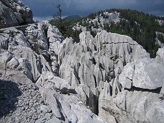
WKarst is a topography formed from the dissolution of soluble rocks such as limestone, dolomite, and gypsum. It is characterized by underground drainage systems with sinkholes and caves. It has also been documented for more weathering-resistant rocks, such as quartzite, given the right conditions. Subterranean drainage may limit surface water, with few to no rivers or lakes. However, in regions where the dissolved bedrock is covered or confined by one or more superimposed non-soluble rock strata, distinctive karst features may occur only at subsurface levels and can be totally missing above ground.
 W
WThe following is a list of sinkholes, blue holes, dolines, crown holes cenotes, and pit caves. A sinkhole is a depression or hole in the ground caused by some form of collapse of the surface layer. Some are caused by karst processes—for example, the chemical dissolution of carbonate rocks or suffosion processes. Sinkholes vary in size from 1 to 600 m both in diameter and depth, and vary in form from soil-lined bowls to bedrock-edged chasms. Sinkholes may form gradually or suddenly, and are found worldwide.
 W
WLjubišnja, a Dinaric mountain range of Montenegro, conventionally referred to as the highland of Montenegro, represents a major natural feature of the country alongside Tara Canyon, Draga Canyon and Montenegro.
 W
WMount Mirna, literally ‘peaceful mountain’, is a mountain in the eastern part of Kočevje Rog. It is located above the settlement of Planina and is the highest point in the traditional White Carniola region of Slovenia.
 W
WNanos is a karst limestone plateau at the eastern border of the Inner Carniola in southwestern Slovenia.
 W
WThe Northern Velebit National Park is a national park in Croatia that covers 109 km2 of the northern section of the Velebit mountains, the largest mountain range in Croatia. Because of the abundant variety of this part of the Velebit range, the area was upgraded from a nature reserve in 1999, and opened as a national park in September the same year.
 W
WObzova is a mountain located on the Croatian island of Krk and the highest point of the island.
WOrjen is transboundary Dinaric Mediterranean limestone mountain range, located between southernmost Bosnia and Herzegovina and southwestern Montenegro.
 W
WA pit cave, shaft cave or vertical cave—or often simply called a pit or pot ; jama in South Slavic languages scientific and colloquial vocabulary —is a type of cave which contains one or more significant vertical shafts rather than being predominantly a conventional horizontal cave passage. Pit caves typically form in limestone as a result of long-term erosion by water. They can be open to the surface or found deep within horizontal caves. Among cavers, a pit is a vertical drop of any depth that cannot be negotiated safely without the use of ropes or ladders.
 W
WA polje, also karst polje or karst field, is a large flat plain found in karstic geological regions of the world, with areas usually 5–400 km2 (2–154 sq mi). The name derives from the Slavic languages and literally means 'field', whereas in English polje specifically refers to a karst plain or karst field.
 W
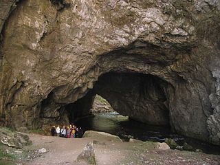
WA ponor is a natural opening where surface water enters into underground passages; they may be found in karst landscapes where the geology and the geomorphology is typically dominated by porous limestone rock.
 W
WPopovo field is a polje in Bosnia and Herzegovina, located in a southernmost region of the country, near the Adriatic coast. Its size is 5.9 square kilometres (2.3 sq mi).
 W
WReovačka greda is a ridge of Mount Orjen located in Krivošije, in southwestern Montenegro, separating the Bijela Gora plateau from the rest of the Orjen range. The ridge stretches for 17 kilometres from Vučji zub peak on the west, at the border of Montenegro and Bosnia and Herzegovina, and the villages of Crkvice and Malov Do on the east. Its highest peak is Pazua, which is 1,769 metres high.
 W
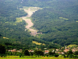
WThe Slano Blato Landslide, or the Salt Mud Slide, is a periodic landslide in Slovenia that is triggered approximately once a century. Although around 8,000 active landslides are present in Slovenia, the Slano Blato Landslide stands out as one of the most serious in terms of the damage it has caused.
 W
WSlivnica is a peak in the Dinaric Alps in Slovenia, southeast of Cerknica on the edge of the plain defined by Lake Cerknica. Its southern and western slopes are covered in deciduous and pine forests, which also obstruct the view from the highest peak, Big Slivnica.
 W
WSnežnik is a wide karst limestone plateau with an area of about 85 km2 (33 sq mi) in the Dinaric Alps. It can also be viewed as a southern extension of the Julian Alps. The main part of the plateau is in Slovenia, while the southern part extends into Croatia and connects to the mountain region of Gorski Kotar.
 W
WSpeleothems, commonly known as cave formations, are secondary mineral deposits formed in a cave. Speleothems typically form in limestone or dolomite solutional caves. The term "speleothem," as first introduced by Moore (1952), is derived from the Greek words spēlaion "cave" + théma "deposit". The definition of "speleothem," in most publications, specifically excludes secondary mineral deposits in mines, tunnels, and other man-made structures. Hill and Forti more concisely defined "secondary minerals" which create speleothems in caves:A "secondary" mineral is one which is derived by a physicochemical reaction from a primary mineral in bedrock or detritus, and/or deposited because of a unique set of conditions in a cave; i.e., the cave environment has influenced the mineral's deposition.
 W
WThe Stari Vlah-Raška Mountain Range is a highland in southwest Serbia, in the regions of Stari Vlah and Raška, which part of the Dinaric Alps. These highlands stretch from Užice, Arilje and Ivanjica to the border with Montenegro.
 W
WThe Šumadija Mountain Range is a highland in central Serbia, between rivers Sava and Danube in the north, river Great Morava in the east, river West Morava in the south, and Kolubara, Ljig and Dičina in the west.
 W
WTroglav is the highest peak of the Dinara Mountain Range in the Dinaric Alps (also known as Dinarides). Dinara is the longest massif within karstic mountain chain of the western Balkan peninsula. Troglav is located in the territory of Bosnia and Herzegovina. It is named after Triglav, Slavic god. The name literally means "three headed".
 W
WUvala is originally a local toponym used by people in some regions in Slovenia, Croatia, Bosnia and Herzegovina, Montenegro and Serbia. In geosciences it denotes a closed karst depression, a terrain form usually of elongated or compound structure and of larger size than that of sinkholes (dolines). It is a morphological form frequently found in the “Outer Dinarides” anywhere between Slovenia and Greece. But large closed karst depressions are found on all continents in different landscapes and therefore uvala has become a globally established term, used also to distinguish such depressions from poljes. Definitions of uvalas are often poorly empirically supported. “The coalescence of dolines” is a most frequently found and still dominant explanation. Yet because of the ongoing dissatisfaction with this definition the term ‘uvala’ has often been belittled – occasionally it was even proposed that the term be given up altogether.
 W
WVelebit is the largest, though not the highest, mountain range in Croatia. The range forms a part of the Dinaric Alps and is located along the Adriatic coast, separating it from Lika in the interior. Velebit begins in the northwest near Senj with the Vratnik mountain pass and ends 145 km to the southeast near the source of the Zrmanja river northwest of Knin.
 W
WThe Via Dinarica is a network of long-distance hiking trails in the Dinaric Alps, and consists of the White Trail, Blue Trail and Green Trail. Via Dinarica connects the countries Slovenia, Croatia, Bosnia and Herzegovina, Montenegro and Albania.
 W
WThe Žumberak Mountains is a range of hills and mountains in northwestern Croatia and southeastern Slovenia, extending from the southwest to the northeast between the Krka and the Kupa.