 W
WThe Corps of Topographs of the Imperial Russian Army has a long history dating back to the mid-18th century. The earliest existing subunit of the Corps dates back to Quartermaster unite on 20 February 1702 with the act of Peter the Great.
 W
WTopography is the study of the forms and features of land surfaces. The topography of an area could refer to the surface forms and features themselves, or a description.
 W
WAbove and Below is an installation by American artist Maya Lin, the designer of the Vietnam Veterans Memorial in Washington, D.C. It is on display at and owned by the Indianapolis Museum of Art located in Indianapolis, Indiana, United States. The artwork was inspired by underground water systems in Indiana.
The Army Map Service (AMS) was the military cartographic agency of the United States Department of Defense from 1941 to 1968, subordinated to the United States Army Corps of Engineers. On September 1, 1968, the AMS was redesignated the U.S. Army Topographic Command (USATC) and continued as an independent organization until January 1, 1972, when it was merged into the new Defense Mapping Agency (DMA) and redesignated as the DMA Topographic Center (DMATC). On October 1, 1996, DMA was folded into the National Imagery and Mapping Agency (NIMA), which was redesignated as the National Geospatial-Intelligence Agency (NGA) on 2003.
 W
WBritannia Illustrata, also known as Views of Several of the Queens Palaces and also of the Principal Seats of the Nobility & Gentry of Great Britain is a 1707–09 map plate folio of parts of Great Britain, arguably the most important work of Dutch draughtsman Jan Kip, who collaborated with Leonard Knijff. The folio consisted of a range of large, detailed folded colored and black and white drawings which today provides a valuable insight into land and buildings at country estates at the time.
 W
WA ciénega is a wetland system unique to the American Southwest. Ciénagas are alkaline, freshwater, spongy, wet meadows with shallow-gradient, permanently saturated soils in otherwise arid landscapes that often occupied nearly the entire widths of valley bottoms. That description satisfies historic, pre-damaged ciénagas, although few can be described that way now. Incised ciénagas are common today. Ciénagas are usually associated with seeps or springs, found in canyon headwaters or along margins of streams. Ciénagas often occur because the geomorphology forces water to the surface, over large areas, not merely through a single pool or channel. In a healthy ciénaga, water slowly migrates through long, wide-scale mats of thick, sponge-like wetland sod. Ciénaga soils are squishy, permanently saturated, highly organic, black in color or anaerobic. Highly adapted sedges, rushes and reeds are the dominant plants, with succession plants—Goodding's willow, Fremont cottonwoods and scattered Arizona walnuts—found on drier margins, down-valley in healthy ciénagas where water goes underground or along the banks of incised ciénagas.
 W
WThe coastline paradox is the counterintuitive observation that the coastline of a landmass does not have a well-defined length. This results from the fractal curve-like properties of coastlines, i.e., the fact that a coastline typically has a fractal dimension. The first recorded observation of this phenomenon was by Lewis Fry Richardson and it was expanded upon by Benoit Mandelbrot.
 W
WA contour line of a function of two variables is a curve along which the function has a constant value, so that the curve joins points of equal value. It is a plane section of the three-dimensional graph of the function f(x, y) parallel to the (x, y)-plane. In cartography, a contour line joins points of equal elevation (height) above a given level, such as mean sea level. A contour map is a map illustrated with contour lines, for example a topographic map, which thus shows valleys and hills, and the steepness or gentleness of slopes. The contour interval of a contour map is the difference in elevation between successive contour lines.
 W
WThe Datum of 2022 is a placeholder name for a new vertical datum set to be produced by the National Geodetic Survey in 2022 to improve the National Spatial Reference System (NSRS) by replacing the North American Datum of 1983 and the North American Vertical Datum of 1988 with a new geometric reference frame and geopotential datum.
 W
WA double summit, double peak, twin summit or twin peak refers to a mountain or hill that has two summits, separated by a col or saddle.
 W
WThe elevation of a geographic location is its height above or below a fixed reference point, most commonly a reference geoid, a mathematical model of the Earth's sea level as an equipotential gravitational surface . The term elevation is mainly used when referring to points on the Earth's surface, while altitude or geopotential height is used for points above the surface, such as an aircraft in flight or a spacecraft in orbit, and depth is used for points below the surface.
 W
WIn mountain biking and skiing, a fall line refers to the line down a mountain or hill which is most directly downhill; that is, the direction a ball or other body would accelerate if it were free to move on the slope under gravity. In mountain biking, a trail follows the "fall line" if it generally descends in the most downward direction, rather than traversing in a sideways direction. A skier is said to be "skiing the fall line" if he or she is moving generally down, making turns either side of the fall line, rather than moving across the slope. Mathematically the fall line, the line of greatest slope, is the negative of the gradient and perpendicular to the contour lines.
 W
WGeomorphology is the scientific study of the origin and evolution of topographic and bathymetric features created by physical, chemical or biological processes operating at or near the Earth's surface. Geomorphologists seek to understand why landscapes look the way they do, to understand landform history and dynamics and to predict changes through a combination of field observations, physical experiments and numerical modeling. Geomorphologists work within disciplines such as physical geography, geology, geodesy, engineering geology, archaeology, climatology and geotechnical engineering. This broad base of interests contributes to many research styles and interests within the field.
 W
WKarst is a topography formed from the dissolution of soluble rocks such as limestone, dolomite, and gypsum. It is characterized by underground drainage systems with sinkholes and caves. It has also been documented for more weathering-resistant rocks, such as quartzite, given the right conditions. Subterranean drainage may limit surface water, with few to no rivers or lakes. However, in regions where the dissolved bedrock is covered or confined by one or more superimposed non-soluble rock strata, distinctive karst features may occur only at subsurface levels and can be totally missing above ground.
 W
WThe King's England is a topographical and historical book series written and edited by Arthur Mee in 43 volumes. It was said that the series was a modern Domesday Book and that the compilers had travelled half-a-million miles in order to complete their task. The first, introductory, volume was published in 1936. In 1989, The King's England Press was established to reprint the series.
 W
WA landscape is the visible features of an area of land, its landforms, and how they integrate with natural or man-made features. A landscape includes the physical elements of geophysically defined landforms such as (ice-capped) mountains, hills, water bodies such as rivers, lakes, ponds and the sea, living elements of land cover including indigenous vegetation, human elements including different forms of land use, buildings, and structures, and transitory elements such as lighting and weather conditions. Combining both their physical origins and the cultural overlay of human presence, often created over millennia, landscapes reflect a living synthesis of people and place that is vital to local and national identity.
 W
WIn topography, the line of greatest slope is a curve following the steepest slope. In mountain biking and skiing, the line of greatest slope is sometimes called the fall line.
 W
WA mill pond is a body of water used as a reservoir for a water-powered mill.
 W
WIn topography, a nadir is a point on a surface that is lower in elevation than all points immediately adjacent to it. Mathematically, a nadir is a local minimum of elevation. A nadir may be the lowest point of a dry basin or depression, or the deepest point of a body of water or ice. The nadir of a body of water is often called a "deep", as in the Challenger Deep, the nadir of the Earth's oceans.
WThe National Geodetic Vertical Datum of 1929 is the official name since 1973 of the vertical datum established for vertical control surveying in the United States of America by the General Adjustment of 1929. Originally known as Sea Level Datum of 1929, NGVD 29 was determined and published by the National Geodetic Survey and used to measure the elevation of a point above and depression below mean sea level (MSL).
 W
WThe National Land Surveying and Mapping Center is the agency of the Ministry of the Interior of the Republic of China (Taiwan) responsible for survey and registration of land.
 W
WThe National Map is a collaborative effort of the United States Geological Survey (USGS) and other federal, state, and local agencies to improve and deliver topographic information for the United States. The purpose of the effort is to provide "...a seamless, continuously maintained set of public domain geographic base information that will serve as a foundation for integrating, sharing, and using other data easily and consistently".
WThe North American Vertical Datum of 1988 is the vertical datum for orthometric heights established for vertical control surveying in the United States of America based upon the General Adjustment of the North American Datum of 1988.
 W
WOpen terrain, open country or open ground is terrain which is mostly flat and free of obstructions such as trees and buildings. Examples include farmland, grassland and specially cleared areas such as an airport.
 W
WA raised-relief map or terrain model is a three-dimensional representation, usually of terrain, materialized as a physical artifact. When representing terrain, the vertical dimension is usually exaggerated by a factor between five and ten; this facilitates the visual recognition of terrain features and velocity.
 W
WIn the United States, a river mile is a measure of distance in miles along a river from its mouth. River mile numbers begin at zero and increase further upstream. The corresponding metric unit using kilometers is the river kilometer. They are analogous to vehicle roadway mile markers, except that river miles are rarely marked on the physical river; instead they are marked on navigation charts, and topographic maps. Riverfront properties are sometimes partially legally described by their river mile.
 W
WSpeculum Britanniae, published in London from 1593, was a projected, but unfinished, chorography of Britain by John Norden (1548—1625). It was intended to take the form of a series of county maps, accompanied by place-by-place written descriptions. Norden was primarily a surveyor and cartographer, and the written descriptions always had a subsidiary role, being much slighter than other early county histories. Nevertheless, they were based on direct observation, and Norden recorded much topographical and antiquarian detail of interest, including the heraldry of tombs, and archaeological sites.
 W
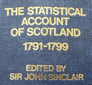
WThe Statistical Accounts of Scotland are a series of documentary publications, related in subject matter though published at different times, covering life in Scotland in the 18th, 19th and 20th centuries.
 W
WA Steilhang is a geoscientific term for a steep mountainside or hillside, the average slope of which is greater than 1:2 or 30°. Leser defines a steilhang as a mountainside with an incline of between 16° and 60°, slopes of between 30° and 60° being described as "very steep" (übersteil) and anything over 60° being a rock face (wand).
 W
WStratum Pier is an interactive overlook by American artist Kendall Buster. The functional sculpture is located at the Indianapolis Museum of Art's 100 Acres: Virginia B. Fairbanks Art & Nature Park.
 W
WA summit is a point on a surface that is higher in elevation than all points immediately adjacent to it. The topographic terms acme, apex, peak, and zenith are synonymous.
 W
WSwisstopo is the official name for the Swiss Federal Office of Topography, Switzerland's national mapping agency.
 W
WTerrain or relief involves the vertical and horizontal dimensions of land surface. The term bathymetry is used to describe underwater relief, while hypsometry studies terrain relative to sea level. The Latin word terra means "earth."
 W
WThe topographic isolation of a summit is the minimum distance to a point of equal elevation, representing a radius of dominance in which the peak is the highest point. It can be calculated for small hills and islands as well as for major mountain peaks, and can even be calculated for submarine summits.
WTopography concerns the shape and character of the Earth's surface, and maps were among the first artifacts to record these observations. They are also known as topographical maps. In modern mapping, a topographic map or topographic sheet is a type of map characterized by large-scale detail and quantitative representation of relief, usually using contour lines, but historically using a variety of methods. Traditional definitions require a topographic map to show both natural and artificial features. A topographic survey is typically based upon systematic observation and published as a map series, made up of two or more map sheets that combine to form the whole map. A topographic map series uses a common specification that includes the range of cartographic symbols employed, as well as a standard geodetic framework that defines the map projection, coordinate system, ellipsoid and geodetic datum. Official topographic maps also adopt a national grid referencing system.
WA topographic profile or topographic cut is a representation of the relief of the terrain that is obtained by cutting transversely the lines of a topographic map. Each contour line can be defined as a closed line joining relief points at equal height above sea level. It is usually drawn on the same horizontal scale as the map, but the use of an exaggerated vertical scale is advisable to underline the elements of the relief. This can vary according to the slope and amplitude of the terrestrial relief, but is usually three to five times the horizontal scale.
WIn topography, prominence measures the height of a mountain or hill's summit relative to the lowest contour line encircling it but containing no higher summit within it. It is a measure of the independence of a summit. A peak's key col is a unique point on this contour line and the parent peak is some higher mountain, selected according to various criteria.
 W
WThe topography of the Moon has been measured by the methods of laser altimetry and stereo image analysis, including data obtained during the Clementine mission. The most visible topographic feature is the giant far side South Pole-Aitken basin, which possesses the lowest elevations of the Moon. The highest elevations are found just to the north-east of this basin, and it has been suggested that this area might represent thick ejecta deposits that were emplaced during an oblique South Pole-Aitken basin impact event. Other large impact basins, such as the maria Imbrium, Serenitatis, Crisium, Smythii, and Orientale, also possess regionally low elevations and elevated rims.
 W
WAn ultra-prominent peak, or Ultra for short, is a mountain summit with a topographic prominence of 1,500 metres (4,900 ft) or more; it is also called a P1500. There are approximately 1,524 such peaks on Earth. Some well-known peaks, such as the Matterhorn and Eiger, are not Ultras because they are connected to higher mountains by high cols and therefore do not achieve enough topographic prominence.
 W
WThe zenith is an imaginary point directly "above" a particular location, on the imaginary celestial sphere. "Above" means in the vertical direction opposite to the gravity direction at that location (nadir). The zenith is the "highest" point on the celestial sphere.