 W
WThe Admiralty Islands are an archipelago group of 18 islands in the Bismarck Archipelago, to the north of New Guinea in the South Pacific Ocean. These are also sometimes called the Manus Islands, after the largest island.
WThe Admiralty Islands are an archipelago group of 18 islands in the Bismarck Archipelago, to the north of New Guinea in the South Pacific Ocean. These are also sometimes called the Manus Islands, after the largest island.
 W
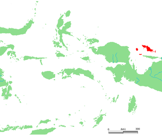
WThe Banda Sea Islands moist deciduous forests is a tropical moist forest ecoregion in Indonesia. The ecoregion includes several island groups in the southwestern Banda Sea, including the Tanimbar Islands, Kai Islands, and the Barat Daya Islands except for Wetar.
 W
WThe Schouten Islands are an island group of Papua province, eastern Indonesia in the Cenderawasih Bay 50 km off the north-western coast of the island of New Guinea. The group consists of the main islands of Biak, Supiori and Numfor, and numerous smaller islands, mostly covered in rain forest.
 W
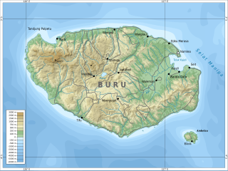
WBuru is the third largest island within Maluku Islands of Indonesia. It lies between the Banda Sea to the south and Seram Sea to the north, west of Ambon and Seram islands. The island belongs to Maluku province and includes the Buru and South Buru regencies. Their administrative centers, Namlea and Namrole, respectively, have ports and the largest towns of the island. There is a military airport at Namlea which supports civilian cargo transportation.
 W
WThe New Guinea Highlands, also known as the Central Range or Central Cordillera, is a long chain of mountain ranges it is home of several highest peaks in the island of New Guinea including a 16,024 ft (4,884 m) Puncak Jaya the highest mountain in Oceania. The intermountain river valleys, many of which support thriving agricultural communities, on the large island of New Guinea. The highlands run generally east-west the length of the island, which is divided politically between Indonesia in the west and Papua New Guinea in the east.
WThe New Guinea Highlands, also known as the Central Range or Central Cordillera, is a long chain of mountain ranges it is home of several highest peaks in the island of New Guinea including a 16,024 ft (4,884 m) Puncak Jaya the highest mountain in Oceania. The intermountain river valleys, many of which support thriving agricultural communities, on the large island of New Guinea. The highlands run generally east-west the length of the island, which is divided politically between Indonesia in the west and Papua New Guinea in the east.
 W
WThe Mulga Lands are an interim Australian bioregion of eastern Australia consisting of dry sandy plains with low mulga woodlands and shrublands that are dominated by Acacia aneura (mulga). The Eastern Australia mulga shrublands ecoregion is coterminous with the Mulga Lands bioregion.
 W
WThe Halmahera rain forests is a tropical moist forest ecoregion in Indonesia. The ecoregion includes the island of Halmahera and neighboring islands, including Bacan, Morotai, the Obi Islands, Ternate, Tidore, Gebe, and many smaller islands.
 W
WHuon Peninsula is a large rugged peninsula on the island of New Guinea in Morobe Province, eastern Papua New Guinea. It is named after French explorer Jean-Michel Huon de Kermadec. The peninsula is dominated by the steep Saruwaged and Finisterre and Cromwell Mountains. The nearest large town is the Morobe provincial capital Lae to the south, while settlements on the north coast include the former German town of Finschhafen, the district capital of Wasu, Malalamai and Saidor with its World War II era Saidor Airport.
 W
WThe Lesser Sundas deciduous forests is a tropical dry forest ecoregion in Indonesia. The ecoregion includes the islands of Lombok, Sumbawa, Komodo, Flores, and Alor, along with the many adjacent smaller islands.
 W
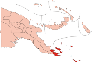
WThe Louisiade Archipelago is a string of ten larger volcanic islands frequently fringed by coral reefs, and 90 smaller coral islands in Papua New Guinea.
 W
WThe New Britain-New Ireland lowland rain forests is a tropical moist forest ecoregion in Papua New Guinea. The ecoregion covers the lowland rain forests of New Britain, New Ireland, and nearby islands in the Bismarck Archipelago.
 W
WThe New Britain-New Ireland montane rain forests is a tropical moist forest ecoregion in Papua New Guinea. The ecoregion includes the mountain rain forests on the islands of New Britain and New Ireland, which lie northeast of New Guinea.
 W
WThe New Caledonia dry forests is a tropical dry broadleaf forest ecoregion in New Caledonia, an overseas territory of France located in the South Pacific Ocean. The dry forests cover the western side of Grand Terre, New Caledonia's largest island.
 W
WThe New Caledonia rain forests are a terrestrial ecoregion, located in New Caledonia in the South Pacific. It is a tropical moist broadleaf forest ecoregion, part of the Australasian realm.
WThe New Guinea Highlands, also known as the Central Range or Central Cordillera, is a long chain of mountain ranges it is home of several highest peaks in the island of New Guinea including a 16,024 ft (4,884 m) Puncak Jaya the highest mountain in Oceania. The intermountain river valleys, many of which support thriving agricultural communities, on the large island of New Guinea. The highlands run generally east-west the length of the island, which is divided politically between Indonesia in the west and Papua New Guinea in the east.
 W
WThe New Guinea mangroves is a mangrove ecoregion that covers extensive areas of the coastline New Guinea, the large island in the western Pacific Ocean north of Australia.
 W
WThe Northern New Guinea lowland rain and freshwater swamp forests is a tropical moist broadleaf forest ecoregion of northern New Guinea.
 W
WThe Northern New Guinea montane rain forests is a tropical moist forest ecoregion in northern New Guinea. The ecoregion covers several separate mountain ranges lying north of New Guinea's Central Range and south of the Pacific Ocean.
 W
WThe Northland temperate forests, also known as the North Island temperate forests, is a temperate broadleaf and mixed forests ecoregion on New Zealand’s North Island.
 W
WThe Northland temperate kauri forests is an ecoregion in northern New Zealand, within the temperate broadleaf and mixed forests biome.
 W
WThe Richmond temperate forests is an ecoregion covering the northern part of New Zealand's South Island.
WThe Schouten Islands are an island group of Papua province, eastern Indonesia in the Cenderawasih Bay 50 km off the north-western coast of the island of New Guinea. The group consists of the main islands of Biak, Supiori and Numfor, and numerous smaller islands, mostly covered in rain forest.
 W
WThe Seram rain forests is a tropical moist forest ecoregion in Indonesia. The ecoregion includes the island of Seram and neighboring islands.
 W
WThe Solomon Islands rain forests are a terrestrial ecoregion covering most of the Solomon Islands archipelago.
 W
WThe Southeastern Papuan rain forests is a tropical moist forest ecoregion in southeastern New Guinea. The ecoregion covers the mountainous center and coastal lowlands of the Papuan Peninsula.
 W
WThe Southern New Guinea freshwater swamp forests is a tropical moist forest ecoregion in southern New Guinea. The ecoregion includes the extensive swamp forests of southern and western New Guinea.
 W
WThe Southeastern Papuan rain forests is a tropical moist forest ecoregion in southeastern New Guinea. The ecoregion covers portions of New Guinea's southern lowlands.
 W
WThe Southland montane grasslands, also known as the South Island montane grasslands, is a montane grasslands and shrublands ecoregion on New Zealand’s South Island. The ecoregion covers the middle portion of the Southern Alps, and includes extensive alpine grasslands, fellfields, and montane forests.
 W
WThe Southland temperate forests is a temperate broadleaf and mixed forests ecoregion on New Zealand's South Island. The natural vegetation was mostly forest, but over the centuries human activities, including grazing and fires, replaced much of the original forest with grassland and agriculture.
 W
WThe Sulawesi lowland rain forests is a tropical moist forest ecoregion in Indonesia. The ecoregion includes the lowlands of Sulawesi and neighboring islands.
 W
WThe Sulawesi montane rain forests is a tropical moist forest ecoregion in Indonesia. It includes the highlands of Sulawesi.
 W
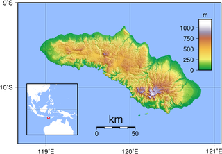
WSumba is an island in eastern Indonesia. It is one of the Lesser Sunda Islands and is in the province of East Nusa Tenggara. Sumba has an area of 11,059.6 square kilometres, and the population was estimated to be 755,849 in 2015. To the northwest of Sumba is Sumbawa, to the northeast, across the Sumba Strait, is Flores, to the east, across the Savu Sea, is Timor, and to the south, across part of the Indian Ocean, is Australia.
 W
WThe Timor and Wetar deciduous forests is a tropical dry forest ecoregion in Indonesia and East Timor. The ecoregion includes the islands of Timor, Wetar, Rote, Savu, and adjacent smaller islands.
 W
WThe Trans Fly savanna and grasslands are a lowland ecoregion on the south coast of the island of New Guinea in both the Indonesian and Papua New Guinean sides of the island. With their monsoon and dry season climate these grasslands are quite different from the tropical rainforest that covers most of the island and resemble the landscape of northern Australia which lies to the south.
 W
WThe Trobriand Islands rain forests are a tropical moist broadleaf forest ecoregion of southeastern Papua New Guinea.
 W
WThe Vanuatu rain forests are tropical and subtropical moist broadleaf forests ecoregion which includes the islands of Vanuatu, as well as the Santa Cruz Islands group of the neighboring Solomon Islands. It is part of the Australasian realm, which includes neighboring New Caledonia and the Solomon Islands, as well as Australia, New Guinea, and New Zealand.
 W
WThe Vogelkop montane rain forests is a tropical moist forest ecoregion in western New Guinea. The ecoregion covers the mountains of western New Guinea's Bird's Head and Bomberai peninsulas.
 W
WThe Vogelkop-Aru lowland rain forests is a tropical moist forest ecoregion in Indonesia. The ecoregion covers the peninsular lowlands of western New Guinea, along with the Aru Islands and other nearby islands.
 W
WThe Western Islands are a group of islands in the Bismarck Archipelago, and within Manus Province of the Islands Region, in northern Papua New Guinea.
 W
WThe Westland temperate forests, also known as the Westland temperate rainforests, is a temperate broadleaf and mixed forests ecoregion located along the central west coast of New Zealand’s South Island, also known as Te Waipounamou. These forests are found in the region of the Westland District, which spans approximately 11,880 square kilometers. It is bounded on the west by the Tasman Sea, and on the east by the Southern Alps. Much of this area is protected by the Westland Tai Poutini National Park.