 W
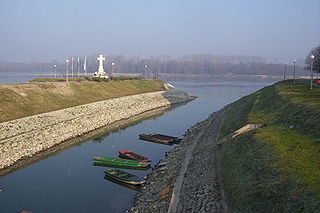
WThe Bednja is a river in northern Croatia, a right tributary of the Drava. It is 133 kilometres (83 mi) long and its basin covers an area of 966 square kilometres (373 sq mi). The Bednja rises in the mountainous forested areas near Macelj in northern Croatia, west of Trakošćan, where it also forms a 0.2 km2 (0.077 sq mi) lake at 255 m.a.s.l.. It flows towards the southeast until turning east near Bednja, meandering south at Novi Marof, returning to its eastward course shortly thereafter, and then turning northeast toward Ludbreg. It flows into the Drava River north of Mali Bukovec, at 46.303333°N 16.756389°E.
 W
WBoljunčica is a river in inland Istria, Croatia. It discharges into the Adriatic Sea near Plomin. It is 33 kilometres (21 mi) long and it has a basin with an area of 230 square kilometres (89 sq mi). Its average discharge at the measurement station in Polje Čepić is 0.956 m3/s, and it can go completely dry.
 W
WThe Bosut is a river in eastern Croatia and northwestern Serbia, a 186 km long left tributary of the Sava river. Its name from the Indo-European root *bhogj, meaning "to flow". The same root is seen in hydronym "Bosna".
 W
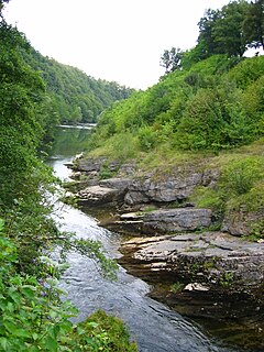
WThe Čabranka is a small river on the border between Slovenia and Croatia. It is 17.5 kilometres (10.9 mi) long and is a left tributary of the Kupa River. Its source is just west of the settlement of Podplanina in the Municipality of Loški Potok in southern Slovenia and just north of the Croatian village of Čabar, from which it gets its name. It joins the Kupa at Osilnica.
 W
WČesma is a river in central Croatia, a left tributary of the river Lonja-Trebež. It is 106 km (66 mi) long, and its catchment area is 3,253 km2 (1,256 sq mi).
 W
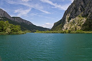
WCetina is a river in southern Croatia. It has a length of 101 km (63 mi) and its basin covers an area of 1,463 km2 (565 sq mi). From its source, Cetina descends from an elevation of 385 metres (1,263 ft) above sea level to the Adriatic Sea. It is the most water-rich river in Dalmatia.
 W
WČikola (Italian:Cigola) is a river of 47.8 km in length, located in Dalmatia, southern Croatia.
 W
WThe Danube is Europe's second-longest river, after the Volga. It is located in Central and Eastern Europe.
 W
WThe Dobra is a river located mostly in the Karlovac County in the Republic of Croatia. It is 104.2 kilometres (64.7 mi) long and its basin covers an area of 1,428 square kilometres (551 sq mi). Its name is the feminine form of the Croatian adjective meaning "good" but it is over simplistic folk etymology. The river name probably comes from the Celtic transl. cel – transl. dubrum, dubron meaning ‘water’, Illyrian δυβρις ‘deep’ or Old Slavonic dъbrь also ‘deep’ or ‘valley’.
 W
WThe Dragonja is a 30-kilometre (19 mi) long river in the northern part of the Istrian peninsula. It is a meandering river with a very branched basin and a small quantity of water. It has the pluvial regime and often dries up in summer. It features very diverse living environments and is home to a number of animal and plant species. The Dragonja has been a matter of a territorial dispute between Croatia and Slovenia, with its lowest portion de facto the border of the two countries.
 W
WThe Drava or Drave is a river in southern Central Europe. With a length of 710 kilometres (440 mi), 724 kilometres (450 mi) including the Sextner Bach source, it is the fifth or sixth longest tributary of the Danube, after the Tisza, Sava, Prut, Mureș and perhaps Siret. Its source is near the market town of Innichen, in the Puster Valley of South Tyrol, Italy. The river flows eastwards through East Tirol and Carinthia in Austria into the Styria region of Slovenia. It then turns southeast, passing through Croatia and, after merging with its main tributary Mur, forms most of the border between Croatia and Hungary, before it joins the Danube near Osijek.
 W
WGacka is a river located in the Lika region in central Croatia. Because for a large part of its course it is a subterranean river, estimates on its length vary. The overground part has undergone substantial human intervention - before it was 32 kilometres long; now it is only 11 kilometres long. It has been regulated by man to flow into an aqueduct in Gusić polje and then into the Adriatic Sea through a hydroelectric installation HE Senj near Sveti Juraj. HE Senj takes inflow from Gacka and Lika, since it was built in 1965. The river passes through karst fields and most notably the town Otočac, and its headwaters are known as a popular locale for trout fishing.
 W
WGlina is a river in central Croatia and Bosnia and Herzegovina, a right tributary of Kupa. It is 112 kilometres (70 mi) long and its basin covers an area of 1,427 square kilometres (551 sq mi).
 W
WIlova is a river in central Croatia, a left tributary of the Sava. It is 104.6 kilometres (65.0 mi) long and its basin covers an area of 1,796 square kilometres (693 sq mi).
 W
WThe Jadro is a watercourse in Dalmatia, Croatia that discharges to the Adriatic Sea. The upper reaches of the Jadro River, as well as its source, Jadro Spring, are protected as an ichthyological nature reserve, partly due to the presence of an endemic species of soft-mouthed trout. The headwaters of the Jadro River were the original water supply for the ancient city comprised by Diocletian's Palace. Contemporary studies indicate favourable water quality levels of the river near the headwaters at Jadro Spring.
 W
WKarašica or Baranjska Karašica or Karassó is a river in southern Hungary and eastern Croatia. It is 81 kilometres (50 mi) long, of which 30.46 km (18.93 mi) in Croatia. Its basin covers a total of 910 km2 (350 sq mi).
 W
WKarašica is a river in eastern Croatia whose length, combined with its tributary Vučica is 150 kilometres (93 mi), and whose basin covers 2,347 square kilometres (906 sq mi).
 W
WThe Korana is a river in central Croatia and west Bosnia and Herzegovina. The river has a total length of 138.6 km (86.1 mi) and watershed area of 2,301.5 km2 (888.6 sq mi).
 W
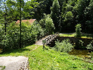
WThe Krapanski Potok is a tributary to the Raša in Istria, Croatia.
 W
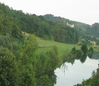
WThe Krapina is a Croatian river flowing through Krapina-Zagorje County and Zagreb County. It is a tributary to the Sava. The confluence of the Krapina River and the Sava River is near Zaprešić. Its length is 66.9 km (41.6 mi) and its basin covers an area of 1,237 km2 (478 sq mi).
 W
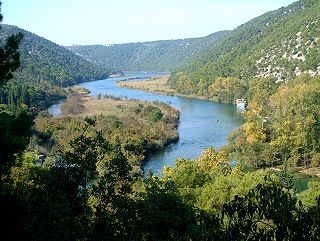
WKrka is a river in Croatia's Dalmatia region, known for its numerous waterfalls. It is 73 km (45 mi) long and its basin covers an area of 2,088 km2 (806 sq mi). It was known in ancient Greek as Kyrikos, or may be also as Catarbates by the ancient Greeks, it was known to the ancient Romans as Titius, Corcoras, or Korkoras.
 W
WThe Kupa or Kolpa river, a right tributary of the Sava, forms a natural border between north-west Croatia and southeast Slovenia. It is 297 kilometres long, with its border part having a length of 118 km (73 mi) and the rest located in Croatia.
 W
WThe Lika is a river in Croatia which gives its name to the Lika region. It is 77 kilometres (48 mi) long and it has a basin with an area of 1,014 square kilometres (392 sq mi). Its average discharge at the measurement station in Bilaj is 7.33 m3/s, and it can go completely dry.
 W
WThe Mirna is a river in Istria, Croatia. In ancient times it was called the Aquilis. It is Istria's longest and richest river, being 53 km (33 mi) long and having a basin covering an area of 458 km2 (177 sq mi). It rises near Buzet, passes along Motovun and empties into the Adriatic Sea near Novigrad.
 W
WThe Mrežnica is a river in Karlovac County, Croatia. It is 63 kilometres (39 mi) long and its basin covers an area of 64 square kilometres (25 sq mi).
 W
WThe Mur or Mura is a river in Central Europe rising in the Hohe Tauern national park of the Central Eastern Alps in Austria with its source being 1,898 m (6,227 ft) above sea level. It is a tributary of the Drava and subsequently the Danube.
 W
WThe Neretva, also known as the Narenta, is one of the largest rivers of the eastern part of the Adriatic basin. Four HE power-plants with large dams provide flood protection, power and water storage. It is recognized for its natural environment and diversity of its landscape.
 W
WOdra is a river in central Croatia. It is 83 km (52 mi) long and its basin covers an area of 604 km2 (233 sq mi). Its source is in the Žumberak mountain, southwest of Zagreb. It flows eastwards, passes south of Velika Gorica, then turns south-east, more or less parallel to the river Sava. It flows into the river Kupa near Odra Sisačka, just northeast of Sisak, also just before the Kupa joins the river Sava.
 W
WThe Ombla is a short river in Croatia, northeast of Dubrovnik. Its course is approximately 30 metres long, and it empties into the Rijeka Dubrovačka, ria formed by the Adriatic Sea near Komolac in Dubrovnik-Neretva County. Rijeka Dubrovačka is actually a ria, a flooded river valley formed through changes in sea surface elevation on a geologic time scale. The river rises as a karst spring fed by groundwater replenished by Trebišnjica, which is an influent stream flowing in Popovo Polje, in the immediate hinterland of the Ombla. The elevation difference between the river's source and its mouth is just over 2 metres. The average discharge of the river is 24.1 cubic metres per second. The drainage basin of the Ombla encompasses 600 square kilometres and, besides the short surface course, includes only groundwater flow.
 W
WOrljava is a river in Slavonia, eastern Croatia, a left tributary of Sava. It is 87.6 kilometres (54.4 mi) long and its basin covers an area of 1,618 square kilometres (625 sq mi).
 W
WPakra is a river in western Slavonia and central Croatia, a left tributary of the Ilova. It is around 72 kilometres (45 mi) long.
 W
WPlitvica is a river in northern Croatia, a right tributary of Drava. It is 65 kilometres (40 mi) long and its basin covers an area of 272 square kilometres (105 sq mi).
 W
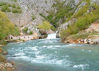
WThe Raša in Croatian Istria is a major river of Croatia's Istria County. It is 23 kilometres (14 mi) long, and its basin covers an area of 279 km2 (108 sq mi). Its mouth is in the long ria of Raški zaljev/Porto d'Arsia, which is a drowned river valley scoured out when world sea levels were lowered, then drowned by the rising waters of the post glacial era. The Raša rises in springs near Pićan and flows south through a steep-sided valley before opening into the head of the Adriatic Sea. The river, although short in length, has an ancient history as a border.
 W
WThe Reka, also the Inner Carniola Reka, is a river that starts as Big Creek in Croatia, on the southern side of Mount Snežnik, and flows through western Slovenia, where it is also initially known as Big Creek. The river is 54 kilometres (34 mi) long, of which 51 km in Slovenia. At the village of Škocjan it disappears underground through Škocjan Caves, flowing 38 km (24 mi) underneath the Slovenian Karst. The river continues as part of the Timavo in Italy, however, tracer studies have shown that it also feeds springs elsewhere on the Adriatic Coast between Trieste and Monfalcone. It has the pluvial regime.
 W
WThe Rječina, also known as the Fiumara, is a river in Croatia that flows into the Adriatic Sea at the city of Rijeka.
 W
WRuda is a small river in the Dalmatian Zagora region of Croatia. It is a left tributary of the Cetina river, into which it flows about 1 km north of Trilj. The Orlovac Hydroelectric Power Plant, located partly in the Split-Dalmatia County and partly in Bosnia and Herzegovina, discharges the water used to generates power into the Ruda river.
 W
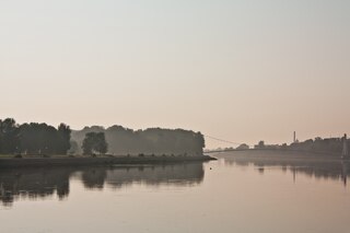
WThe Sava is a river in Central Europe, a right tributary of the Danube. It flows through Slovenia, Croatia and along its border with Bosnia and Herzegovina, and finally through Serbia, feeding into the Danube in its capital, Belgrade. The Sava forms the main northern limit of the Balkan Peninsula, and the southern edge of the Pannonian Plain.
 W
WThe Slunjčica is a river, which flows through the Kordun region in central Croatia. It partly flows underground through porous karst and surfaces in the vicinity of the city of Slunj. At Rastoke the Slunjčica leads into the river Korana, which reaches this point after passing the Plitvice Lakes National Park. The city of Slunj bears its name from this river. Due to its underground course the Slunjčica river has a quite cold temperature even during summer and the nearby situated towns use it as drinking water.
 W
WSpačva is a small river in eastern Croatia. It rises in the swampy Spačva region, takes in river Breznica, and flows into the Bosut between Lipovac and Apševci. It is also linked with Studva, and its entire course is 40.2 km (25.0 mi) long.
 W
WThe Studva is a river in eastern Croatia and northern Serbia, a 37 km-long right tributary to the Bosut river. It flows entirely within the Syrmia region of both Croatia and Serbia (Vojvodina).
 W
WSunja is a river in central Croatia, a right tributary of Sava. It is 69 kilometres (43 mi) long and its basin covers an area of 462 square kilometres (178 sq mi).
 W
WThe Sutla (Croatian) or Sotla (Slovene) is a river flowing through Slovenia and Croatia, mostly forming their border. It is a tributary to the Sava, itself a tributary to the Danube. It is 89 kilometres (55 mi) long and has a watershed area of 584 square kilometres (225 sq mi).
 W
WThe Trnava is a river in northern Croatia, a right tributary of the Mura River and the last significant one to flow into Mura before its confluence with Drava. It flows through Međimurje County.
 W
WThe Una is a border river between Bosnia and Herzegovina and Croatia and a right tributary of the Sava river. It is part of the Black Sea drainage basin, and its watershed has a size of 10.200 km², of which 8.080 km² belongs to Bosnia and Herzegovina, and 2.120 km² to Croatia. The total length of the river is 212 km. The source of the river is located in the town of Donja Suvaja in Croatia, and its mouth is located near the town of Jasenovac, on the border with Bosnia. The largest right tributaries are the Krka, Unac, Krušnica and Sana rivers, and the largest left tributary is the Klokot river. Its longest headwater is the Unac river. The largest and most important city located on the river is Bihać. Other, smaller cities and towns are Bosanska Krupa, Novi Grad and Kostajnica. The river is characterized by a multitude of waterfalls, rapids, karst springs and relatively untouched nature. A large part of the upper river is part of the Una National Park.
 W
WThe Vrljika is short sinking river in Croatia and Bosnia and Herzegovina, belonging to Neretva River basin. Its source is located on the outskirts of village Proložac near town of Imotski, Croatia. The Vrljika River is home of endangered endemic Softmouth' trout, also known as Adriatic trout.
WKarašica is a river in eastern Croatia whose length, combined with its tributary Vučica is 150 kilometres (93 mi), and whose basin covers 2,347 square kilometres (906 sq mi).
 W
WVuka is a river in eastern Croatia, a right tributary of the Danube river. At 112 kilometres, it is the 13th-longest river flowing through Croatia and it has a drainage area of 644 square kilometres. The river is located in Vukovar-Srijem County, in the Slavonia region. It empties into the Danube at the town of Vukovar, which got its name from the river.
 W
WZrmanja is a river in southern Lika and northern Dalmatia, Croatia. It is 69 km (43 mi) long and its basin covers an area of 907 km2 (350 sq mi).