 W
WThe Aare or Aar is a tributary of the High Rhine and the longest river that both rises and ends entirely within Switzerland.
 W
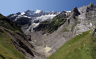
WThe Gauli Glacier is a 6.2 km (3.9 mi) long glacier (2005) in the Bernese Alps in the canton of Bern in Switzerland. In 1973, it had an area of 17.7 km2 (6.8 sq mi). The glacier is famous for the 1946 C-53 Skytrooper crash on the Gauli Glacier and the following rescue mission, which was the first carried out by an aircraft landing on a glacier.
 W
WThe Lower Grindelwald Glacier is a Glacier in the Swiss Bernese Alps, situated to the south-east of Grindelwald. It starts below the Agassizhorn and the Strahlegghörner and is connected with the Finsteraar Glacier via the Finsteraarjoch.
 W
WThe Oberaargletscher, literally "Upper Aare-Glacier" is a 4 km (2.5 mi) long glacier (2005) situated in the Bernese Alps in the canton of Berne in Switzerland. In 1973 it had an area of 5.82 km2 (2.25 sq mi). The lower end of this glacier lies almost 400 m higher than the (original) lower end of neighbouring Unteraargletscher.
 W
WThe Plaine Morte Glacier is a glacier located at an elevation of 2,750 m (9,020 ft), in the canton of Bern above Lenk and in the Valais above Crans-Montana in Switzerland. The ice field, which covers 7.88 square kilometres (3.04 sq mi), is located below the mountain of Wildstrubel in the Bernese Alps. Its largest tongue is also called in German Rezligletscher or Rätzligletscher.
 W
WThe Rosenlaui Glacier is a 5-km-long glacier (2005) situated in the Bernese Alps in the canton of Berne in Switzerland. In 1973 it had an area of 6.14 km2.
 W
WThe Trift Glacier is a 5 km (3.1 mi) long glacier (2005) in the Urner Alps near Gadmen, in the extreme east of the canton Berne in Switzerland.
 W
WThe Tschingel Glacier is a 3 km long glacier (2005) situated in the Bernese Alps in the canton of Berne in Switzerland. In 1973 it had an area of 6.19 km².
 W
WThe Unteraargletscher, literally "Lower Aare-Glacier", is the larger of the two sources of the Aare river in the Bernese Alps. It emerges from the association of the Finsteraargletscher and the Lauteraargletscher and flows for about 6 km (3.7 mi) to the east down to the Grimselsee near the Grimsel Pass. In total the glacier was 12.95 km (8.05 mi) long and 29.48 km2 (11.38 sq mi) in area in 1973. Its lower end is almost 400 metres lower than that of the neighbouring Oberaargletscher.
 W
WThe Upper Grindelwald Glacier is one of the two valley glaciers near Grindelwald on the northern side of the Bernese Alps, in the Canton of Berne. It had a length of about 6.6 km (4.1 mi) and covered an area of 9.6 km2 (3.7 sq mi) in 1973.
 W
WThe Wenden Glacier is a glacier in the Urner Alps in the canton of Berne in Switzerland.
 W
WThe Wildstrubel Glacier is a 2.5 km (1.6 mi) long glacier (2005) situated in the Bernese Alps in the canton of Valais, on the eastern slopes of the Wildstrubel. In 1973 it had an area of 4.8 km2 (1.9 sq mi)
 W
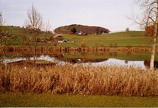
WAmsoldingersee is small lake adjacent to the town of Amsoldingen, in the Upper Gürbetal. It is located near the city of Thun, Switzerland. The lake has a surface area of 38 hectares and a maximum length of 1.1 km and width of 500 m. The maximum depth is 14 m. It is fed by Rotmoos-Bach from the smaller Uebeschisee.
 W
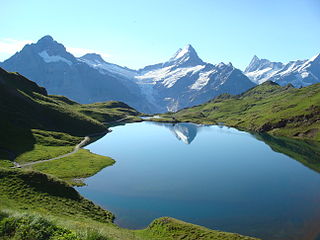
WBachalpsee or Bachsee is a lake with an area of 8.06 ha close to the First above Grindelwald in the Bernese Oberland, Switzerland. The lake, located at an elevation of 2,265 m (7,431 ft), is split by a natural dam, the smaller part of the lake being 6 m (20 ft) lower.
 W
WLake Baldegg is a lake in the Canton of Lucerne, Switzerland. Its area is about 5.2 km² and its maximum depth is 69 m.
 W
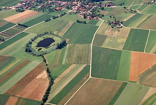
WBellacher Weiher is a small lake at Bellach in the Canton of Solothurn, Switzerland. Its surface area is 3.3 ha. The pond was formed in 1548. Lake and surroundings are a nature preserve.
 W
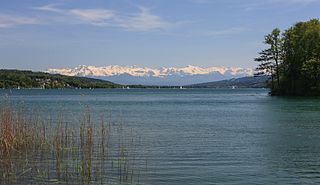
WLake Bienne, or Lake Biel is a lake in western Switzerland. Together with Lake Morat and Lake Neuchâtel, it is one of the three large lakes in the Jura region of Switzerland. It lies approximately at 47°5′N 7°10′E, at the language boundary between German and French speaking areas.
 W
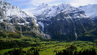
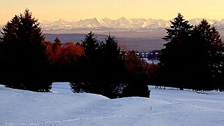
WLake Brienz is a lake just north of the Alps, in the canton of Berne in Switzerland. It has a length of about 14 kilometres (8.7 mi), a width of 2.8 kilometres (1.7 mi) and a maximum depth of 260 metres (850 ft). Its area is 29.8 square kilometres (11.5 sq mi), and the surface is 564 metres (1,850 ft) above the sea-level. It is fed, among others, by the upper reaches of the Aare at its eastern end, the Giessbach at its southern shore from steep, forested and rocky hills of the high Faulhorn and Schwarzhoren more than 2,000 metres (6,600 ft) above the lake, and by the Lütschine, flowing from the valleys of Grindelwald and Lauterbrunnen, at its south-western corner. It flows out into a further stretch of the Aare at its western end. The culminating point of the lake's drainage basin is the Finsteraarhorn at 4,274 metres above sea level.
WBurgäschisee is a lake near Aeschi in Switzerland, on the border of the cantons of Berne and Solothurn. The lake has a surface of 21 ha and a maximum depth of 36 m.
 W
WDittligsee is a lake in the Canton of Berne, Switzerland, near Blumenstein and Wattenwil. Its surface area is 6.02 ha.
 W
WEngstlensee is a natural lake used as a reservoir in the municipality of Innertkirchen, Bernese Oberland, Switzerland. It is located near Joch Pass at an elevation of 1850 m. It can be reached by gondola and by foot from Titlis.
 W
WGeistsee is a lake at Längenbühl in the Canton of Berne, Switzerland. Its surface area is 0.95 ha. The lake is private property and not accessible by the public.
 W
WGelmersee is a reservoir in Bernese Oberland, Switzerland. The hydroelectric reservoir was completed in 1932, at about the same time as the Grimselsee reservoir, and both are operated by Kraftwerke Oberhasli. The reservoir's volume is 13 million m³ and its surface area 64.5 ha.
 W
WGerzensee is a lake in Canton of Berne, Switzerland. Its surface area is 25 ha.
 W
WLake Hallwil is a lake largely in the Canton of Aargau, Switzerland, located at 47°17′N 8°12′E. It is the largest lake in Aargau and lies mostly in the districts of Lenzburg and Kulm on the southern edge of the canton. The southern tip of the lake reaches into the canton of Lucerne. The main river leading to this lake is the Aabach, which is coming from the Lake Baldegg.
 W
WIffigsee is a lake near Lenk, in Canton of Berne, Switzerland. The lake is located in the Iffigtal, near Rawil Pass. To the south of the lake is the Wildhorn.
 W
WInkwilersee is a small lake on the border of the municipalities of Inkwil, Canton of Berne, and Bolken, Canton of Solothurn, Switzerland. Its surface area is 0.1016 km2.
 W
WLauenensee are two lakes near Lauenen in the Canton of Berne, Switzerland. At an elevation of 1381 m, their surface area is 0.1 km²: the larger lake has a surface of 8.8 ha, the smaller one of 1.3 ha.
 W
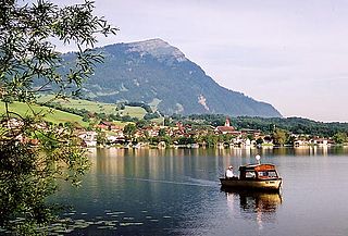
WLake Lauerz is a lake in the Canton of Schwyz, Switzerland. Its water area varies between 310 ha and 360 ha, a maximum depth of 14 m (45.9 ft), and a water level elevation above sea level of 447 m (1,466.5 ft).
 W
WLobsigensee is a lake at Lobsigen in Seedorf, Berne, Switzerland. Its surface area is 1.73 ha.
 W
WMauesee is a lake in the canton of Lucerne, Switzerland, near the town Mauensee. Mauensee Castle is built on an islet in the 0.55 km² large lake. It was built in 1605 for the Pfyffer family.
 W
WMoossee is a lake in the Canton of Berne, Switzerland. Its surface area is 31 ha. The lake gives the name to Moosseedorf on its southern shore. The golf course Moossee is located east of the lake at Münchenbuchsee. The Urtenen drains Chli Moossee before flowing into Grosser Moossee 400 m further.
 W
WOberaarsee is a hydroelectric reservoir in the Grimsel area, part of the municipality of Guttannen, Switzerland. Its surface area is 1.47 km2 (0.57 sq mi). The Oberaar dam was completed in 1953, and is operated by Kraftwerke Oberhasli. It is drained by the Oberaarbach, which flows into the Grimselsee.
 W
WLake Sempach is a lake in the canton of Lucerne, Switzerland. Its area is about 14.5 km² and its maximum depth is 87 m.
 W
WSoppensee is a lake in Canton of Lucerne, Switzerland. The surface area is 22.7 ha. The lake and its surroundings are located in the municipalities of Buttisholz, Menznau and Ruswil.
 W
WLake Thun is an Alpine lake in the Bernese Oberland in Switzerland named after the city of Thun, on its northern shore.
 W
WTotesee is a small natural lake at the Grimsel Pass in Switzerland. The lake lies immediately to the south of the natural watershed and cantonal boundary at the pass. It is therefore in the canton of Valais, and it would naturally drain into the river Rhône in the valley below. However a dam has been constructed to enable its use as a reservoir, increasing its size and raising its level by 16 metres (52 ft). As part of this work, an aqueduct supplies water to the Grimselsee, which drains into the river Aare and thus forms part of the Rhine catchment.
 W
WUebeschisee is a small lake at Uebeschi, in the Upper Gürbetal, near Thun, Switzerland. It is located adjacent to the municipalities of Höfen, Amsoldingen and Uebeschi. The lake has a surface area of 14.2 hectares and a maximum depth of 15 m. Rotmoos-Bach drains it into the larger Amsoldingersee.
 W
WChapfensee is a reservoir at Mels, Canton of St. Gallen, Switzerland. The area around the reservoir is a nature preserve.
 W
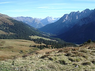
WReichenbachtal is an Alpine valley in Oberhasli, canton of Berne, Switzerland. It is situated within the municipality of Schattenhalb, connecting Meiringen with the Grosse Scheidegg pass towards Grindelwald. Its water, the Rychenbach, forms the Reichenbach Fall before joining the Aare at Meiringen.
 W
WThe Grimselsee or Lake Grimsel is an artificial lake near the Grimsel Pass in the Canton of Berne, Switzerland. With a volume of 95 mio m³, it is larger than other hydroelectric reservoirs in the region: Oberaarsee, Räterichsbodensee and Gelmersee. The dam was completed in 1932 and is operated by Kraftwerke Oberhasli AG (KWO). It is located in the municipality of Guttannen.
 W
WThe Klingnauer Stausee is a reservoir near Böttstein, canton of Aargau, Switzerland, at 47°35′N 8°14′E. The reservoir with a surface of 1.16 km2 (0.45 sq mi) was formed at the construction of a power plant on the Aare river in the 1930s.
 W
WMattenalpsee is a reservoir in the municipality of Innertkirchen, Canton of Berne, Switzerland. Its surface area is 18.6 ha. The reservoir receives the water from Gauli Glacier. The water is channeled into Räterichsbodensee.
 W
WNiederriedsee is a reservoir formed by the Niederried dam on the Aar River in the Canton of Berne, Switzerland. It is named after the nearby village Niederried bei Kallnach.
WTrübtensee or Triebtenseewli is a lake in the municipality of Guttannen, Bernese Oberland, Switzerland. The reservoir's surface area is 0.1 km2. Its dam was completed in the 1950s and holds a volume of 1.1 mio m³.
 W
WLake Wohlen is a reservoir in the Canton of Berne, Switzerland. Its surface is approximately 3.65 km² and its maximum depth is 20 m. It lies between the towns of Bremgarten bei Bern and Mühleberg. Lake Wohlen was completed in 1920.
 W
WTessenberg is an elevated plateau above Lake Biel, on the southern slopes of Chasseral, at an elevation of about 800 m. It is divided between the Swiss cantons of Berne and Neuchâtel, and three municipalities, Nods, Lignières and Plateau de Diesse.
 W
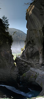
WThe Reichenbach Falls are a waterfall cascade of seven steps on the stream called Rychenbach in the Bernese Oberland region of Switzerland. They drop over a total change of altitude of about 250 metres (820 ft). At 110 metres (360 ft), the Grand Reichenbach Fall, the upper one, is by far the largest one and one of the higher waterfalls in the Alps and among the forty highest in Switzerland. The Rychenbach loses 290 metres (950 ft) of height from the top of the falls to the valley floor of the Haslital. Today, a hydro-electric power company harnesses the flow of the Reichenbach Falls during certain times of year, reducing its flow.
 W
WThe Staubbach Fall is a waterfall in Switzerland, located just west above Lauterbrunnen in the Bernese Highlands. The waterfall drops 297 metres (974 ft) from a hanging valley that ends in overhanging cliffs above the Weisse Lütschine.
 W
WThe Trümmelbach Falls in Switzerland are a series of ten glacier-fed waterfalls inside the mountain made accessible by a tunnel-funicular, built 1913, stairs, and illumination.