 W
WCugnot Ice Piedmont is an ice piedmont in Trinity Peninsula, about 15 nautical miles (30 km) long and between 3 and 6 nautical miles wide, extending from Russell East Glacier to Eyrie Bay and bounded on the landward side by Louis Philippe Plateau. It was mapped from surveys by the Falkland Islands Dependencies Survey (1960–61), and named by the UK Antarctic Place-Names Committee for Nicolas-Joseph Cugnot, a French military engineer who designed and built the first full-sized vehicle propelled by its own engine (steam), in 1769.
 W
WGetman Ice Piedmont is an ice piedmont between Reichle Mesa and Three Slice Nunatak at the east end of Joerg Peninsula, Bowman Coast, Antarctica. It drains north-northeastwards into Hondius Inlet. The feature was explored from the ground and photographed from the air by the United States Antarctic Service, 1939–41, the Ronne Antarctic Research Expedition, 1947–48, and was surveyed by the Falkland Islands Dependencies Survey, 1946–48. It was named by the Advisory Committee on Antarctic Names in 1977 for Commander Robert T. Getman of the United States Coast Guard, an Executive Officer on USCGC Southwind during U.S. Navy Operation Deep Freeze, 1969.
 W
WStefan Ice Piedmont is a small ice piedmont at the northwest extremity of Pernik Peninsula, Loubet Coast in Graham Land, overlying the coast between Cape Rey and Holdfast Point. Mapped from air photos taken by Falkland Islands and Dependencies Aerial Survey Expedition (FIDASE) (1956–57). Named by United Kingdom Antarctic Place-Names Committee (UK-APC) for Josef Stefan (1835–1893), Slovenian physicist who in 1889 pioneered the theory of heat flow in a freezing ice layer and first used it to calculate rates of sea ice growth in the Arctic.
 W
WWidmark Ice Piedmont is an ice piedmont between Holtedahl and Darbel bays on Stresher Peninsula on the west coast of Graham Land. Photographed by Hunting Aerosurveys Ltd. in 1955-57 and mapped from these photos by the Falkland Islands Dependencies Survey (FIDS). Named by the United Kingdom Antarctic Place-Names Committee (UK-APC) in 1959 for Erik J. Widmark (1850–1909), Swedish ophthalmologist, pioneer of researches upon the etiology and treatment of snow blindness.
 W
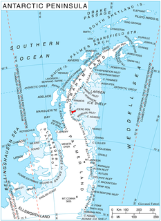
WWright Peninsula is a peninsula on the east coast of Adelaide Island, Antarctica, lying between Stonehouse Bay to the north and Ryder Bay to the south. On its northern coastline the peninsula is fringed by the Stokes Peaks; on its southern side by the Reptile Ridge. The Princess Royal Range separates the peninsula from the rest of Adelaide Island; the only 'gap' is provided by McCallum Pass.
 W
WWright Ice Piedmont is an ice piedmont extending westward from Lanchester Bay along the west coast of Graham Land. Photographed by Hunting Aerosurveys Ltd. in 1955-57 and mapped from these photos by the Falkland Islands Dependencies Survey (FIDS). Named by the United Kingdom Antarctic Place-Names Committee (UK-APC) in 1960 for Wilbur Wright (1867–1912) and his brother Orville Wright (1871–1948), American aeronautical engineers who made the first controlled flights in a powered heavier-than-air machine on December 17, 1903.
WZnepole Ice Piedmont is the glacier extending 13 km in northwest-southeast direction and 7.5 km wide on Trinity Peninsula in Graham Land, Antarctica. It lies south of Victory Glacier and northeast of Dreatin Glacier, and is bounded by Kondofrey Heights to the north and the 5.2 km long narrow rocky ridge featuring Mount Bradley to the west, flowing southeastwards into Prince Gustav Channel, Weddell Sea.