 W
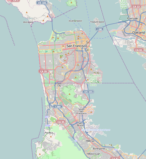
WClarks Point was a cape on the north side of Yerba Buena Cove in what is now San Francisco, California. Its former Spanish name was Punta Del Embarcadera. During the California Gold Rush the Clarks Point and the Cove was filled in to form the Embarcadero on San Francisco Bay. The location of the Point is just east of the intersection of Battery Street on Broadway.
 W
WCrissy Marsh is a wetland area in San Francisco, California, United States. Crissy Marsh has brackish waters, making an ideal habitat for many bird species along the Pacific Flyway. Here, fresh river water meets the salt water of the bay. It is 130-acres and located on the northern end of the San Francisco Peninsula. This salt marsh was largely destroyed to build Crissy Field, an airfield used during World War I and World War II. It has since been restored, with the airfield being removed. It now hosts abundant and recovering wildlife on the northern San Francisco coast.
 W
WFort Funston is a former harbor defense installation located in the southwestern corner of San Francisco. Formerly known as the Lake Merced Military Reservation, the fort is now a protected area within the Golden Gate National Recreation Area (GGNRA). It was named in honor of Frederick N. Funston (1865–1917), a Major General in the United States Army with strong connections to San Francisco, and included several artillery batteries. The fort is located on Skyline Boulevard at John Muir Drive, west of Lake Merced.
WMission Bay was a bay and the estuary of Mission Creek, on the west shore of San Francisco Bay, between Steamboat Point and Point San Quentin or Potrero Point. It is now mostly filled in and is the location of the Mission Bay neighborhood of San Francisco.
 W
WPotrero Point in San Francisco, California, is the location of the earliest and most important industrial facilities in the Western United States on the eastern extension of San Francisco's Potrero Hill, a natural land mass extending into San Francisco Bay south of Mission Bay. Potrero Point, the point of Potrero Hill, was systematically blasted and cut, its serpentine cliffs removed. The work yielded two square miles of rock for fill and hundreds of acres of flat industrial land east of Illinois Street between 20th Street and Islais Creek.
WRincon Point, was a cape marking the southern extremity of Yerba Buena Cove in what is now San Francisco, California. The cove now filled in and the Point land locked, it is now the location where the Oakland Bay Bridge terminates in San Francisco.
 W
WSeal Rock is a group of small rock formation islands in the Lands End area of the Outer Richmond District in western San Francisco, California. They are located just offshore in the Pacific Ocean, at the north end of the Ocean Beach, near the Cliff House and Sutro Baths ruins.
WYerba Buena Cove was a cove on San Francisco Bay where the Mexican pueblo of Yerba Buena was located. It lay between Clarks Point to the north and Rincon Point to the south. The beach of the cove was set back as far as what is now Montgomery Street between Clay and Washington Streets.