 W
WA lithosphere is the rigid, outermost shell of a terrestrial-type planet or natural satellite. On Earth, it is composed of the crust and the portion of the upper mantle that behaves elastically on time scales of thousands of years or greater. The crust and upper mantle are distinguished on the basis of chemistry and mineralogy.
 W
WA convergent boundary is an area on Earth where two or more lithospheric plates collide. One plate eventually slides beneath the other, a process known as subduction. The subduction zone can be defined by a plane where many earthquakes occur, called the Wadati–Benioff zone. These collisions happen on scales of millions to tens of millions of years and can lead to volcanism, earthquakes, orogenesis, destruction of lithosphere, and deformation. Convergent boundaries occur between oceanic-oceanic lithosphere, oceanic-continental lithosphere, and continental-continental lithosphere. The geologic features related to convergent boundaries vary depending on crust types.
 W
WAn earthquake is the shaking of the surface of the Earth resulting from a sudden release of energy in the Earth's lithosphere that creates seismic waves. Earthquakes can range in size from those that are so weak that they cannot be felt to those violent enough to propel objects and people into the air, and wreak destruction across entire cities. The seismicity, or seismic activity, of an area is the frequency, type, and size of earthquakes experienced over a period of time. The word tremor is also used for non-earthquake seismic rumbling.
 W
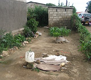
WGroundwater is the water present beneath Earth's surface in soil pore spaces and in the fractures of rock formations. A unit of rock or an unconsolidated deposit is called an aquifer when it can yield a usable quantity of water. The depth at which soil pore spaces or fractures and voids in rock become completely saturated with water is called the water table. Groundwater is recharged from the surface; it may discharge from the surface naturally at springs and seeps, and can form oases or wetlands. Groundwater is also often withdrawn for agricultural, municipal, and industrial use by constructing and operating extraction wells. The study of the distribution and movement of groundwater is hydrogeology, also called groundwater hydrology.
 W
WGroundwater pollution occurs when pollutants are released to the ground and make their way down into groundwater. This type of water pollution can also occur naturally due to the presence of a minor and unwanted constituent, contaminant or impurity in the groundwater, in which case it is more likely referred to as contamination rather than pollution.
 W
WThe lithosphere–asthenosphere boundary represents a mechanical difference between layers in Earth's inner structure. Earth's inner structure can be described both chemically and mechanically. The lithosphere–asthenosphere boundary lies between Earth's cooler, rigid lithosphere and the warmer, ductile asthenosphere. The actual depth of the boundary is still a topic of debate and study, although it is known to vary according to the environment.
WPlate tectonics is a scientific theory describing the large-scale motion of seven large plates and the movements of a larger number of smaller plates of Earth's lithosphere, since tectonic processes began on Earth between 3.3 and 3.5 billion years ago. The model builds on the concept of continental drift, an idea developed during the first decades of the 20th century. The geoscientific community accepted plate-tectonic theory after seafloor spreading was validated in the late 1950s and early 1960s.
 W
WSubduction is a geological process that takes place at convergent boundaries of tectonic plates where one plate moves under another and is forced to sink due to high gravitational potential energy into the mantle. Regions where this process occurs are known as subduction zones. Rates of subduction are typically measured in centimeters per year, with the average rate of convergence being approximately two to eight centimeters per year along most plate boundaries.