 W
WThe Armenian Highlands is the most central and the highest of the three plateaus that together form the northern sector of Western Asia. Clockwise starting from the west, the Armenian Highlands is bounded by the Anatolian plateau, the Caucasus, the Kura-Aras lowlands, the Iranian Plateau, and Mesopotamia. The highlands are divided into western and eastern regions, defined by the Ararat Valley where Mount Ararat is located. Western Armenia is nowadays referred to as eastern Anatolia, and Eastern Armenia as the Lesser Caucasus or Caucasus Minor, and historically Anti-Caucasus, meaning "opposite the Caucasus".
 W
WThe Caucasus Mountains are a mountain system at the intersection of Europe and Asia. Stretching between the Black Sea and the Caspian Sea, it is surrounded by the Caucasus region and is home to Mount Elbrus, the highest peak in Europe.
 W
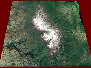
WGegham mountains, Armenian: Գեղամա լեռնաշղթա are a range of mountains in Armenia. The range is a tableland-type watershed basin of Sevan Lake from east, inflows of rivers Araks and Hrazdan from north and west, Azat and Vedi rivers from south-west and Arpachai river from south. The average elevation of the Gegham mountain range is near 2500m. The range is of volcanic origin including many extinct volcanoes. The range is 70 km length and 48 km width, and stretch between Lake Sevan and the Ararat plain. The highest peak of the Gegham mountains is the Azhdahak, at 3597m. They are formed by a volcanic field, containing Pleistocene-to-Holocene lava domes and cinder cones. The highland reaches a height of 1800–2000m up to 3000m in the dividing ridge.
 W
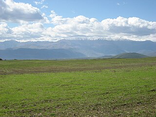
WJavakheti Range or Javakhk Range – is a volcanic range in southern Georgia and northern Armenia. The range is about 50 km (31 mi) long and runs north to south from Trialeti to Bazum Range. The highest peak is Achkasar at an elevation 3196 m (10485 ft) above sea level. Other notable peaks include Leyli (3154), Yemlikli (3054), Garanlig (3039), Aghrigar (2973) and Shambiani (2923). Javakheti/Javakhk Range is known with a lot of rainfall too. The name of Wet Mountains originated herein. Range are mainly covered with alpine meadows and grasslands. There are a number of small-sized lakes in and around the Javakheti Range.
 W
WThe Karabakh Range is a mountain range of Lesser Caucasus. It is an arc stretching from North to South-East from Tartar river to Aras River. The Həkəri River separates it from the Karabakh Plateau. The highest point is Mount Boyuk-Kirs.
 W
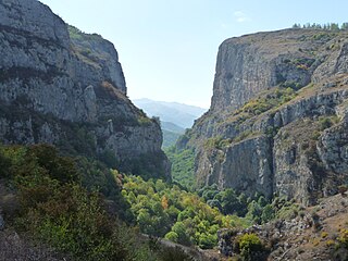
WThe Lesser Caucasus, also called Caucasus Minor, is the second of the two main mountain ranges of Caucasus mountains, of length about 600 km (370 mi). The western portion of the Lesser Caucasus overlaps and converges with the high plateau of Eastern Anatolia, in the far northeast of Turkey.
 W
WTsaghkunyats Mountains, Armenian: Ծաղկունյաց լեռնաշղթա, are a range of mountains in Armenia, mainly in the provinces of Kotayk and Aragatsotn.
 W
WThe Zangezur Mountains comprise a mountain range that defines the border between Armenia's southern provinces of Syunik, Vayots Dzor and Nakhichevan Autonomous Republic. The Zangezur region is internationally recognized as being the second largest tracts of forests in Armenia, which are located in the Zangezur Mountains where they cover more than 20% of the territory of Armenian Syunik province and reach an elevation of 2,200-2,400 m.