 W
WArkengarthdale is a dale, or valley, on the east side of the Pennines in North Yorkshire, England. Running roughly north-west to south-east, it is the valley of the Arkle Beck, and is the northernmost of the Yorkshire Dales. It is a subsidiary dale to Swaledale, which it joins at Reeth.
 W
WArkengarthdale Gunnerside and Reeth Moors is a 7,634.72 hectares biological Site of Special Scientific Interest (SSSI) in the Yorkshire Dales between Arkengarthdale and Swaledale. The SSSI was first notified in June 1998 and is due to the blanket bog, heather moorland, and breeding bird populations such as merlin and golden plover.
 W
WArkle Beck is the stream running through the valley of Arkengarthdale in the Yorkshire Dales, England. It is a tributary of the River Swale, which it joins just past Reeth at Grinton Bridge. The beck itself has several tributaries which include:Great Punchard Gill William's Gill Annaside Beck Roe Beck
 W
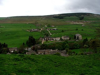
WArkle Town is a hamlet adjoining Langthwaite in Arkengarthdale in the Richmondshire district of, North Yorkshire, England. Arkel is a Norse personal name and probably arrived with settlers during the tenth century. Formerly it had a parish church, inn and workhouse. Now there are none of these though the graveyard can still be traced.
 W
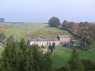
WBooze is a hamlet in Arkengarthdale, in the Richmondshire district of North Yorkshire, England. It is about 1 mile (1.6 km) east of Langthwaite and Arkle Town. There is a riding school nearby.
 W
WEskeleth is a hamlet in Arkengarthdale in North Yorkshire, England. It is in the Yorkshire Dales National Park. As with all places in Arkengarthdale, there is no record for the location in the Domesday Book. The first element in the name seems to be the Common Brythonic word Isca, which probably meant 'water' or 'fish'. The second element could be the Cumbric llaith meaning 'damp' or 'moist'. The first element could also be Old Norse *Eski-, 'ash tree'. Eskeleth sits 4 miles from the village of Reeth.
 W
WFremington Edge is a 5 kilometres (3 mi) long wall of crags and scree slopes that is situated to the north of the village of Reeth in Swaledale in the Yorkshire Dales National Park, England. Fremington Edge forms the northern edge of Arkengarthdale, extending to the point where the dale meets Swaledale. Throughout its full length the Edge stays above the height of 400 metres and reaches a highest point of 473 metres (1552 feet) at the northern end of the escarpment.
 W
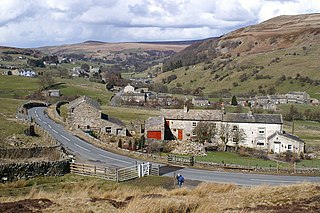
WLangthwaite is one of the few villages in Arkengarthdale, North Yorkshire, England. It is 3.5 miles (5.6 km) north of Reeth and sits 870 feet (270 m) above sea level. It is the main settlement in the dale and is one of the most northerly settlements in the whole of Yorkshire Dales National Park. Langthwaite is one of two places in the dale that have houses clustered together closely in a traditional village set up; the rest of the settlements in the dale are populated by scattered buildings.
 W
WWhaw is a hamlet in Arkengarthdale in North Yorkshire, England. It is one of few settlements in the dale and is one of the smallest. Its name derives from the Old Norse of Kvi and Hagi, which means the enclosure of the sheep. It is about 2 miles (3.2 km) north of Langthwaite and 5 miles (8 km) north west of Reeth. The adjacent Arkle Beck Meadows form a Site of Special Scientific Interest.