 WRemote sensing
 WRemote sensing (geology)
 WAerial photographic and satellite image interpretation
 WAerial video
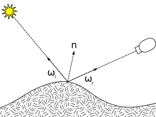 WBidirectional reflectance distribution function
 WDifferential optical absorption spectroscopy
 WDigital elevation model
 WGNSS reflectometry
 WHemispherical photography
 WHydroacoustics
 WHyperspectral Imager for the Coastal Ocean
 WHyperspectral imaging
 WLand Remote-Sensing Commercialization Act of 1984
 WMETRIC
 WMoment distance index
 WMultispectral image
 WNormalized difference vegetation index
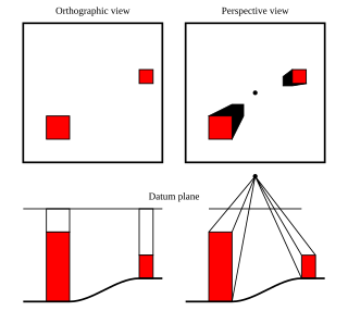 WOrthophoto
 WRed edge
 WMobile mapping
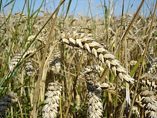 WSatellite crop monitoring
 WSpecim
 WSwathe
 WTasseled cap transformation
 WTier-scalable reconnaissance
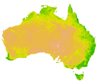 WVegetation Index
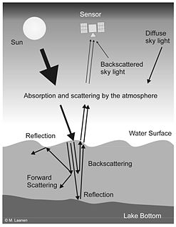 WWater remote sensing