 W
WLuxembourg is a small country located in the Low Countries, part of North-West Europe It borders Belgium for 148 kilometres to the west and north, France (73 km [45 mi]) to the south, and Germany (138 km [86 mi]) to the east. Luxembourg is landlocked, separated from the North Sea by Belgium.
 W
WThe Bock is a promontory in the north-eastern corner of Luxembourg City's old historical district. Offering a natural fortification, its rocky cliffs tower above the River Alzette, which surrounds it on three sides. It was here that Count Siegfried built his Castle of Lucilinburhuc in 963, providing a basis for the development of the town that became Luxembourg. Over the centuries, the Bock and the surrounding defenses were reinforced, attacked, and rebuilt time and time again as the armies of the Burgundians, Habsburgs, Spaniards, Prussians, and French vied for victory over one of Europe's most strategic strongholds, the Fortress of Luxembourg. Warring did not stop until the Treaty of London was signed in 1867, calling for the demolition of the fortifications. Ruins of the old castle and the vast underground system of passages and galleries known as the casemates continue to be a major tourist attraction.
 W
WThis is a list of the extreme points of Luxembourg, the points that are farther north, south, east or west, higher or lower than any other location in the territory of the state.
 W
WThe German-Luxembourg Nature Park is a cross-border nature park, which was established on 17 April 1964 by state treaty between the German state of Rhineland-Palatinate and the Grand Duchy of Luxembourg. It thus became the first cross-border nature park in Western Europe.
 W
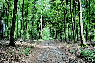
WThe Grünewald is a forest in central Luxembourg, most of which is owned by the national government. Grünewald stretches through the communes of Niederanven, Steinsel, and Walferdange; the centre of the forest is situated 6 kilometres (3.7 mi) north-east of central Luxembourg City. As a result of its proximity to Luxembourg's capital city, it is a popular destination for tourism, leisure, and hospitality. Within the Grünewald are the sources of the Black Ernz and the White Ernz.
 W
WLeithum, Luxembourg is a populated place in the district of Diekirch, at one end of the border that was established in 1839 between Belgium and Luxembourg at the Treaty of London.
 W
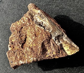
WMinette is a type of mineral deposit, consisting of iron ore of sedimentary origin, found in the south of Luxembourg and in Lorraine. Minette ore was deposited in the Early Jurassic and Middle Jurassic.
 W
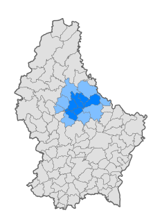
WNordstad is a development area in north-central Luxembourg, and a colloquial term to refer to the combined urban areas in the region. The name is Luxembourgish for 'northern city', but it remains the title, both formal and informal, of the region in any language.
 W
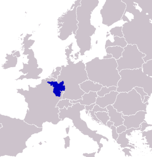
WSaarLorLux or Saar-Lor-Lux, a portmanteau of Saarland, Lorraine and Luxembourg, is a euroregion of five regional authorities located in four European states. The term has also been applied to cooperations of several of these authorities or of their subdivisions, administrations, organisations, clubs and people. Member regions represent different political structures: the sovereign state of Luxembourg; Belgium's Walloon region, comprising the French and German speaking parts of Belgium; Lorraine, a region of France; the French départements Moselle and Meurthe-et-Moselle; and the German federated states of Saarland and Rhineland-Palatinate.
 W
WThe Upper Sûre Natural Park is a national park in north-western Luxembourg. Located in the Oesling region, the park is primarily an area of conservation and a specially protected area for wild birds.